The Brazeau Reservoir Archaeological Survey Project

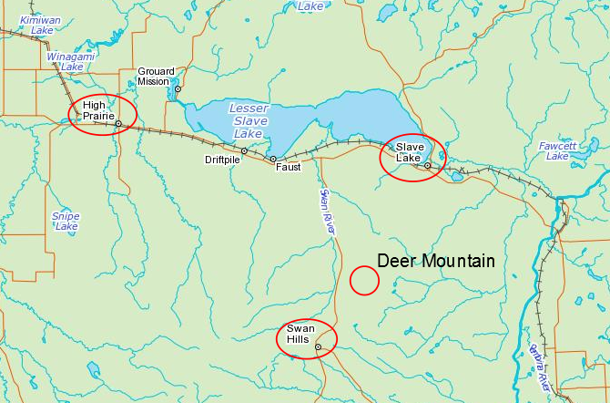
The Brazeau Reservoir Archaeological Survey is a project hosted by the Strathcona Archaeological Society, and is sponsored by Tree Time Services. It currently is centred around a large campsite and workshop on the upper valley margin at the confluence of the Brazeau and Elk Rivers, located near Drayton Valley and Rocky Mountain House.

The main site, FfPv-1, was found in 2009 by Sandy and Tom Erikson while out on a day hike. They contacted the Royal Alberta Museum to report their finds, and the site was visited by curators Jack Brink and Bob Dawe in 2013. They conducted an exploratory survey with Sandy and Tom, and found five additional sites, FfPv-2 to 6. These sites are all located around the edge of the upper water lines of the Brazeau Reservoir, and are covered by water for most of the year.

2 surface finds_resized


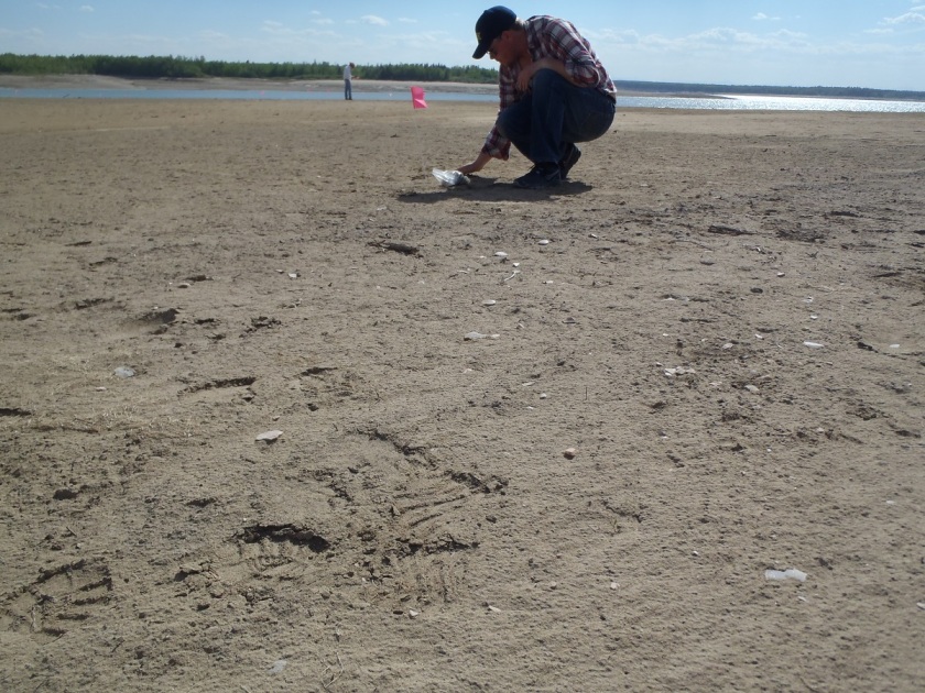
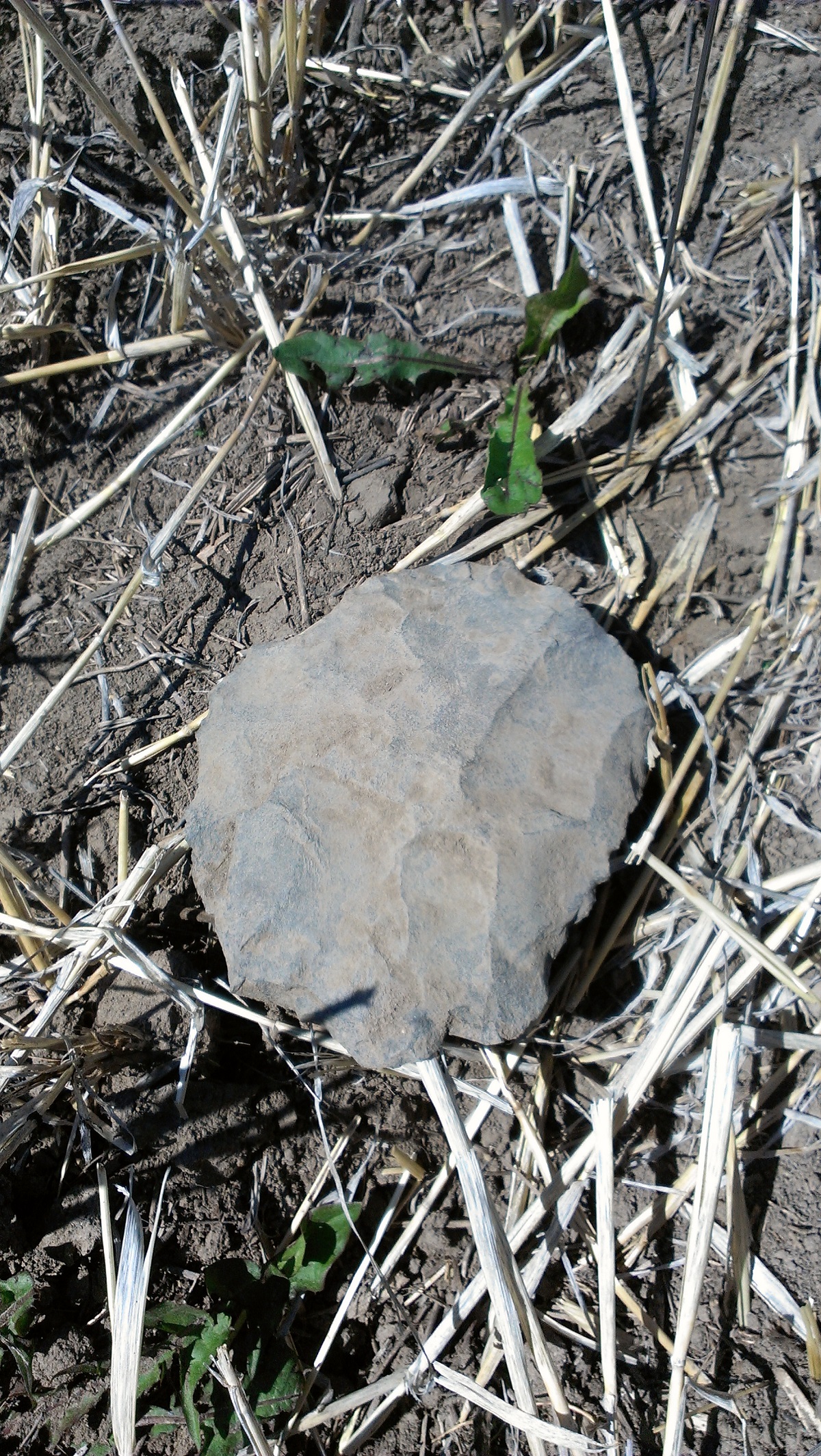
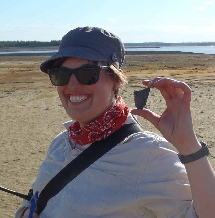
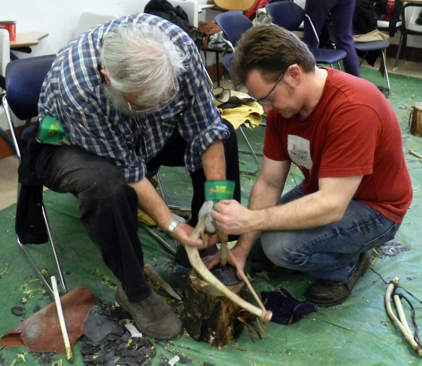
Jack and Bob brought these sites to the attention of the Strathcona Archaeological Society as an opportunity to engage with the society’s members through the practice of archaeology. What made these sites perfect to use for a volunteer project is that all the sites were identified by the artifacts found on the surface, thanks to the reservoir water that slowly stripped the soil away. This meant that volunteers could learn how to spot the artifacts sitting on the surface.

3 artifact sample

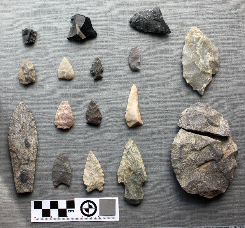
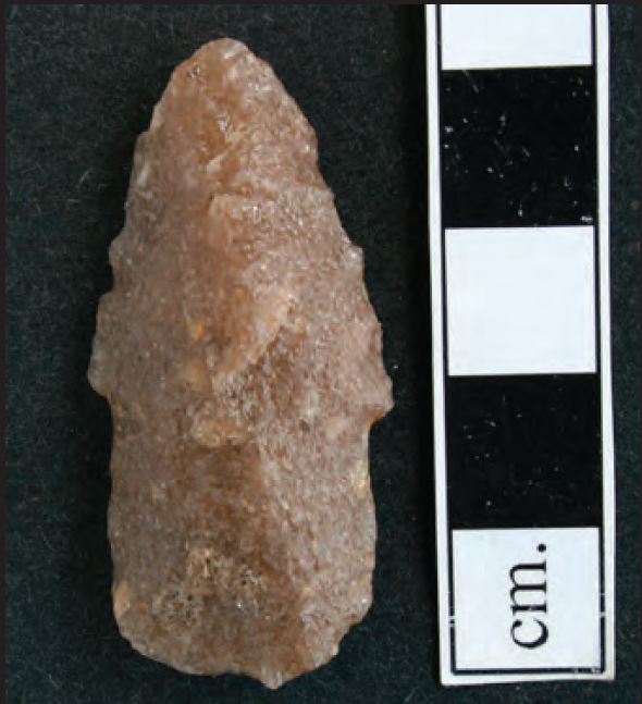
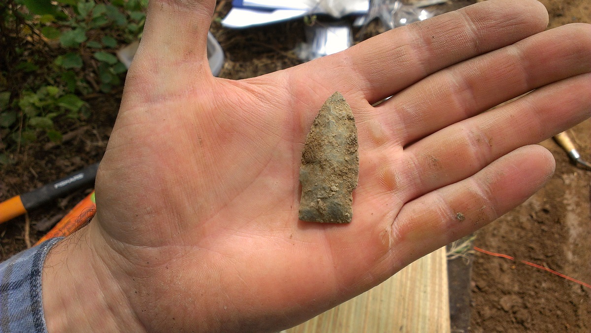
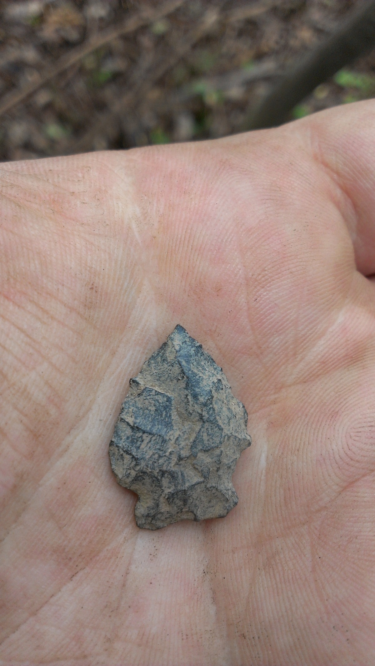
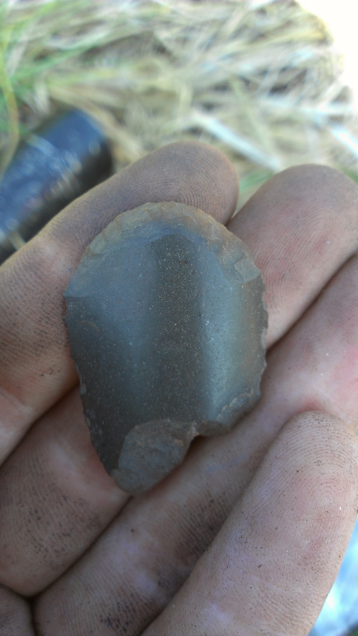
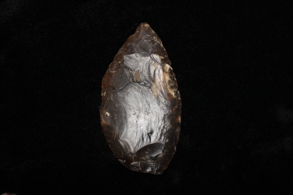
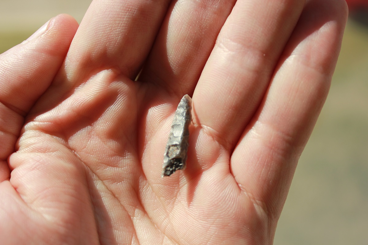
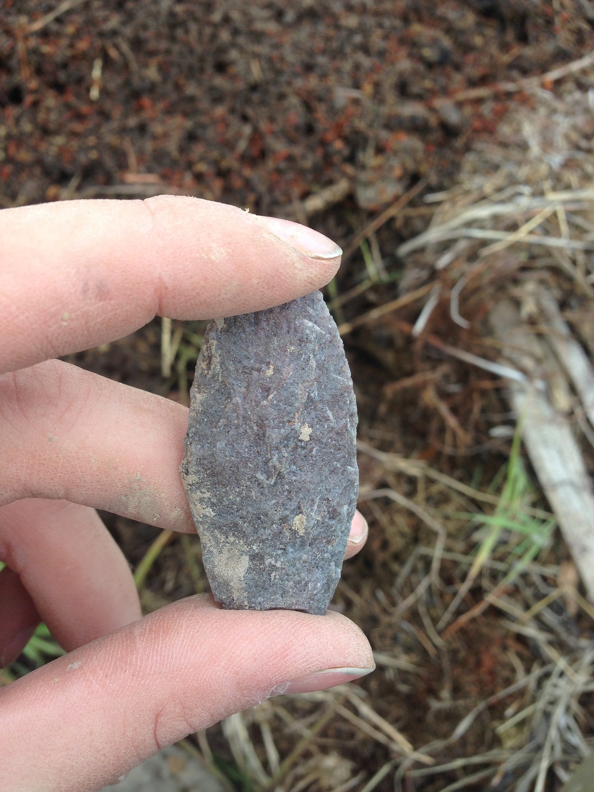
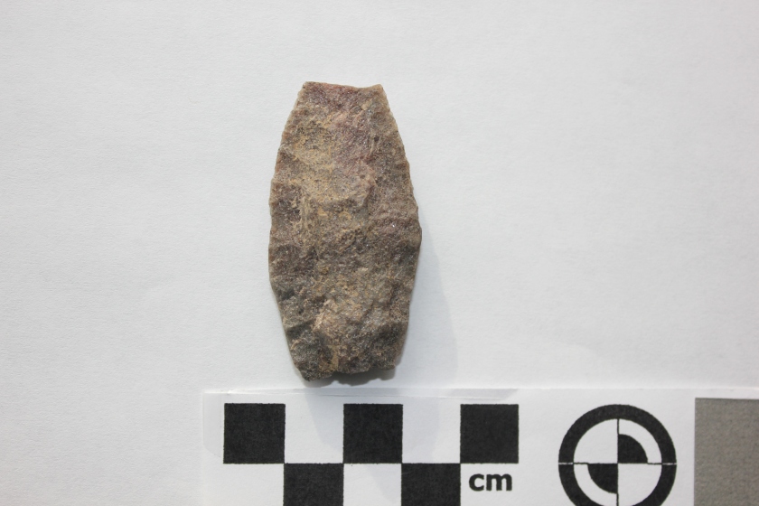
In 2015, Madeline Coleman, one of our Permit Archaeologists, co-organized the pilot volunteer project with another SAS member, Amandah van Merlin. Volunteers travelled across FfPv-1 to figure out the site’s extent, and what type of site it was. Survey of the landforms around FfPv-1 found three new sites!! Volunteers also found projectile points that crossed almost the entire expanse of Alberta Precontact history. The cultural phases represented include Clovis, Agate Basin, Hell Gap, Oxbow, and Plains Corner-notch.


4 amandah with a find_resized

Based on the location of the sites, it is very likely that the sites are located around the whole reservoir! The construction of the reservoir began in 1910, long before developments in Alberta were examined for impacts to archaeological resources. Currently, many of the sites recently identified are only accessible by boat.

A new survey with test excavation units are planned for May 28th and 29th. To register or for more information, email Madeline at mcoleman@treetime.ca

Stone Drill

This week, we showcase a stone drill. That’s right, you guessed it, this type of stone tool is used to drill holes in things. Like knives and projectile points, drills are worked on both sides to create sharp edges and a narrow tip. Unlike other stone tools however, drills are very narrow and thick, and often are diamond shaped in cross-section. This design makes the drill stronger, and less likely to break. In Alberta, stone drills are often either long and straight, with a bulb or a “T” shaped base. More often than not, you find the broken end of drills, because they snapped off while in use. The stone drill bit would be attached to a long wood handle using sinew, rawhide, and pitch, and then spun to create the circular motion for drilling. This could be either done by hand, or using a small bow and string to spin the drill.

DSCN1489.jpg
Using a stone drill with a bow saw to drill a hole in a slate ulu.

We found this stone drill while working for Sundre Forest Products in 2012, in the Foothills west of Red Deer. The artifact is made from a brownish-gray chalcedony, and also shows evidence that it was heat treated. The drill has small “potlid” fractures, where irregular pieces of the stone popped off. This type of break happens when a stone is quickly heated and cooled.

Agate Basin Spear Point

This week’s photograph is of an artifact we found in 2015 when undertaking an HRIA for Sundre Forest Products. It comes from a site south of the Ram River – our 100th site of the year, in fact. It’s an exciting find: a spear point of the Agate Basin style. The picture above was taken when it was found and the picture below shows the point after it was catalogued in our lab. We have found our fair share of points over the years, but this is a rare one because of its age. Agate Basin points are some of the oldest found in the province and date between 10,200 and 9,600 years ago.

FbPu-31_8_IMG_0106The site was identified when we were surveying a disturbed area. Like Corey explained in his blog entry, a lot of information may be lost when a site is disturbed because the relationship of one artifact to another has been disturbed. Although we always hope to find sites intact and undisturbed, disturbances like erosion can allow archaeologists to see a larger area of soil than through shovel testing alone. This artifact was found lying on the ground when we were walking over a ridge. This is why archaeological assessments in disturbed areas can be worthwhile. It’s also why archaeologists are hard to walk with – they’re always looking down, searching for artifacts in even the most unlikely places.

Archaeology on Deer Mountain

On Friday, April 15th at 7 PM Tree Time Services Sr. Project Archaeologist Kurtis Blaikie-Birkigt will be presenting  at the High Prairie and District Museum on ongoing research on Deer Mountain, Alberta.  On the weekend, Tree Time will be at the High Prairie Gun & Sportsmen’s show with a display of artifacts and replicas to help identify your finds.

DeerMountainPoint
Figure 1. Stemmed projectile point found by Darryel Sowan of Swan River First Nation during archaeological survey by Western Heritage Services for Alberta Plywood Ltd. (From Cloutier, 2006. Courtesy of Western Heritage Services)


Early archaeological research on northern Alberta was focused on big lakes. Large campsites were found on major lakeshores and were assumed to be related to seasonal fisheries. It was assumed that past people’s hunting forays into the hills and hinterlands wouldn’t have left much of an archaeological trace. When we started doing archaeological surveys for forestry cutblocks in 2001, we didn’t expect to find very much. The typical sites we’d find would be small scatters of stone chips and flakes left from making stone tools like arrowheads. Even those sites were almost always very close to major streams or other waterbodies.

Deer_Mouintain
Figure 2. Location of Deer Mountain. Note the distance from major waterbodies.

In 2005, I was part of a crew that did some pre-harvest archaeology surveys for Alberta Plywood on Deer Mountain (Figure 2). Earlier surveys had found a few sites there, more than would be expected in a place so far from major waterbodies. Even knowing there were sites there, our findings in 2005 surprised us. We found quite a few sites, they were richer than expected, included a unique local stone called Grizzly Ridge Chert (Figure 3), and we found a spear point similar in style to ones that date to 8000 years ago (Figure 1). Deer Mountain was an unusual place, archaeologically speaking, and was very eye opening to me.

GfPt-28-41_GrizzlyRidgeChertflake_cropped.jpg
Figure 3. Grizzly Ridge Chert retouched / utilized flake found on Deer Mountain in 2015.

Last year, I got to revisit some of the same areas for Alberta Plywood, with the benefit of another 10 years of experience, high resolution LiDAR imagery, and significant improvements in survey and site evaluation methods. We found more sites, bigger sites, and more interesting sites in places we didn’t even think to look in 2005. I came away with an even greater appreciation for how interesting Deer Mountain is, and for how much I’ve learned over the intervening years.

In this talk, I’ll touch on careers in archaeology, archaeological methods, how industry and government manage risks to archaeological sites, and a really interesting area in Alberta archaeology that’s barely been studied.

OLYMPUS DIGITAL CAMERA
Figure 4. View to significant site GfPt-3 on Deer Mountain.


References:

Cloutier, Riel

2006      Heritage Evaluation of West Fraser Slave lake (Alberta Plywood Ltd. Division) 2005/2006 Annual Operating Plan Forest Harvest Developments, Slave Lake, Alberta. Archaeological Research Permit No. 2005-378. Report on file, Archaeological Survey of Alberta, Edmonton.


Radial Biface

Today’s picture comes from the Ahai Mneh site on the shores of Lake Wabamun, west of Edmonton, AB. This archaeological site has a long history of human occupation, from earliest hints of people in Alberta using Clovis technology, right up to the Late Precontact and Historic Periods. Featured here is a large radial biface, made of a fine-grained siltstone. This artifact was found in a field adjacent to the site, having been turned up by a plow. While not exclusive, radial bifaces such as this one are commonly associated with the Clovis tool kit, dating back to 13 000 years ago in Alberta.

Scottsbluff Point

Today’s picture comes from the Ahai Mneh site on the shores of Lake Wabamun, west of Edmonton, AB. This archaeological site has a long history of human occupation, from earliest hints of people in Alberta using Clovis technology, right up to the Late Precontact and Historic Periods. Featured here is a Scottsbluff point, made of classic Alberta quartzite. This projectile point type is part of the Cody Complex, which was present across North America between 9 000 and 7 000 years ago. Point such as this one are famously associated with large communal kills, where the hunters dispatched dozens of giant Ice Age bison in natural and built traps.

Late Precontact Arrowhead

Today’s picture comes from the Ahai Mneh site on the shores of Lake Wabamun, west of Edmonton, AB. This archaeological site has a long history of human occupation, from earliest hints of people in Alberta using Clovis technology, right up to the Late Precontact and Historic Periods. Featured here is a Late Precontact side-notched arrowhead, made of a fine-grained black siltstone, that likely dates between 1000 to 300 years ago.

End Scraper

Today’s artifact is an endscraper, a tool used to remove the flesh and hair from an animal hide. The person who made this tool took a small pebble, split it in half, and then chipped fine flakes off the one end to create a steeply beveled edge. The stone blade would then be attached to a handle, and dragged across a stretched hide to scrape the unwanted flesh and hair away. This artifact was found at the Quarry of the Ancestors site near Fort McMurray, and is made of a high quality chert.


Long distance trade

Featured picture this week is a bifacial knife, with fine retouch along the right margin to create a sharp edge. This knife is made from Knife River Flint, a stone material that can only be found in North Dakota, USA. Today’s artifact was found 70 years ago in Manitoba, Canada.