Cecily Margaret Guido (Peggy Piggott)

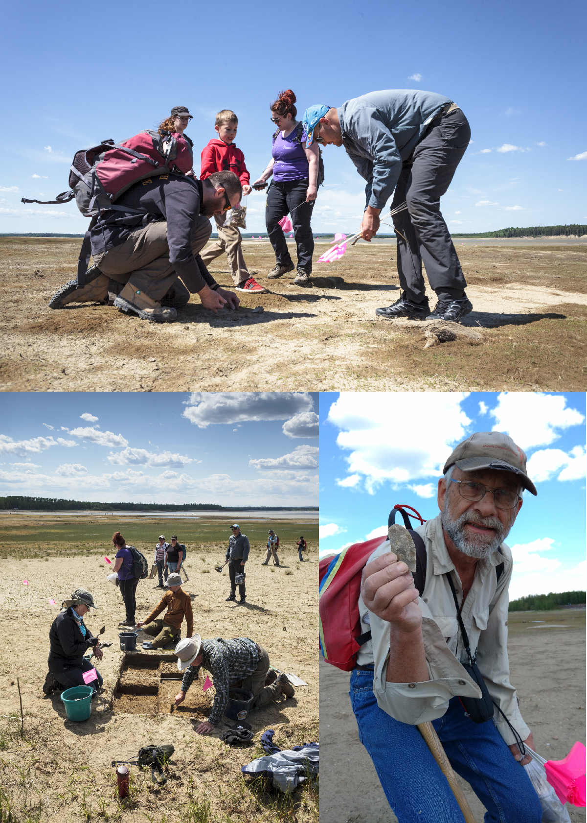
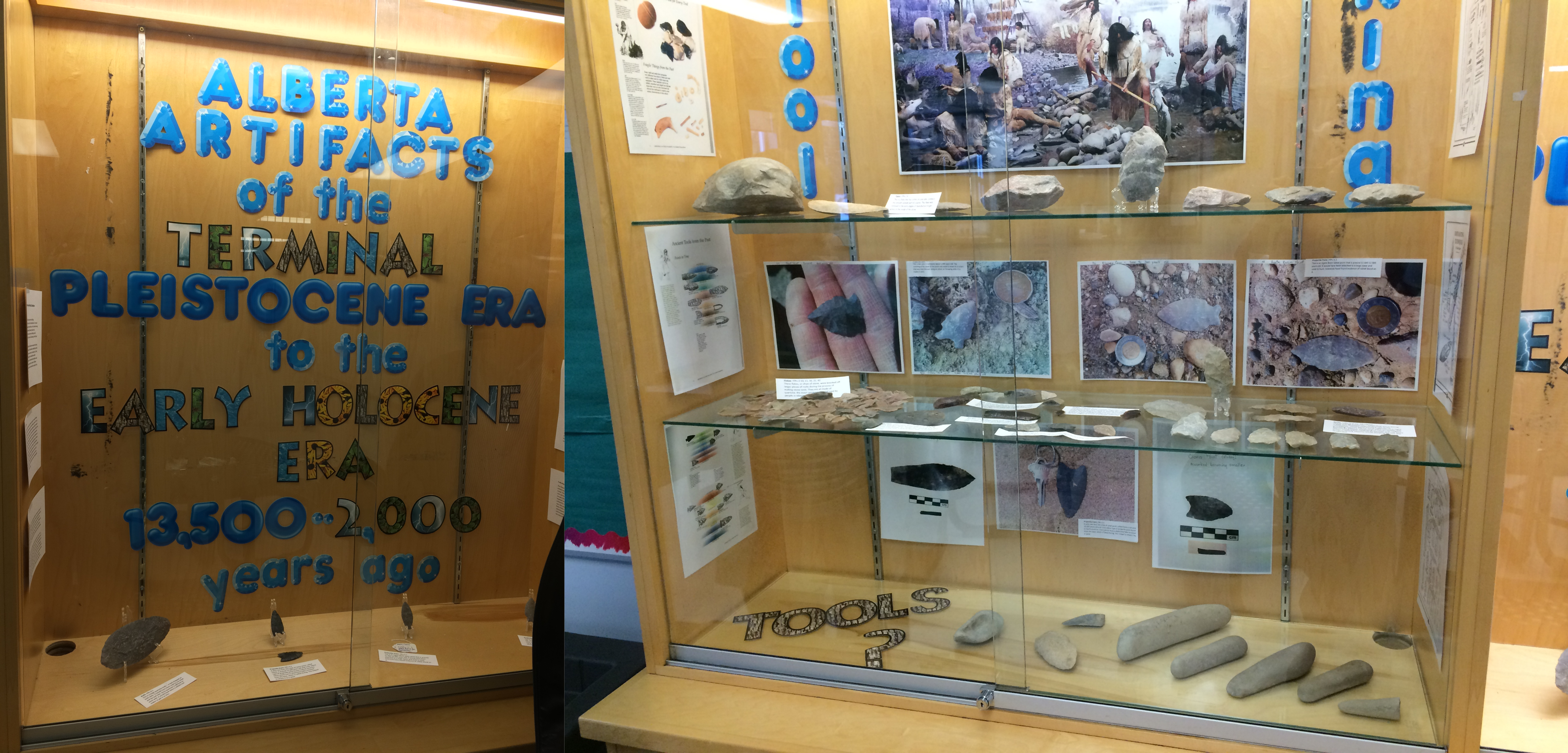
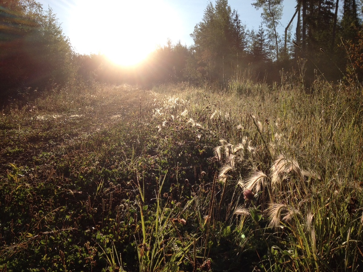
Books and movies, like The Dig (author John Preston and director Simon Stone), reintroduce us to people in our archaeological history that have either been forgotten or downplayed by societal norms of the time. They encourage us to dig into the past to discover who these people were, and how they contributed to the advancement of our field. Cecily Margaret Guido, or Peggy Piggott, as she was known at the time of the Sutton Hoo excavations in 1939, was in the right place at the right time. She discovered the first item of the large collection of artifacts from the famous ship burial. But this was was such a small snippet of a long and productive career. Peggy was a very busy woman!

Lily James plays Peggy Piggott in the new film The Dig

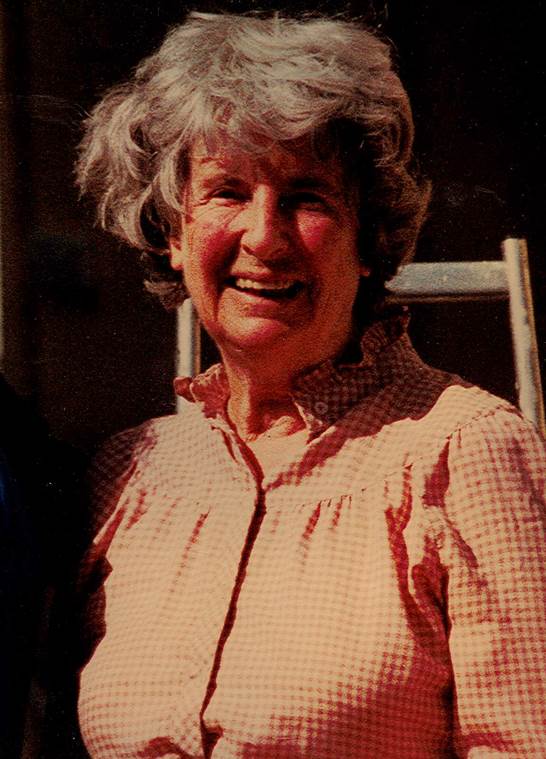
Margaret Guido (b. August 5, 1912, d. September 8, 1994) was an English archaeologist known for methods, field-leading research into prehistoric settlements, burial traditions, and artifact studies. Her career spanned sixty years, and was defined by high field standards, and rapid, high-quality publications. At the time of the Sutton Hoo discovery in 1939, she was already an accomplished archaeologist with plenty of fieldwork experience, and not as inexperienced or “bumbling” as portrayed in the The Dig. In 1933 she excavated under the tutelage of Mortimer and Tessa Verney Wheeler, at the Roman town, Verulamium (Hertfordshire, England). In 1934 she earned a “diploma” from the University of Cambridge, as they did not award degrees to women at the time. By 1936, she had completed a post-graduate diploma from the Institute of Archaeology in London, where she focused on Western European Prehistory. In 1937, at the age of 25, she directed an excavation at the Latch Farm (Hampshire) Middle Bronze Age barrow and urnfield cemetery, wrote up the excavation of an Early Iron Age site at Southcote (Berkshire), and published a study on the pottery from Iron Age Theale. In 1938-39 she worked on research excavations at the Early Iron Age site of Little Woodbury (Wiltshire), and published the results of work conducted at the Early Iron Age site at Langton Matravers (Dorset).

Original photograph by Barbara Wagstaff © Trustees of the British Museum, digital image © National Trusthttps://www.nationaltrust.org.uk/blogs/archaeologists-blog/personal-reflections-on-the-digs-and-discoveries-at-sutton-hoo

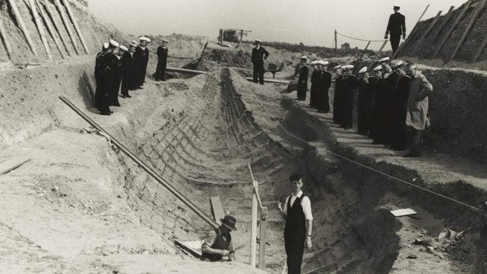
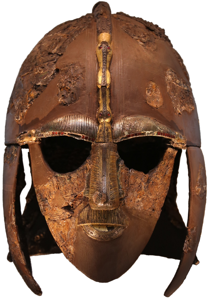
In July 1939, Guido and her then husband, Stuart Piggott, arrived at the Sutton Hoo location to aid Charles Phillips, who had assumed control of the excavations under the British Museum, the Office of Works, Cambridge University, Ipswich Museum, and the Suffolk Institute. On July 21, not long after her arrival at site, Guido had discovered the first of 263 items that confirmed the ship was a burial mound, and that the Anglo-Saxon Dark Ages were in fact a rich cultural period.

https://en.wikipedia.org/wiki/Sutton_Hoo_helmet

Over the next two decades, Guido’s work forged her into one of the most important British prehistorians. She conducted extensive excavations at six hillforts, excavated for the Ministry of Works during WWII, and produced approximately fifty publications for British Prehistory which advanced the fields of Bronze Age burial traditions, Late Bronze Age artifact studies, Later Bronze Age and Iron Age settlement studies (especially roundhouse architecture and hillfort chronologies). Later in her career she produced the definitive texts on Prehistoric, Roman, and Anglo-Saxon glass beads that are still used today. By the age of 32 she was elected a Fellow of the Society of Antiquaries of London due to her contributions to the study of British prehistory. In 1987 she was President of the Wiltshire Archaeological and Natural History Society, a position she held until her death at the age of 82.

Her work on hillfort studies (both field methods and interpretations) are some of the most influential work on the understanding of early British prehistory. In 1948 she excavated Hownam Rings, Hayhope Knowe in 1949, and Bonchester Hill in 1950, and published the results within the same year. The field methods she used at Hayhope Knowe was a combination of the best parts of the Wheeler and Bersu schools of excavation, but modified to allow for quick assessment. This was the first time these were used on northern Iron age sites. As a result, in one season Guido was able to open 520 sq. m in targeted open-area trenches, which were used to investigate three houses and their enclosure sequence.

Hayhope Know Excavation map – Fig. 9 from “The Iron Age Settlement at Hayhope Knowe, Roxburghshire. Excavations 1949. By C.M. Piggott, Proceedings of the Society of Antiquaries of Scotland, 1951.

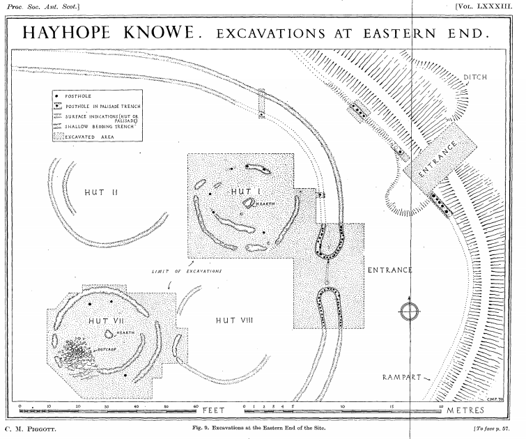
Hownam Rings became the type-site for hillfort development, known as the Hownam Paradigm. The paradigm indicated that the progressing complexity of enclosures (pallisade to multivallate earthworks) also represented complexity of cultural development. This paradigm remains valid to this day. Guido also used this site to discuss for the first time the problems of archaeological survival, slope erosion, and the vestigial nature of timber features. She also tested and refined the CBA model, allowing her to provide a relative chronological framework for later prehistoric settlement in southern Scotland. This was a major leap for prehistoric studies in the days before the use of radiocarbon dating became prevalent.

In the later part of her career in the 70s and 80s, Guido focused on researching ancient British glass beads. Her first volume covered both prehistoric and Roman period beads, and the second volume (published posthumously by Martin Welch in 1999) on Anglo-Saxon beads. She co-founded the Bead Study Trust (in 1981), and the Peggy Guido Fund for research on beads. Both volumes remain the primary reference works on the topic.

If you want to read more about the works of Margaret Guido, check out the following links!

https://peoplepill.com/people/margaret-guido/

https://trowelblazers.com/raising-horizons-queens-of-the-castles/

https://en.wikipedia.org/wiki/Margaret_Guido

Muddy Lab Secrets

The mud we slog through in the field doesn’t always stay in the field. It’s wrapped around a lot of the artifacts we find, and ends up in our sample bags. Once we get back from the field, we start the process of washing all the artifacts. As the sediment is brushed away, some of the artifact’s secrets are slowly revealed!

The mud can really hide what colour an artifact is. This flake was a dull grey brown until a “wet brush” made it’s way across one side. Underneath this layer is a beautiful pale quartzite that transitions into a orange-reddish pink the further washing was completed.
quartzite flake_blog

Washing all artifacts in water is not possible. Bone just absorbs the water, which makes it take longer to dry fully. Putting wet bone into a bag will ultimately end up destroying the artifact with mold. Tools we find in the field are also only “dry brushed”. This helps preserve any residue left on tools, which can be used in various residue analyses. A good brushing will help pull out little details though. This thumbnail scraper has been worked around almost its entire edge. The brushing (left) really helps it stand out.
scraper edge_blog

Sometimes, however, a tool is only discovered after washing the mud away. Retouched flakes (as opposed to a formed tool) are often only discovered as the edges are cleaned, allowing the knapped edge to be fully exposed.  The same goes for a utilized flake.  These are flakes that look like a regular flake, but with closer inspection the edge has been chipped and worn from use.  These are often called expedient tools.  The flake’s sharp edge is used until it is dull, after which it is discarded.
retouched_blog

The Whiskey Jack!

In 2015 a two year poll was issued by Canadian Geographic for a new National Bird.  In the end, our little Grey Jay took the lead, beating out the common loon, black-capped chickadee, snowy owl, and Canadian Goose. Although not officially recognized as the new National bird yet, it was selected as an avian representation of Canadians: its found in every province and territory, it’s friendly, and it’s very intelligent!

Gray Jay Range_FINAL_02_Ocean_Labels - KS
From the Canadian Geographic: https://www.canadiangeographic.ca/article/meet-our-national-bird-gray-jay

For the Cree, the Whiskey Jack, or Wisakedjak, is a shape-shifter, benevolent trickster, teacher, and messenger of the forest. There are many different stories about the Wisakedjak, but most of them have a moral. The appearance of the Wisakedjak in the morning is seen as a good omen, and is believed it warns people of nearby predators.

This boreal forest inhabitant is often spotted by Tree Time’s archaeology crews, and it has quickly become my favourite little bird. They are almost always seen traveling in a group of three: a monogamous pair and a juvenile from the previous year’s breeding season. The friendliest groups have always been found near areas people have made their hunting camps. In fact, the Whiskey Jack has figured out that people mean food. Given a few minutes, some of them may even eat out of your hand!

IMG_0784 - Copy
The Whiskey Jack checking us out! Notice how close it is to our gear.

DSCF1472 - Copy
This camp must have been a popular food gathering place for these Grey Jays. They were very friendly!

Whiskey Jacks stick around all winter too, even incubating their eggs as temperatures dip to -30°C. They store their food in crevices, under lichen, and even under conifer needles. They coat the food in a saliva, called bolus, which makes it sticky, ensuring the food doesn’t move until the Whiskey Jack returns. Unlike forgetful squirrels, these birds will remember exactly where they left their caches! Their food is a variety of arthropods (like spiders), small mammals, ticks, carrion, fungi, fruits, and seeds. The average life span is about 8 years, although the oldest recorded Whiskey Jack was 17 years old!

checking out the truck
These three checking to see if we were going to drop any of our lunch.

What bird would you have voted for?

Camp Fire Hazards

It’s that time of year again! Living in Alberta, we all know how disastrous a forest fire can be. No one wants to see fires tear through their homes and communities, like what has happened previously to Fort McMurray or Slave Lake.  These fires are dangerous, unpredictable, and destructive.  Many of us at Tree Time have walked though the remains of a burned forest and have seen what is left behind.  So here are some tips to remember while you are out camping and enjoying your campfire.

PB230804 - Copy
An area that was partially burned by a forest fire

Building your fire:

  • Check for a fire ban in your area. May can be a dry month, and it only takes one spark to start a forest or brush fire.
  • Use an existing fire ring if you can, rather than build a new one.  Make sure all vegetation or flammable materials (like leaves, sticks, spruce/pine needles, etc) has been cleared away up to 10 ft.
  • If you have to build a new one, dig a pit 1 ft into the ground first and circle it with rocks.
  • Select an open area with no overhanging branches, dense dry grass, logs, etc.
  • NEVER LEAVE IT UNATTENDED!

Putting out your fire:

  • Use water to douse that fire.  If the fire burns too hot, it can still catch fire when the wind picks up, so make sure everything that remains is soaked through.
  • Use shovels or a stick to stir the contents making sure everything gets wet and cools down.
  • Touch it to be sure! People might think that they put out their fire, but debris (roots, moss etc) on or under the ground can catch on fire and spread the fire beyond the stone rings. You can see in the pictures that the area around this abandoned campfire has been burned.

IMG_0226 - Copy
Note the burnt ground under Brian’s feet clearly outside the intended fire pit area


IMG_0230 - Copy
Brian digging up earth around the fire pit to put out the fire

That is why it is so important to make sure that you have properly put out your fire. Please check out the Alberta Parks Website for great advice on campfire safety.

http://www.albertaparks.ca/albertaparksca/advisories-public-safety/outdoor-safety/campfire-safety/

http://www.ofc.alberta.ca/camping-and-outdoor-fire-safety

Also if you need to report a wildfire, call 310-Fire (3473). Never put yourself in danger.

We thought we would share this story in advance of the long weekend to remind people about campfire safety. Alberta is a great place and camping is an amazing way to experience it. So from us at Tree Time, we sincerely wish you a great long weekend and happy, safe camping.

Bridges

Water crossings are something we come across on a daily basis in the boreal forest. Sometimes we are fortunate to work in areas with active hunters or forestry layout crews, and can use the bridges they have already constructed. These brides can be cut logs laid across a deep, but narrow water channel, while others have been constructed with considerable planning and engineering!

IMG_0040 - Copy

The first thing we do when we get to an unknown bridge is test it out. It’s not always obvious that the bridge is in disrepair. In order not to add extra stress to the bridge, we travel across one at a time, each person watching the following person to make sure they safely crossed.

There are times that a water crossing would have been fine to cross on a quad, but beaver activity has flooded the area. In these cases, we like to find a sturdy, wide beaver dam to use as a foot bridge. We move slowly across, testing footholds as we go, since beaver dams, like bridges, can look more sturdy than they are. If the beaver dam seems too small or too weak, we will not cross.

IMG_1160 - Copy

Of course, there are always the days where there are no bridges to help us get to where we are going! At that point we either have to turn around and look for a new route, or bring in different vehicle types, like an Argo.

DSCF1845 - Copy

Tree Time Gals!

International Women’s Day is a great opportunity to talk about women in our past that have paved the way in some fashion. Without the Famous Five women would not have been recognized as persons in Canada as early as we were. Women like Zelia Nuttal, challenged the norm and pursued something she truly loved, expanding our understanding of archaeology and ancient cultures in the process. Thanadelthur and Flores LaDue showed everyone just how strong, creative, and persevering women can be!

To end our posts this week, however, I would like to give a shout out to all the women archaeological consultants in Alberta today. On a daily basis in the field they face the elements, wildlife, and the unknown of what they may or may not find during survey. Those of us that work in the boreal forest have the added challenge of remote access, long hikes with 30-40 lbs of gear, no trails, exhaustion, and the sheer joy of being places people have rarely visited in the recent past. Many of these women lead archaeological survey projects large and small, while others conduct the surveys and are gaining the experience they need to become permit holders. Our permit holders manage the crews, budgets, research designs, safety, data analysis, reporting, and outreach.

In 2017, 62 people applied for a permit in Alberta in order to complete an Historic Resource Impact Assessment (HRIA), of which 23 were women. In Edmonton we have three major forestry CRM companies (Circle CRM, Western Heritage Services, and Tree Time Services) that currently employ 16 permit holders, 8 of which are women, in addition to seasonal and annual archaeologists. At Tree Time, we currently have 4 women (3 permit holders) on a 9 person team: Teresa Tremblay, Brittany Romano, Elenore Hood, and me (Madeline Coleman). We work side by side with our other team members improving our survey techniques, increasing our site identification rates (who doesn’t want to find more?), and annually increasing our understanding of where sites are in our project areas. All of these ladies have inspired me!

Teresa has really improved our understanding of site locations in the High Level area, which typically has very hard access, often needing helicopters. With helicopter access there are so many additional planning and safety considerations to take into account, creating a very challenging project, which she tackles with enthusiasm. In the Sundre area she works with developers on predicting where sites will be, allowing them to avoid areas. That doesn’t stop her from identifying over 30 sites a year in the planned harvest areas, though! She is one of our fastest diggers, and out-tests me on a regular basis. She also has several years teaching experience, preparing our next archaeological generation. She’s worked extensively in Ontario before moving to Alberta, and is working on expanding Tree Time into BC.

Brittany Romano has started to specialize in the Fort Vermilion area but has worked all over the province. Her problem solving skills for access, stuck quads, or site evaluations are excellent. She has recently been heavily involved with developing our outreach programs, which includes school visits. She’s put together our activity stations and worksheets to get young kids really involved and interested in archaeology. She keeps everyone at Tree Time on their toes with light-hearted practical jokes!

Elenore is one of the toughest field archaeologists I have ever met. No holds barred but at the same time the nicest person you could ever hope to work with. She takes no guff from bears, either. She built her career in BC and Alberta and has a keen sense of where on the landforms sites are located. She often finds artifacts in spots I would not have thought to test. She has been the lead of our blog series, and has kept a great balance with articles and featured artifacts. She has recently taken leave to work on a Master’s Degree. The next step is a Permit Archaeologist!

I’ve spent most of my career here, specializing in the Slave Lake region. Over the last few years I’ve been working on better understanding where we find sites in muskeggy regions. I love field archaeology but also really love the analysis part and outreach with First Nations groups. I’ve been working on improving our artifact analysis process, including its photography. I’ve also started working in the realm of public archaeology, which provides everyone with an opportunity to give archaeology a try.

And of course, there are so many other women archaeologists in the province. These include employees at the Archaeological Survey of Alberta, professors, students, volunteers at all our organizations around the province, and even the people who started out as archaeologists but have stepped away (you never really stop being one!). Women are a part of archaeology at every level in Alberta, and they are passionate about what they do.

Keep digging and researching, ladies!!

Public Archaeology at the Brazeau Reservoir

Public archaeological programs are an excellent opportunity for people with a general interest in archaeology or amateur archaeologists to learn what an artifact is, and to practice the techniques that are used to find and interpret them. Often these programs will have a dig component, where people join for a few days or a week, and learn excavation techniques in units laid out over a buried site.

The Brazeau Archaeological Project (BAP), sponsored in part by Tree Time Services Inc., provides a unique experience. The current sites being surveyed are almost entirely exposed by the continuously fluctuating water levels of the reservoir. This also means that the entire history of the area has been deflated to one level, rather than multiple occupation levels that can be apparent in excavations. The occupation of the Brazeau River by First Nations extends as far back as 12- 14,000 years ago. This allows participants to gain a better feel of how large and spread out an archaeological site can really be. The largest site surveyed so far spans almost 1 km!

DSC00028_jack brink - Copy
Bob Dawe (left) discussing boiling pits. Photo Credit: Jack Brink

The project invites members of the Strathcona Archaeological Society (SAS) to come out for a day or weekend to learn survey and excavation techniques, as directed by experienced or professional archaeologists. As most of the artifacts lay exposed on the surface due to the ever changing water levels of the reservoir, the experience is relaxed, family friendly, and can be conducted over a single day or weekend, rather than a week-long commitment.

participants_hilary mcdonalnd and madeline - Copy
Participants surveying, excavating, and generally having a good time!  Photo credit: Top and left – Hilary McDonald; right – Madeline Coleman

Participants learn what features to look for when looking for surface finds, such as material, shape, and modifications. By pairing participants up with experienced archaeologists we can point out the various ways an artifact, such a flake, can look; particularly how it can blend in or really stand out from its surrounding environment. For example, Amandah van Merlin, one of the co-ordinators, picked up a small, indistinct black pebble. The black pebble chert material, however, is a popular flint knapping material. As it turned out, Amandah had found a thumbnail scraper!

thumbnail - Copy
A small pebble with a big surprise!  Photo credit: Amandah van Merlin; inset – Madeline Coleman

Public archaeology programs are also a great way to explore new technology or try experiments. One participant brought his drone. He was able to take photos from a bird’s-eye view of the site, providing a totally new perspective on what these landforms look like along the shore, and the distances between the sites. Madeline Coleman, the other co-ordinator, laid out various sizes of brick pieces in order to examine how artifacts are affected by water movement (or perhaps even people).

ariel view - Copy
Ariel view of FfPv-1.  Photo credit: Robert Wambold

experiment - Copy
Laying out pieces of brick to monitor movement over time.  Photo credit: Madeline Coleman

The project is still in its infancy. The pilot survey in May 2015 occurred over one day and had 9 participants. In May 2016, the survey occurred over two days with over thirty participants joining for one or both days. This past May, there were over 20 participants that joined for the full weekend. In addition, for two days prior to the public survey, BAP worked with University of Alberta field school students. Here they practiced map making, shovel testing, and laying out excavation units.

Outreach is also a very important aspect of a public program, such to First Nations group, schools, and universities. The BAP has recently reached out to Paul First Nation, in whose traditional territory the Brazeau River lies, and whom are active in working to protect their heritage. BAP has also recently partnered with Katie Biittner at Grant MacEwan University to begin a hands-on catalogue experience for university students at Grant MacEwan and the University of Alberta. In addition, the original finders of the site, Sandy and Tom Erikson, worked to create a 3-case display at their hometown school in Edson. The case shows some of the finds and information from the periods they may have originated in.

edson display
School display in Edson. Photo credit Sandy Erikson

What do you see?

Everyone will interpret shapes and lines their own way.  But once someone points out an image they see, sometimes you wonder “how did I not see that?”.   A member of the Paul First Nations group took one look at this biface (from the Brazeau Reservoir) and saw a Bison.  Can you see it?  Scroll down for an outline if you are stumped!  Hint, he’s facing to the right.

bison biface

Moose on the Loose!

As Brian and I headed back to Swan Hills, we turned the corner and saw this fella chilling on the trail!  The forest to either side of the trail, having been harvested in the last decade or so, had young trees growing tightly together, making it difficult for the moose to make his escape.  We signaled our intent to continue on the path by revving the ATVs and moving slowly toward him.  We gave him the time and space he needed to move down the trail and find a safe place to enter the woods.  If we had just chased him, he would have become stressed and could decide to charge us.  Moose are an underestimated hazard in the field.  They are not carnivores, so it’s easy to think they will not be aggressive.  In reality, they are one of the “biggest” wildlife hazards out there, both in size and temperament.  Today was a good day for all three of us though.

img_1607