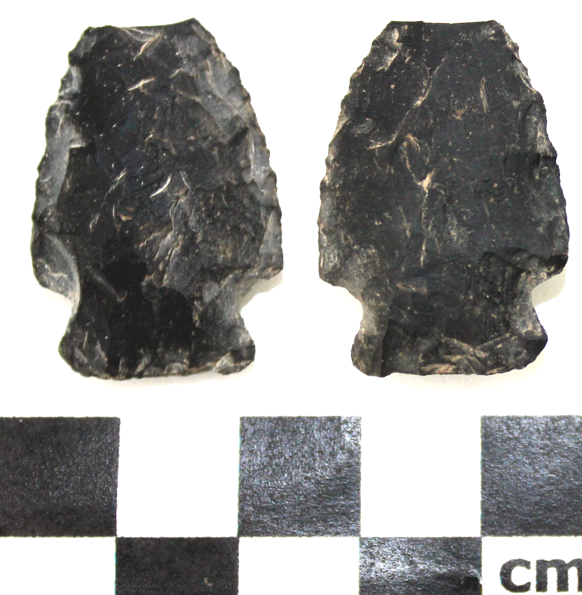
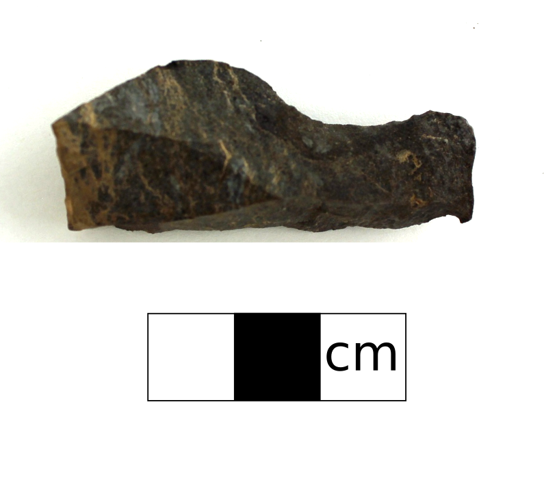
Projectile points come in many shapes and sizes ranging from large paleolithic spear points to small protohistoric arrow heads to even smaller “toy arrow heads”. This artifact type is a stone that has been shaped using flint knapping techniques to create a sharp triangular and aerodynamic tip that is attached to a wooden shaft that can be propelled through the air by throwing by hand, atlatl, or bow, to hunt game. This is an important artifact type as over time the styles of points changed allowing us to use the style to estimate the time period a site was occupied. This particular point is a Besant style dart point, which dates to approximately 2,500 -1,350 BP.
Tag: aboriginal
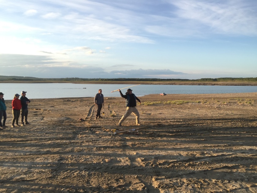
Atlatl
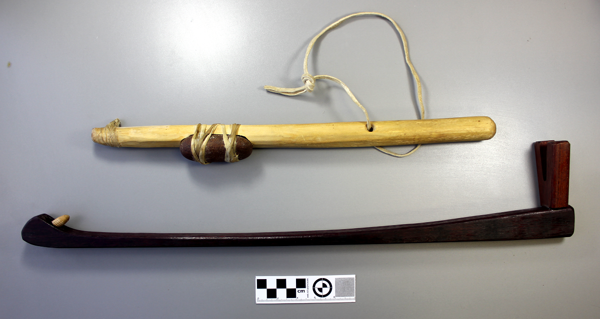
An atlatl is a throwing stick with a small hook used to throw darts (projectiles). It allowed the hunter or warrior to create more leverage to increase the speed and distance of the dart. This weapon was used throughout North America including Alberta, approximately between 7,500 and 1,350 B.P.
Spokeshave
A spokeshave is a type of formed tool that was used to scrape and/or smooth wooden shafts or handles such as on spears, darts and arrows. It is typically identified by the inward curving edge. This edge typically has small flakes removed from use or from shaping it into the curve prior to use.
Biface
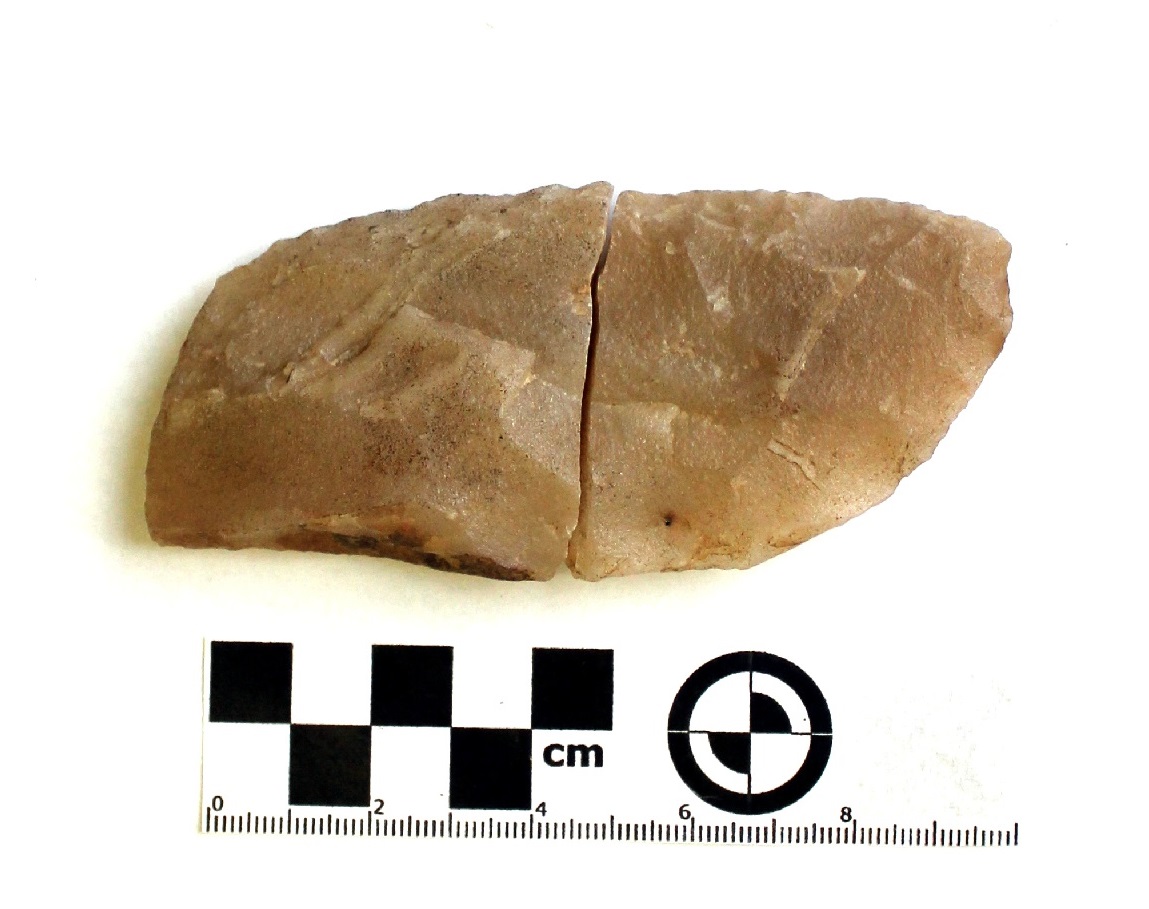
A biface is a stone tool that has flakes removed from both sides. It can be used as a knife, scraper, or further worked into a more recognizable tool. The typical biface shape is an oval with slightly pointed ends. The biface on the left was found near Fort Vermilion in 2016.
Calcined Bone
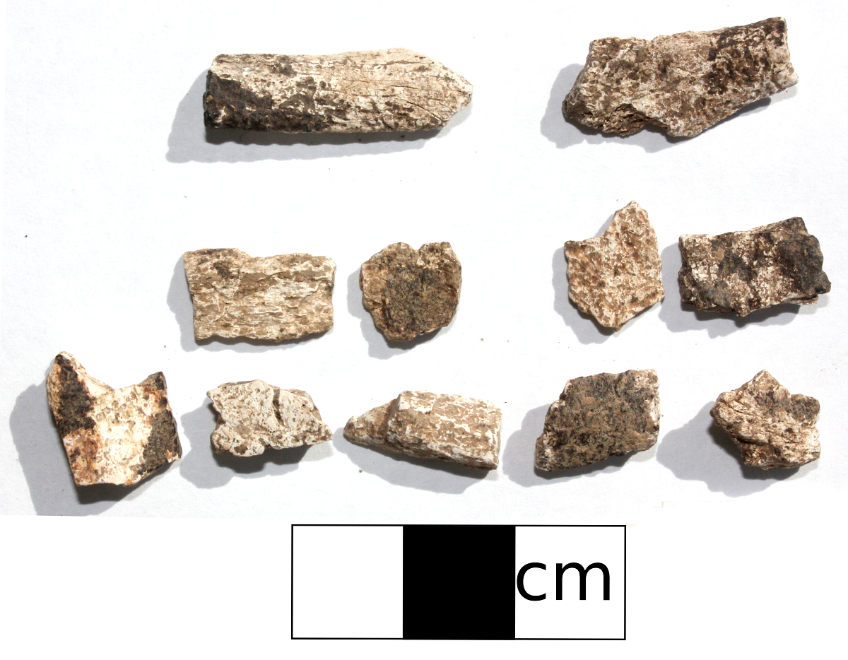
When bone is burnt by a fire it can undergo a range of changes in appearances, such as calcining. Calcining, characterized by its bright white colour, is caused when bone is burnt at a higher temperatures. The bone can shrink, become more white or chalky in appearance, more fragile and more likely to fragment into smaller pieces. These pieces of calcined bone were collected during the summer of 2017. Calcined bone indicates the presence of a hearth at the site.
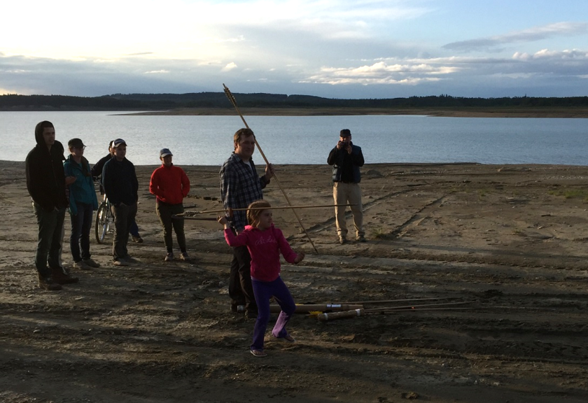
Public Archaeology at the Brazeau Reservoir

Public archaeological programs are an excellent opportunity for people with a general interest in archaeology or amateur archaeologists to learn what an artifact is, and to practice the techniques that are used to find and interpret them. Often these programs will have a dig component, where people join for a few days or a week, and learn excavation techniques in units laid out over a buried site.
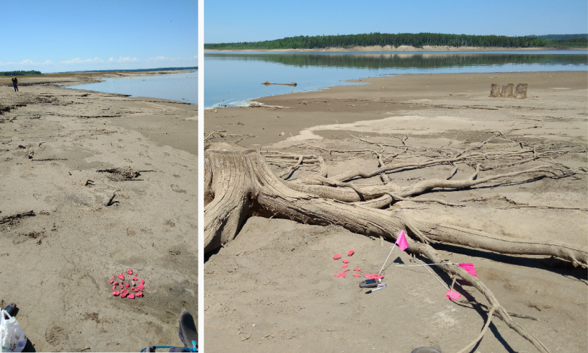
The Brazeau Archaeological Project (BAP), sponsored in part by Tree Time Services Inc., provides a unique experience. The current sites being surveyed are almost entirely exposed by the continuously fluctuating water levels of the reservoir. This also means that the entire history of the area has been deflated to one level, rather than multiple occupation levels that can be apparent in excavations. The occupation of the Brazeau River by First Nations extends as far back as 12- 14,000 years ago. This allows participants to gain a better feel of how large and spread out an archaeological site can really be. The largest site surveyed so far spans almost 1 km!
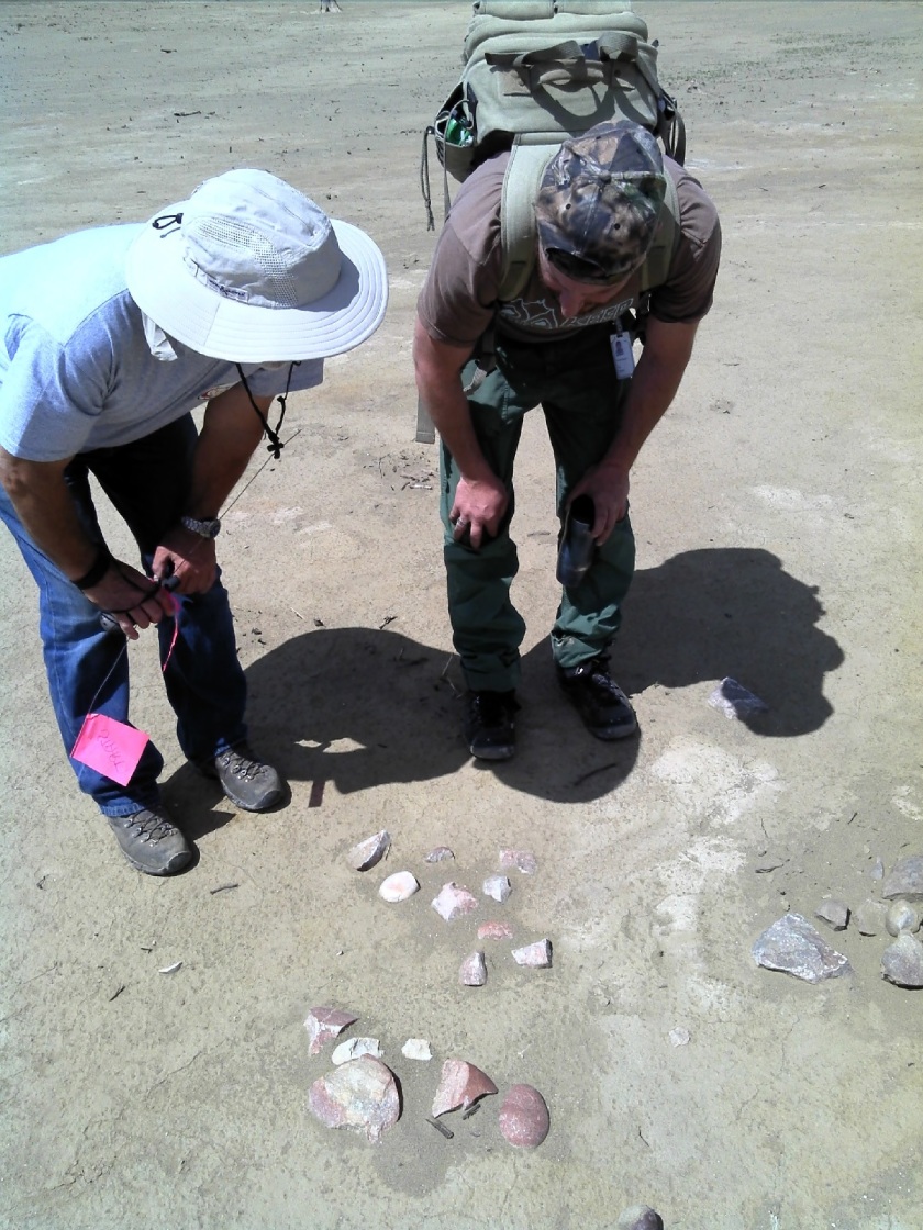
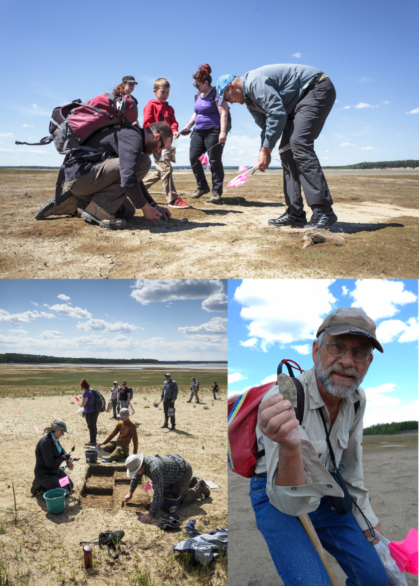
The project invites members of the Strathcona Archaeological Society (SAS) to come out for a day or weekend to learn survey and excavation techniques, as directed by experienced or professional archaeologists. As most of the artifacts lay exposed on the surface due to the ever changing water levels of the reservoir, the experience is relaxed, family friendly, and can be conducted over a single day or weekend, rather than a week-long commitment.
Participants learn what features to look for when looking for surface finds, such as material, shape, and modifications. By pairing participants up with experienced archaeologists we can point out the various ways an artifact, such a flake, can look; particularly how it can blend in or really stand out from its surrounding environment. For example, Amandah van Merlin, one of the co-ordinators, picked up a small, indistinct black pebble. The black pebble chert material, however, is a popular flint knapping material. As it turned out, Amandah had found a thumbnail scraper!
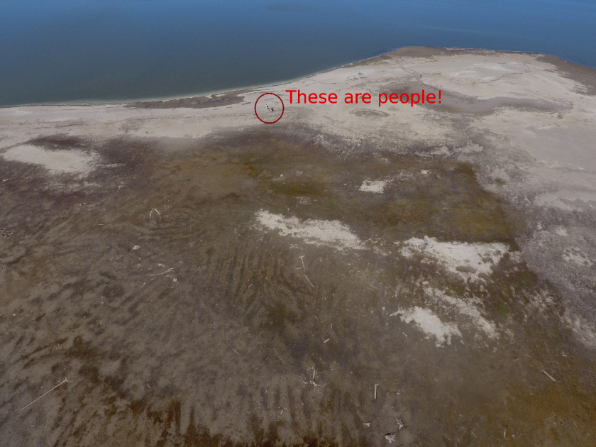
Public archaeology programs are also a great way to explore new technology or try experiments. One participant brought his drone. He was able to take photos from a bird’s-eye view of the site, providing a totally new perspective on what these landforms look like along the shore, and the distances between the sites. Madeline Coleman, the other co-ordinator, laid out various sizes of brick pieces in order to examine how artifacts are affected by water movement (or perhaps even people).
The project is still in its infancy. The pilot survey in May 2015 occurred over one day and had 9 participants. In May 2016, the survey occurred over two days with over thirty participants joining for one or both days. This past May, there were over 20 participants that joined for the full weekend. In addition, for two days prior to the public survey, BAP worked with University of Alberta field school students. Here they practiced map making, shovel testing, and laying out excavation units.
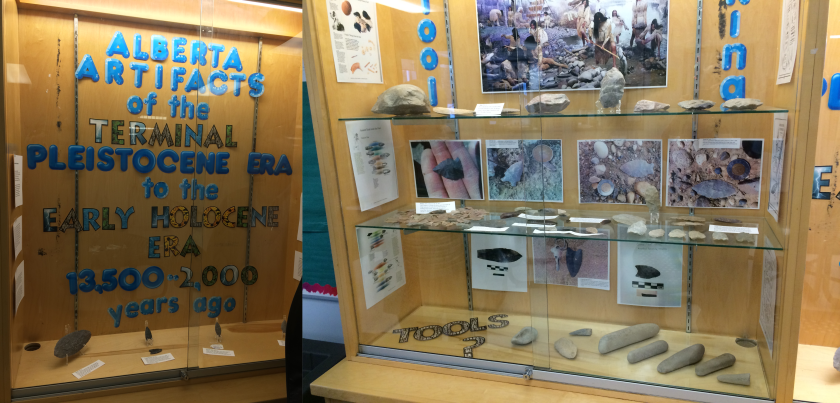
Outreach is also a very important aspect of a public program, such to First Nations group, schools, and universities. The BAP has recently reached out to Paul First Nation, in whose traditional territory the Brazeau River lies, and whom are active in working to protect their heritage. BAP has also recently partnered with Katie Biittner at Grant MacEwan University to begin a hands-on catalogue experience for university students at Grant MacEwan and the University of Alberta. In addition, the original finders of the site, Sandy and Tom Erikson, worked to create a 3-case display at their hometown school in Edson. The case shows some of the finds and information from the periods they may have originated in.
Core
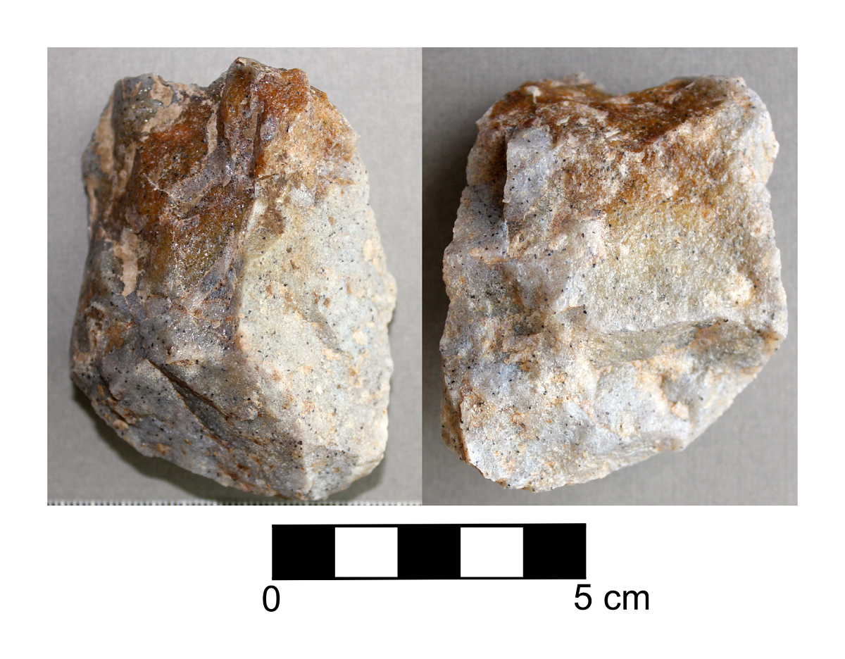
A core is a larger piece of stone from which many smaller flakes are removed. These flakes are then turned into tools or are utilized as they are. There are many different types of cores, but a common way to describe them is by the direction(s) flakes were removed, or by the shape of the core. For example, unidirectional cores have flakes removed all in the same direction. That has had many stone flakes removed to make other tools.
Obsidian
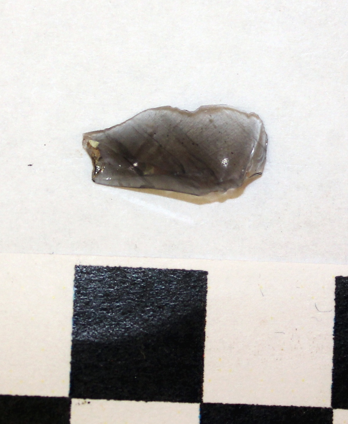
Obsidian is commonly known as volcanic glass. It forms when a volcano erupts and the lava is cooled extremely quickly, such as when it flows into a water body. In Alberta obsidian is considered to be an “exotic material” because it does not occur here naturally. When we find it here it tells us that people in the past engaged in long distance trade, usually with people in British Columbia or the Yukon. In 2016 Teresa found this lovely obsidian flake at site FaPr-6 located near the community of Caroline.
HRV 4C – What Happens Now?
You have made a plan for a development and reviewed your plan against the Listing of Historic Resources. You’ve found that you have a conflict on your land parcel, it is listed with an HRV of 4C. What does that mean?
An HRV of 4C indicates that an historic resource site is located on that parcel of land, and that one or more First Nations groups have reported that the site is of cultural significance to them. These sites are usually Traditional Use Sites with a historic component, or spiritually significant or religious sites. Some examples include historic cabins or trails, community campsites, prayer trees or other spiritual sites, burials, cemeteries, rock art sites, and mission sites.
Before you can proceed you or your historic resource consultant must submit a Historic Resource Application through OPAC (the Online Permitting And Clearance system) to the Aboriginal Heritage Section of Alberta Culture & Tourism. Aboriginal Heritage will review the development plans against their confidential records of the site and determine whether impacts are likely. If impacts to the HRV 4C site are likely, Aboriginal Heritage will issue site-specific Consultation requirements.
This means you may have to Consult with the First Nations who have Listed the site. More than one group may have an interest in the site because of shared history and land use. Be sure to consult with all interested parties in this matter. Consulting with only one group on overlapping Listings is not sufficient. Alberta Culture will inform you if Consultation is required or not, and with which groups site specific Consultation is required (Listing of Historic Resources, Instructions for Use). It’s very important to understand that any Site-Specific Historic Resource Consultation requirements are separate from and in addition to any other standard Consultation requirements regarding Treaty rights and land use. You may have to go back to First Nations you’ve already Consulted about your project in general, and may have to Consult with different groups or individuals.
Whether you are required to Consult with First Nations groups or not, an HRV of 4C may also result in a requirement for an Historic Resources Impact Assessment. The fact that a specific historic resource has been identified within your land parcel does not mean that the rest of the area has been surveyed and that there is only the one site there. It only indicates that an historic resource site has been reported. An historic resources impact assessment requirement is likely because areas that are considered culturally significant today usually have been considered important for centuries, or millennia. Areas with an HRV of 4C have a high potential to contain additional historic resources such as archaeological sites.
You may be required to redesign your project to avoid the HRV 4C historic resources site. If the site can’t be avoided, mitigation may be required. Mitigation of archaeological and historic sites typically requires extensive shovel testing, detailed block excavations proportional to the percent of the site to be impacted and detailed mapping of the site. Mitigation of impacts to a Culturally Significant site would likely be site-specific, and determined in collaboration with the affected communities.
Our recommendation for HRV 4C conflicts is to identify them early, discuss them with communities in advance, avoid them at the planning stage.
If you don’t know where to start, or would like someone to help you Consult with First Nations contact Kurt or Madeline at 780-472-8878 or toll free at 1-866-873-3846 or email us at archaeology@treetime.ca. We are happy to help.
Endscraper
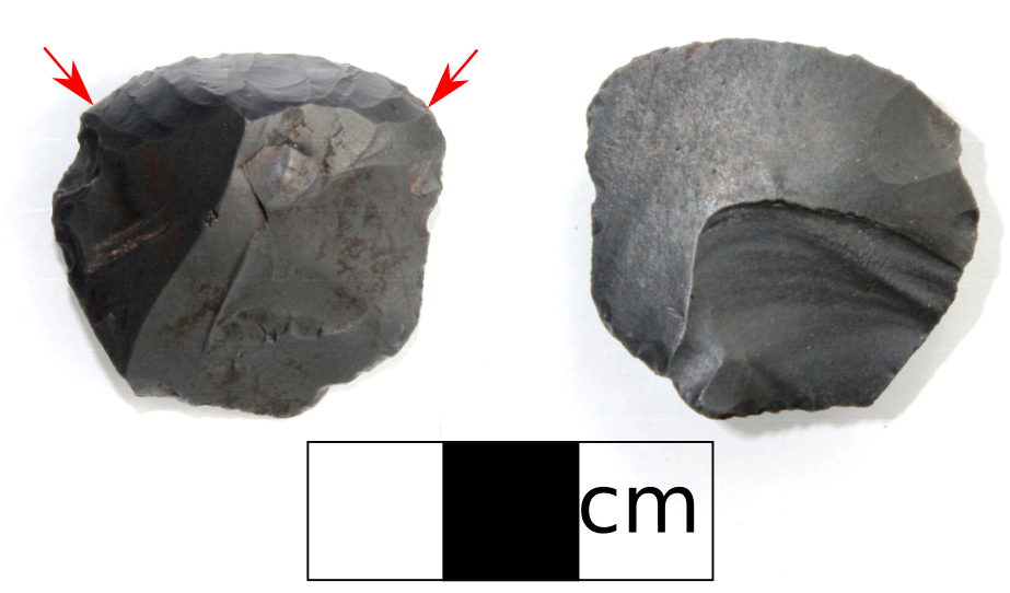
This is a tool used to peel away unwanted matter from an object. It was often used to prepare animal hides and would have been attached to a handle made from either wood, bone or antler. There are different types of scrapers in Alberta including sidescrapers, endscrapers, and thumbnail scrapers. Scrapers are one of the most common types of formed tools we find in Alberta. Pictured here is an endscraper that we collected during the summer of 2017.
