Context

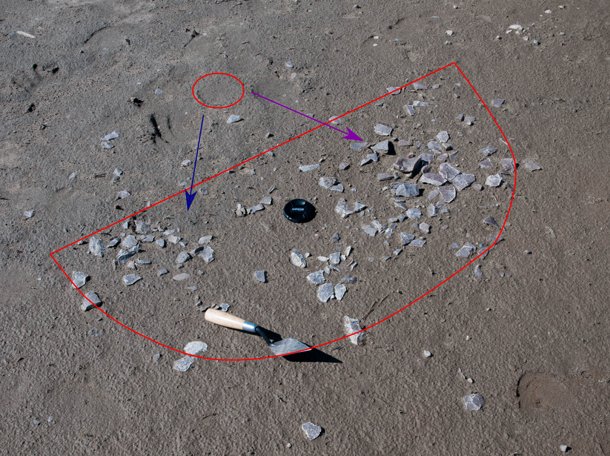
The context of an artifact is extremely important to archaeologists. The context of an artifact means the precise location of the artifact and it’s association with other artifacts and landscape features. This helps us determine such things as the relationships between artifacts on a site, it’s position in time and space, and even how it is related to different archaeological sites.

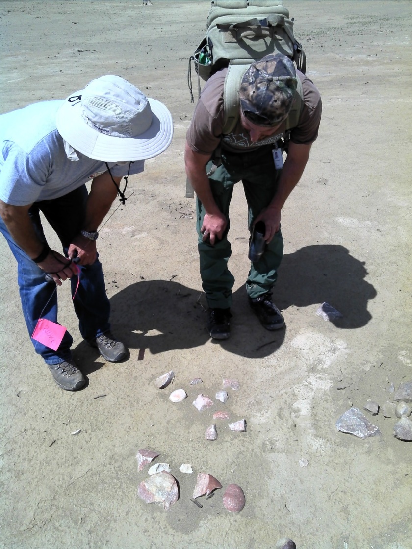
Below is a picture from a site near the Brazeau Reservoir, Alberta. The lithic scatter pictured below shows the flakes in their original context. The whole scatter is in a semi circle shape outlined in red. The positions of the flakes indicate that someone likely sat near the red circle. They then flint knapped purple quartzite which went in the direction of the purple arrow. They then shifted their body and began to flint knap a grey-blue quartzite that went in the direction of the blue arrow.

This is just a small portion of the site, so when we start to put together this information with other information about the site we begin to get a greater understanding of what happened, such as where specific activities took place and even what was going on in the area at that time.

Find the Flake (Part 2!)

While we always prefer to survey areas prior to any impacts, the identification of artifacts in post-impact contexts can be easier because of large areas of exposed sediments. Instead of targeted shovel tests that excavate a very small percentage of a high potential area, we can potentially see everything that is under the ground. However, the context of anything we find must be taken into account because heavy equipment can break cobbles and create things that look very similar to lithic debitage. If we find an artifact in the track of heavy machinery we need to be careful we are not misidentifying what we call a “tractorfact.”

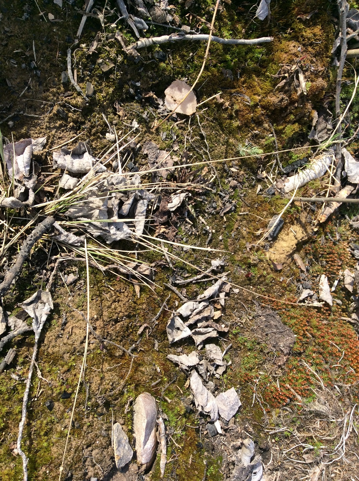
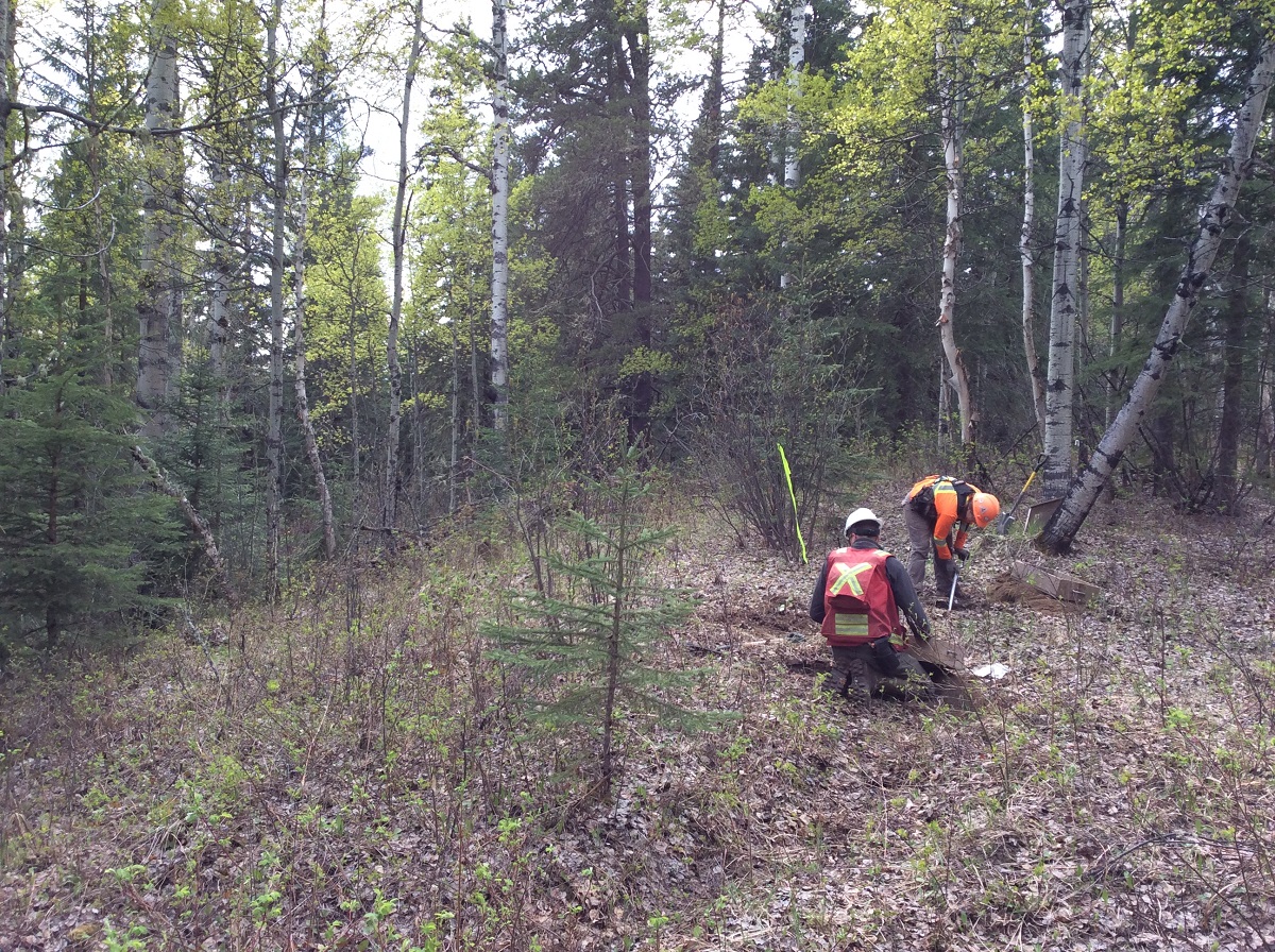
In spring of 2017, we surveyed a proposed Associated Aggregates gravel pit that was being planned in a recently harvested cutblock . We identified several sites that were within the proposed gravel pit boundary, most of which were first identified by spotting artifacts on the ground.  It’s not always easy, as vegetation can trick you into thinking you’ve found something, only to realize it was just a leaf.

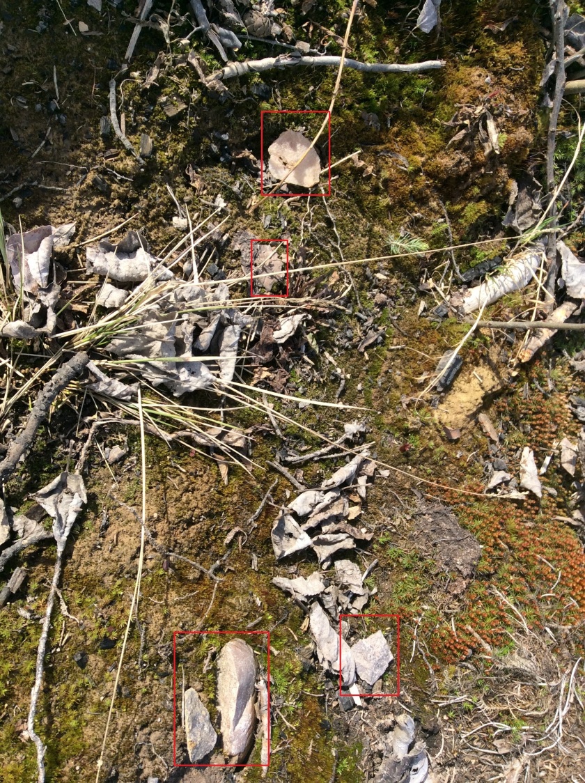
If you want to try your eye, try to spot the flakes in the above picture!

How many did you find? Give up?

Keep scrolling for the answer…

It can be pretty difficult to spot because of the leaves on the ground but when you really take the time to look you can see five pieces of quartzite debitage.

found! - Copy - Copy

Public Archaeology at the Brazeau Reservoir

Public archaeological programs are an excellent opportunity for people with a general interest in archaeology or amateur archaeologists to learn what an artifact is, and to practice the techniques that are used to find and interpret them. Often these programs will have a dig component, where people join for a few days or a week, and learn excavation techniques in units laid out over a buried site.

The Brazeau Archaeological Project (BAP), sponsored in part by Tree Time Services Inc., provides a unique experience. The current sites being surveyed are almost entirely exposed by the continuously fluctuating water levels of the reservoir. This also means that the entire history of the area has been deflated to one level, rather than multiple occupation levels that can be apparent in excavations. The occupation of the Brazeau River by First Nations extends as far back as 12- 14,000 years ago. This allows participants to gain a better feel of how large and spread out an archaeological site can really be. The largest site surveyed so far spans almost 1 km!

DSC00028_jack brink - Copy
Bob Dawe (left) discussing boiling pits. Photo Credit: Jack Brink

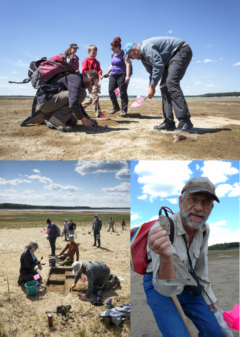
The project invites members of the Strathcona Archaeological Society (SAS) to come out for a day or weekend to learn survey and excavation techniques, as directed by experienced or professional archaeologists. As most of the artifacts lay exposed on the surface due to the ever changing water levels of the reservoir, the experience is relaxed, family friendly, and can be conducted over a single day or weekend, rather than a week-long commitment.

participants_hilary mcdonalnd and madeline - Copy
Participants surveying, excavating, and generally having a good time!  Photo credit: Top and left – Hilary McDonald; right – Madeline Coleman

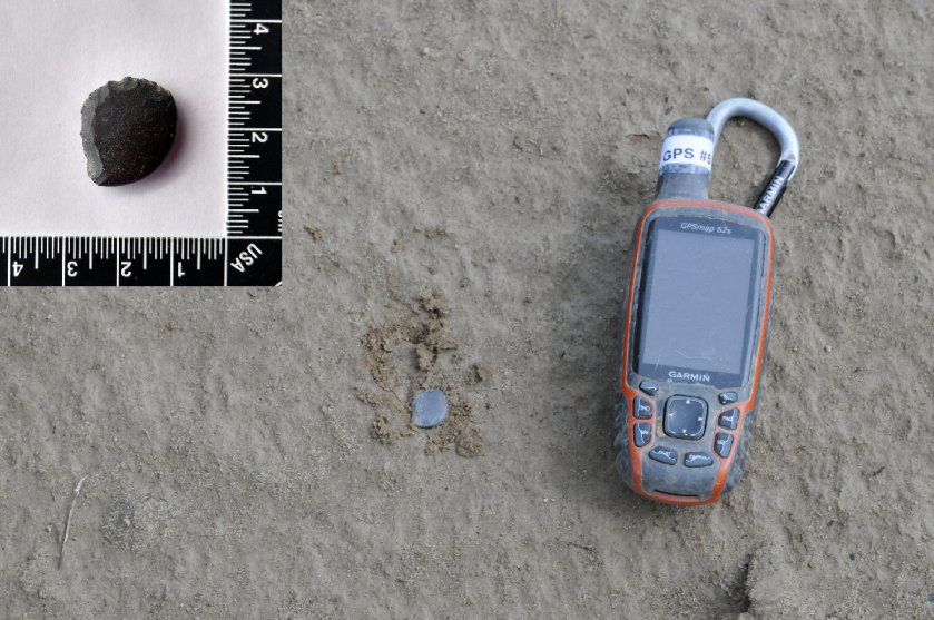
Participants learn what features to look for when looking for surface finds, such as material, shape, and modifications. By pairing participants up with experienced archaeologists we can point out the various ways an artifact, such a flake, can look; particularly how it can blend in or really stand out from its surrounding environment. For example, Amandah van Merlin, one of the co-ordinators, picked up a small, indistinct black pebble. The black pebble chert material, however, is a popular flint knapping material. As it turned out, Amandah had found a thumbnail scraper!

thumbnail - Copy
A small pebble with a big surprise!  Photo credit: Amandah van Merlin; inset – Madeline Coleman

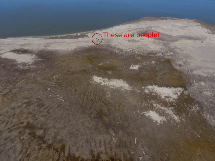
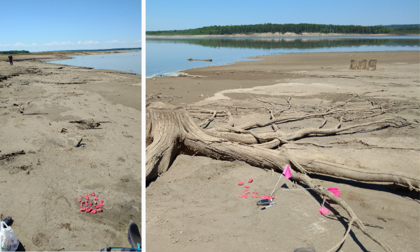
Public archaeology programs are also a great way to explore new technology or try experiments. One participant brought his drone. He was able to take photos from a bird’s-eye view of the site, providing a totally new perspective on what these landforms look like along the shore, and the distances between the sites. Madeline Coleman, the other co-ordinator, laid out various sizes of brick pieces in order to examine how artifacts are affected by water movement (or perhaps even people).

ariel view - Copy
Ariel view of FfPv-1.  Photo credit: Robert Wambold
experiment - Copy
Laying out pieces of brick to monitor movement over time.  Photo credit: Madeline Coleman

The project is still in its infancy. The pilot survey in May 2015 occurred over one day and had 9 participants. In May 2016, the survey occurred over two days with over thirty participants joining for one or both days. This past May, there were over 20 participants that joined for the full weekend. In addition, for two days prior to the public survey, BAP worked with University of Alberta field school students. Here they practiced map making, shovel testing, and laying out excavation units.

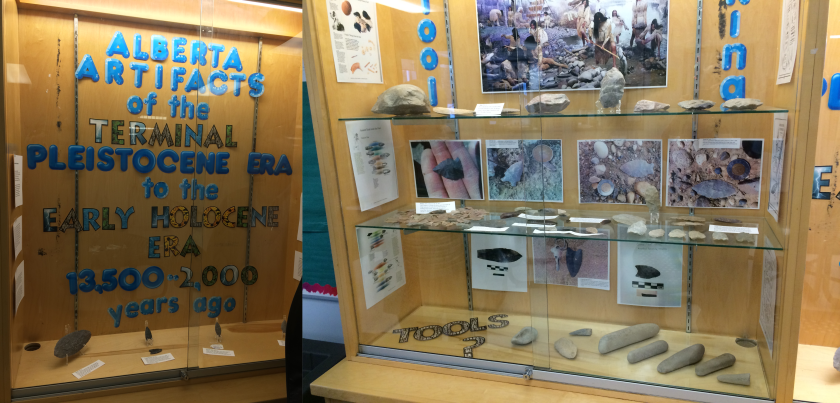
Outreach is also a very important aspect of a public program, such to First Nations group, schools, and universities. The BAP has recently reached out to Paul First Nation, in whose traditional territory the Brazeau River lies, and whom are active in working to protect their heritage. BAP has also recently partnered with Katie Biittner at Grant MacEwan University to begin a hands-on catalogue experience for university students at Grant MacEwan and the University of Alberta. In addition, the original finders of the site, Sandy and Tom Erikson, worked to create a 3-case display at their hometown school in Edson. The case shows some of the finds and information from the periods they may have originated in.

edson display
School display in Edson. Photo credit Sandy Erikson

Obsidian

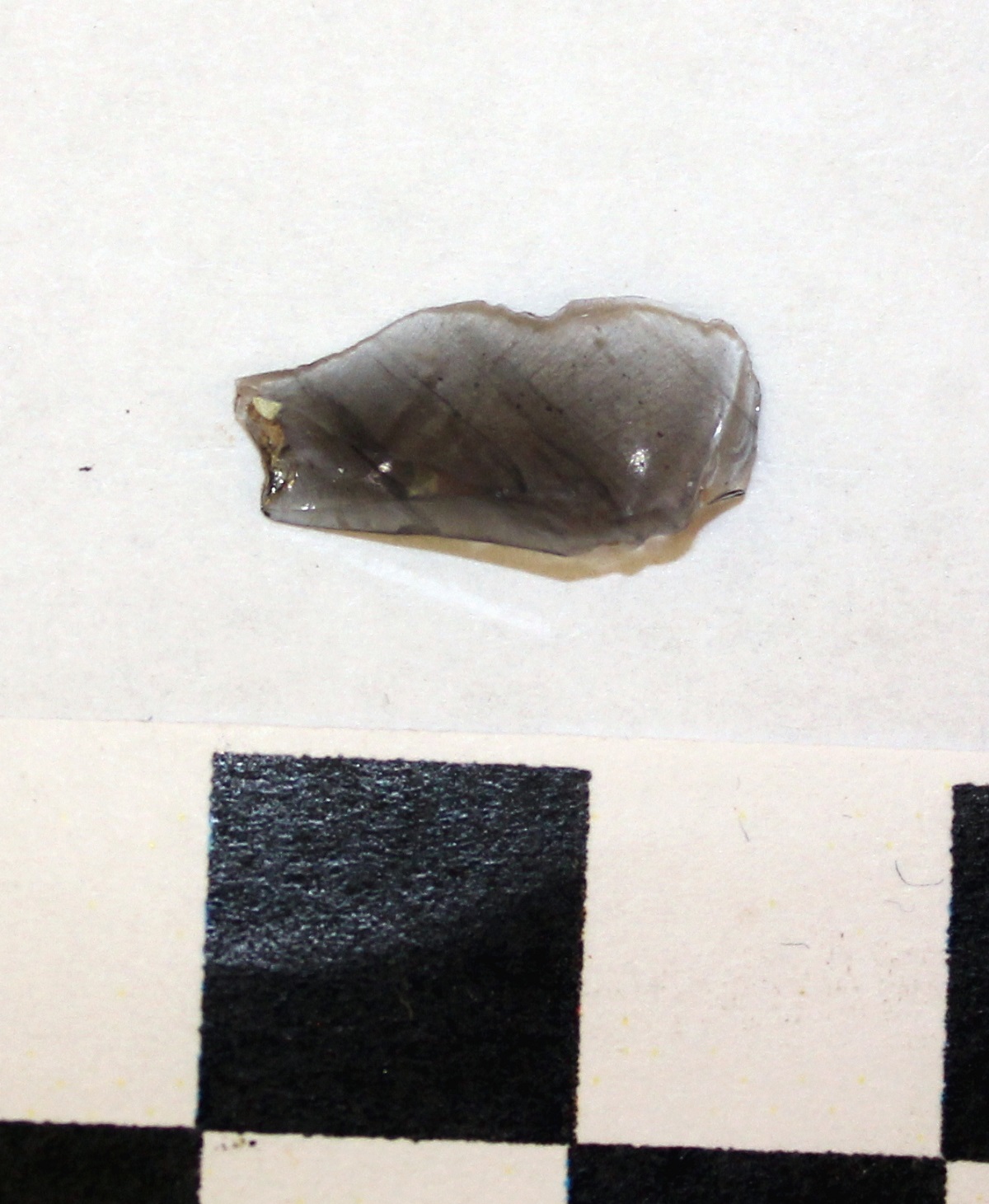
Obsidian is commonly known as volcanic glass. It forms when a volcano erupts and the lava is cooled extremely quickly, such as when it flows into a water body. In Alberta obsidian is considered to be an “exotic material” because it does not occur here naturally. When we find it here it tells us that people in the past engaged in long distance trade, usually with people in British Columbia or the Yukon. In 2016 Teresa found this lovely obsidian flake at site FaPr-6 located near the community of Caroline.

Why do HRIAs (Historic Resource Impact Assessments)?

“Archaeological heritage is an essential element in the affirmation of our Canadian identity and a source of inspiration and knowledge. It is the policy of the Government of Canada to protect and manage this heritage.1

This sentiment is echoed through all levels of government and most provinces2, territories, and municipalities have either a piece of legislation, regulation, policy, or official plan in place that enables the government to protect heritage resources on lands within its jurisdiction.

For example, it’s stated in Alberta’s Historical Resources Act that when the Minister thinks a proposed operation or activity is likely to alter, damage, or destroy a historic resource, the Minister may order that person to undertake an HRIA3. This means that the Minister of Alberta Culture and Tourism (ACT) has the authority to require developers to conduct studies that assess the potential impacts of their development on historic resources. In Alberta, these studies are called “Historic Resources Impact Assessments” or HRIAs.

If the HRIA determines that there are historic resources located within the development footprint that may be impacted by the proposed development, ACT may require that the impacts be mitigated before the project will receive development approval (i.e. through modification of the development plan or the completion of a Historic Resource Impact Mitigation / HRIM). The goal of HRIA and HRIM studies is to ensure that significant historic resources are preserved through the development and land use planning processes. As such, the Minister may require the authority responsible for approving the proposed development (such as Alberta Environment and Parks, Agriculture and Forestry, or the Alberta Energy Regulator) to withhold or suspend the approval (or licence/permit/etc.) until the HRIA/HRIM requirements have been satisfied.

Have you been required to obtain a permit-status archaeologist to undertake an HRIA/HRIM? We’d be happy to discuss how Tree Time Services can best help you through the approvals process so you can focus on your core business. Call Kurt at 780-472-8878 or email archaeology@treetime.ca. 

To keep up to date on Historic Resource regulations and processes, you can also subscribe to our quarterly Regulatory Update email.

1 Archaeological Heritage Policy Framework, Department of Canadian Heritage, Ottawa, 1990.

2 “We value the natural heritage and human history of Alberta because they help us understand and value the past on which our present is built, and give us a deepened awareness of our common roots and shared identity.” The Spirit of Alberta: Alberta’s Cultural Policy, 2009:3

3 Alberta’s Historical Resources Act, Section 37.2

What is Mitigative Excavation?

Mitigative excavation is the process of digging an archaeological site that is threatened either by development or natural erosion. Mitigative excavations have different goals than academic excavations. The goal of mitigative excavations is is to save as much information about the site before it is destroyed, whereas in academic digs the goal is to answer specific questions about how people were using the site in the past.

When a planned development is in direct conflict with a significant archaeological site our normal first recommendation is for a project redesign in order to avoid impacting the site. When a project redesign is not a viable option a mitigative excavation might be required.

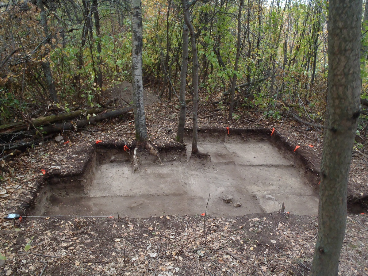
Before the excavation begins additional shovel testing may be required to ensure that the boundaries of the site have been confidently established and to identify the most important or valuable part of the site. Using what we have learned from the shovel testing we select areas for excavation blocks. We try to target the places where we’ll get the best return, in scientific information, for the investment of time. These excavation blocks are usually excavated in 1×1 m units. During the excavation layers of a predetermined depth are carefully removed. The sediment is screened and artifacts are collected. While excavating each layer is carefully described and locations of artifacts within the layer are recorded. Any changes in the soils or unusual staining is also described in detail. As each layer is removed photos are taken to further document the process. Once the unit is excavated to its final depth photos and drawings are taken of the unit walls. These photos and drawings will help us to understand the natural formation of the site area by studying the statigraphy. Looking at the layers of the soil can help us to determine if some artifacts in the site are older than others and can help us to understand how long or often the site was used by people in the past.

Mitigative excavations in Alberta typically do not involve excavation of the entire site as you might see in academic research excavations; instead archaeologists first consult with the developer and the government and excavate a sample of the site that focuses on the area of impact, and maximizes the information value of the dig.

Once the mitigative excavation is complete and the final report describing the project has been approved by the government the development will be allowed to proceed.

Mitigative excavations usually move along at a faster pace than academic excavations. This is related to time restrictions associated with development planning and budgetary concerns, as well as our focus on efficiency, and maximizing the return on investment. Academic excavations often take place over many field seasons but mitigative excavations have to be completed before the developer begins construction.

Mitigative excavation is our best tool to preserve archaeological heritage when avoidance isn’t an option, but it’s still a net loss in heritage value. Archaeological sites are non-renewable resources, once they have been destroyed, whether by excavation or development, no more information can be collected about the site.

HRV 4C – What Happens Now?

You have made a plan for a development and reviewed your plan against the Listing of Historic Resources. You’ve found that you have a conflict on your land parcel, it is listed with an HRV of 4C. What does that mean?

An HRV of 4C indicates that an historic resource site is located on that parcel of land, and that one or more First Nations groups have reported that the site is of cultural significance to them. These sites are usually Traditional Use Sites with a historic component, or spiritually significant or religious sites. Some examples include historic cabins or trails, community campsites, prayer trees or other spiritual sites, burials, cemeteries, rock art sites, and mission sites.

Before you can proceed you or your historic resource consultant must submit a Historic Resource Application through OPAC (the Online Permitting And Clearance system) to the Aboriginal Heritage Section of Alberta Culture & Tourism. Aboriginal Heritage will review the development plans against their confidential records of the site and determine whether impacts are likely. If impacts to the HRV 4C site are likely, Aboriginal Heritage will issue site-specific Consultation requirements.

This means you may have to Consult with the First Nations who have Listed the site. More than one group may have an interest in the site because of shared history and land use. Be sure to consult with all interested parties in this matter. Consulting with only one group on overlapping Listings is not sufficient. Alberta Culture will inform you if Consultation is required or not, and with which groups site specific Consultation is required (Listing of Historic Resources, Instructions for Use). It’s very important to understand that any Site-Specific Historic Resource Consultation requirements are separate from and in addition to any other standard Consultation requirements regarding Treaty rights and land use. You may have to go back to First Nations you’ve already Consulted about your project in general, and may have to Consult with different groups or individuals.

Whether you are required to Consult with First Nations groups or not, an HRV of 4C may also result in a requirement for an Historic Resources Impact Assessment. The fact that a specific historic resource has been identified within your land parcel does not mean that the rest of the area has been surveyed and that there is only the one site there. It only indicates that an historic resource site has been reported. An historic resources impact assessment requirement is likely because areas that are considered culturally significant today usually have been considered important for centuries, or millennia. Areas with an HRV of 4C have a high potential to contain additional historic resources such as archaeological sites.

You may be required to redesign your project to avoid the HRV 4C historic resources site. If the site can’t be avoided, mitigation may be required. Mitigation of archaeological and historic sites typically requires extensive shovel testing, detailed block excavations proportional to the percent of the site to be impacted and detailed mapping of the site. Mitigation of impacts to a Culturally Significant site would likely be site-specific, and determined in collaboration with the affected communities.

Our recommendation for HRV 4C conflicts is to identify them early, discuss them with communities in advance, avoid them at the planning stage.

If you don’t know where to start, or would like someone to help you Consult with First Nations contact Kurt or Madeline at 780-472-8878 or toll free at 1-866-873-3846 or email us at archaeology@treetime.ca. We are happy to help.

What is an Historic Resource Site?

The majority of Tree Time’s archaeological work is done in the context of Historic Resources Impact Assessments, but what is an Historic Resource?

People are sometimes confused about what constitutes an historic resource because it is a very broad category. The first thing to come to most people’s mind would likely be the contents of a museum but as discussed below, historic resources encompass far more than the displays at museum. In the simplest sense an historic resource is anything of significant interest to a community, a cultural group, historians, archaeologists, or other scientists.

Alberta’s Historical Resources Act defines Historic Resources as:

any work of nature or humans that is valued for its palaeontological, archaeological, prehistoric, historic, cultural, natural, scientific or aesthetic interest.”

A Historic Resource Site is any place where Historic Resources are found. When we say “site” people most commonly think of an archaeological site, but this is only one type. Alberta Environment and Parks has defined six categories of Historic Resource sites – archaeological, cultural, geological, historic, natural and palaeontological. However, an Historic Resource site can fall into multiple categories – one doesn’t take precedence over another. Some examples of this are the Big Rock Erratic at Okotoks which is classified as both a geological and an archaeological historic resource site and the Frank Slide which is both a geological and historic site.

The government of Alberta keeps track of all the known historic resource sites in the province. To do this they use a tool called the Listing of Historic Resources. This listing is a database that contains information about historic resource sites such as their location and a description of what they are and what condition they are in. It is important to be aware that not all historic resources are recorded in this listing as many of them have not been recorded yet and the listing is not updated every day.

Some examples of Historic Resources sites found in Alberta:

Archaeological Sites

Archaeological sites are areas that have been occupied by humans in the past and have evidence of that occupation in the form of artifacts found on or under the earth’s surface. Some examples of archaeological sites common to Alberta include precontact campsites, rock art, tipi rings, buffalo pounds, homesteads, trails and medicine wheels. Some well known examples of archaeological sites in Alberta include Head Smashed-In Buffalo Jump and the Bodo Archaeological Site.

Cultural sites

Cultural sites are sites that have been identified as significant to a specific cultural group by members of that group. These sites often include historic villages, cabins and community campsites, burials, prayer trees and other ceremonial sites. The majority of Culturally Significant sites are of First Nations origin, but not all are. Some examples are Pierre Grey’s Trading Post, the St. Charles Mission Site, the Grande Cache Dinosaur Tracks site, the Ukrainian Cultural Heritage Village and Áísínai’pi (Writing-on-Stone) rock carvings and paintings. Culturally significant historic resources often overlap with archaeological and historic period sites.

Geological sites

This site type will often have overlap with other types of Historic Resources. Geological sites are areas of the province with unique geological features like the Canmore Hoodoos, Hetherington Erratics Field and the Whitecourt / Woodlands Meteorite Impact Crater.

Historic Sites

Historic sites are places that can usually be related back to specific people or events in history. This category is a little more complicated because it includes heritage structures, historic places and districts, and historic period archaeological sites.

The most common Historic Sites are places with preserved historic buildings. The Province tracks historic buildings in a database called the Heritage Survey. Any structure older than 50 years is eligible to be added to this list. This of course includes old buildings, like houses, grain elevators and train stations, but also includes other types of man-made above-ground structures, including earthworks, preserved wagon trails, and early 20th century oil wells. Historically significant structures or places can be designated as Municipal or Provincial Heritage Resources, and protected. Some examples of these include include the Brooks Aqueduct, the Alberta Pacific Grain Elevator near Castor, the Parliament Building in Edmonton and old houses in the Highlands neighbourhood of north Edmonton.

Other Historic sites are areas with known historical significance. While these sites may not have retained any standing structures they are places where significant events are known to have taken place or important historic figures visited. These include the locations of many historic fur trade posts and forts. Some of these sites have been recreated for public enjoyment and educational purposes. Some examples of this are Fort Victoria, Lac La Biche Mission and Historic Dunvegan. Other historic sites in Alberta include the Victoria Settlement, Frog Lake Massacre Site, and the Grand Rapids Portage on the Athabasca River.

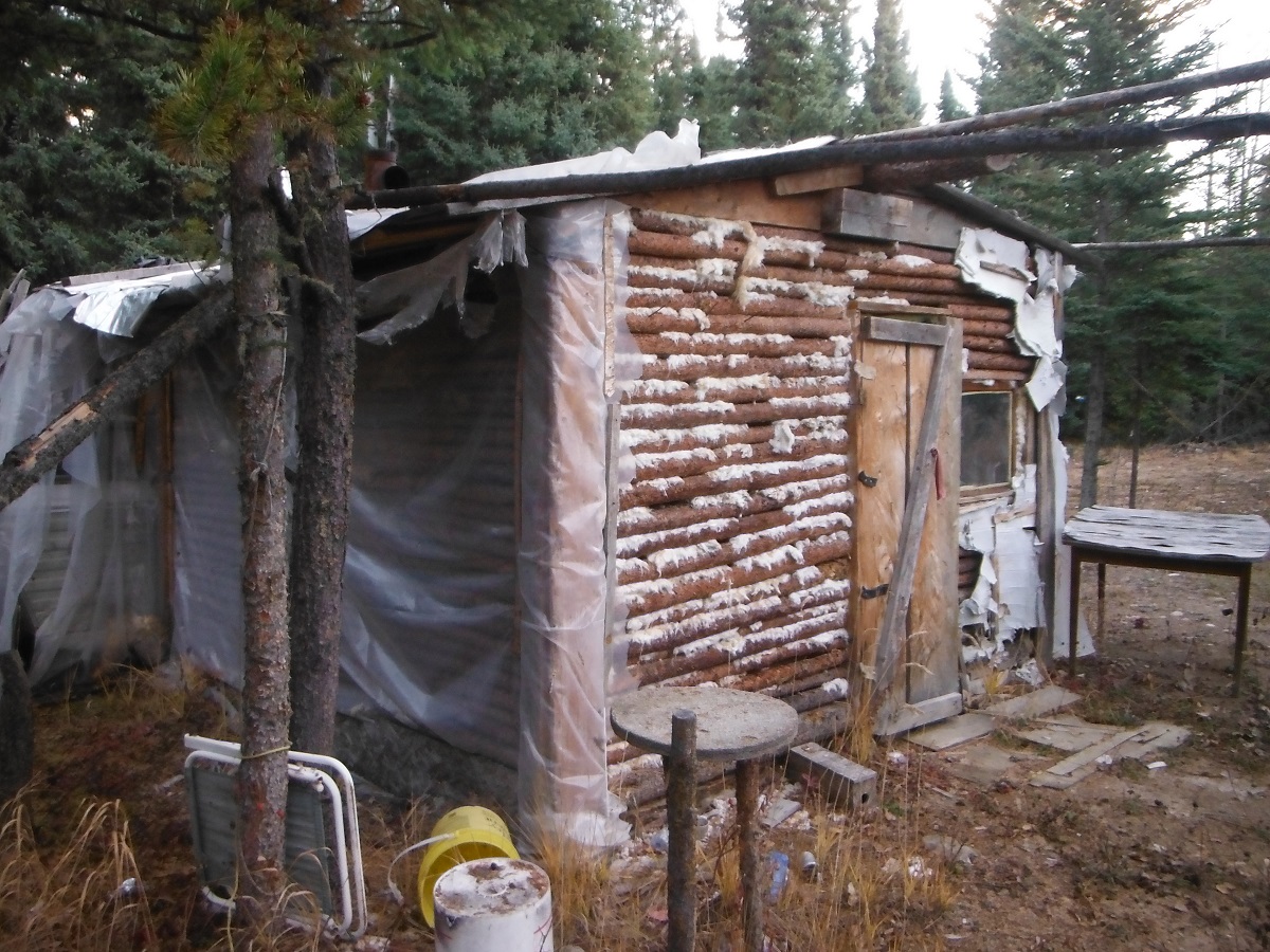
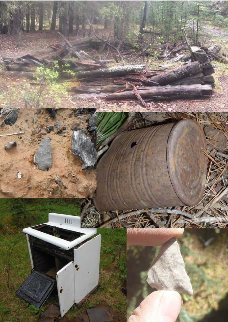
Historic period archaeological sites are the most common example of overlap between two categories. These are places with underground material evidence of the past (archaeological resources) from the historic period. At these places, archaeologists have documented the presence of historic period artifacts, ranging from fur trade beads and tools, to early 20th century cans and bottles. We may or may not have written records about these sites. Common examples of this site type are fur trading posts, pioneer homesteads, and early trapping cabin locations. A less common example would be this plane crash.

Natural sites

Natural sites are areas of special and sensitive natural landscapes of local and regional significance. These sites often have overlap with archaeological and historic site types. Some examples are Eagle Butte, Purple Springs and the Rumsey Natural area.

Palaeontological sites

These are sites where fossils can be found. Fossils of plants, animals and even dinosaur bones fall into this category. Examples include Dinosaur Provincial Park near Brooks and Pipestone Provincial Park near Grande Prairie.

Blasting Powder Cans

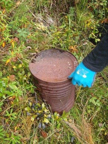
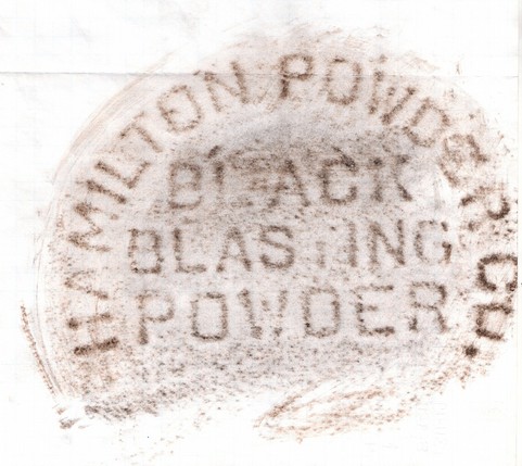
Here is an example of a unique artifact type – it is a large metal can that once contained blasting powder. We often find these cans associated with the old historic railways found throughout the province. This particular can has an inscription on the base which helps us to identify the contents of the can. In this case it also has the name of the producer. This information can help us to narrow down the age of the can.

black blasting powder
This is a rubbing from the base of the can, it sure makes it easy to identify what the can once held.

Animal Bones

During an archaeological survey or excavation when animals bones are found, we look for signs that they were somehow modified or processed by humans. Animals were not only a source for food, but their skin, fur, and bones had many other uses. We might find cut marks from a knife made during butchering, or the bone itself might be shaped into a tool such as an awl. If the animal seems to have been killed or somehow used by humans we can classify it as an artifact.

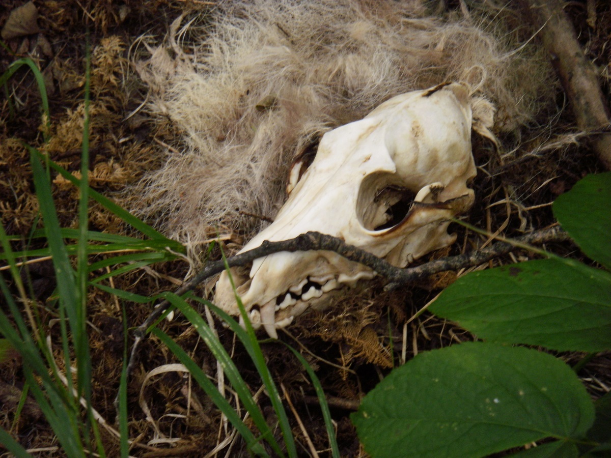
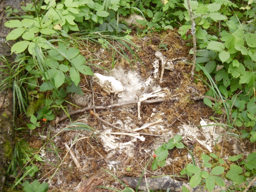
However, not every animal bone that we find is an artifact. Sometimes during a survey, a test pit might have an animal bone in it. If no other artifacts were found in the area and the bone shows no signs of human use, then we cannot call it an artifact. Nature does takes its course without human interference. The animal remains pictured here serve as a reminder of that. These remains, likely of a wolf, found in the summer of 2014 will eventually be buried over time.

P8270357 - Copy