Camp Fire Hazards

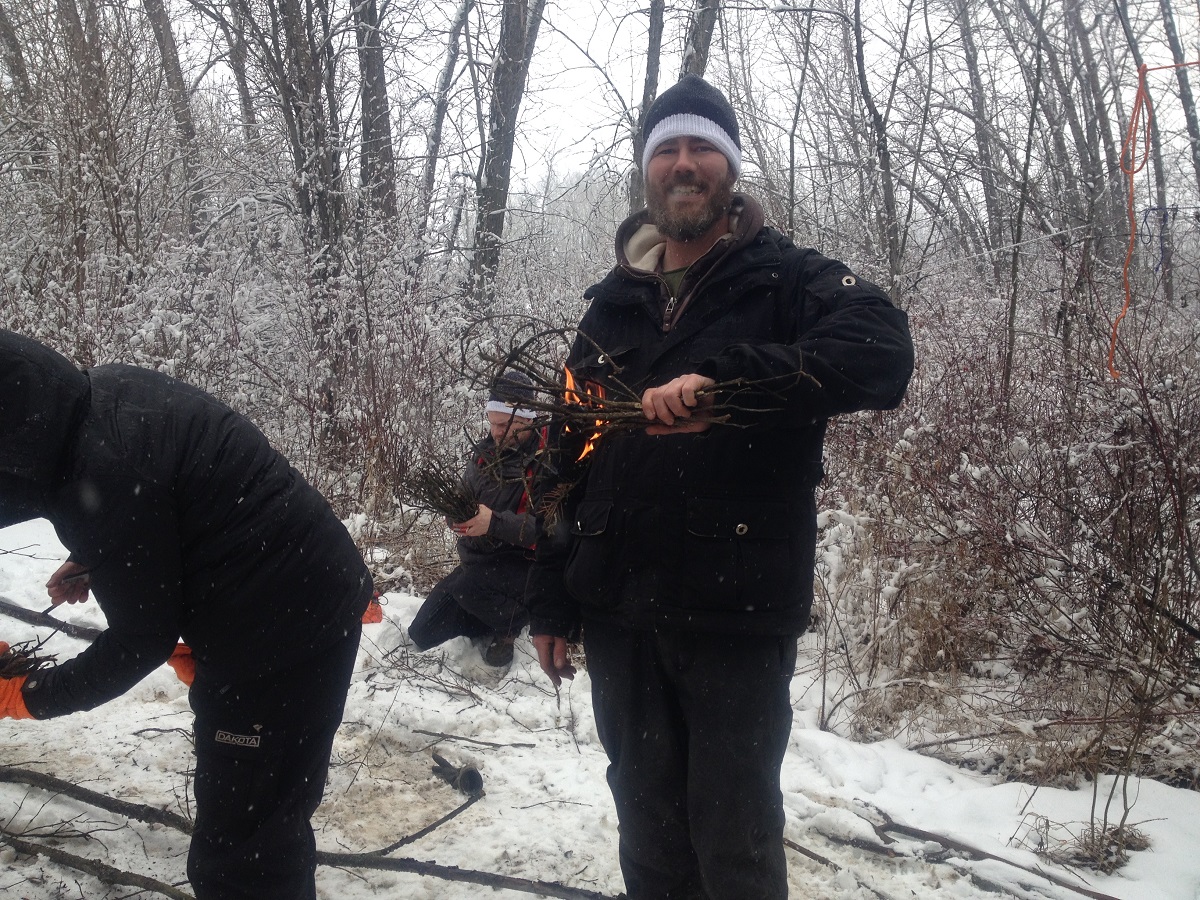
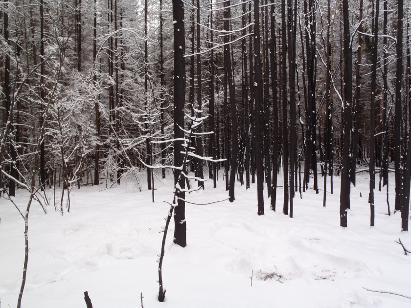
It’s that time of year again! Living in Alberta, we all know how disastrous a forest fire can be. No one wants to see fires tear through their homes and communities, like what has happened previously to Fort McMurray or Slave Lake.  These fires are dangerous, unpredictable, and destructive.  Many of us at Tree Time have walked though the remains of a burned forest and have seen what is left behind.  So here are some tips to remember while you are out camping and enjoying your campfire.

PB230804 - Copy
An area that was partially burned by a forest fire

Building your fire:

  • Check for a fire ban in your area. May can be a dry month, and it only takes one spark to start a forest or brush fire.
  • Use an existing fire ring if you can, rather than build a new one.  Make sure all vegetation or flammable materials (like leaves, sticks, spruce/pine needles, etc) has been cleared away up to 10 ft.
  • If you have to build a new one, dig a pit 1 ft into the ground first and circle it with rocks.
  • Select an open area with no overhanging branches, dense dry grass, logs, etc.
  • NEVER LEAVE IT UNATTENDED!

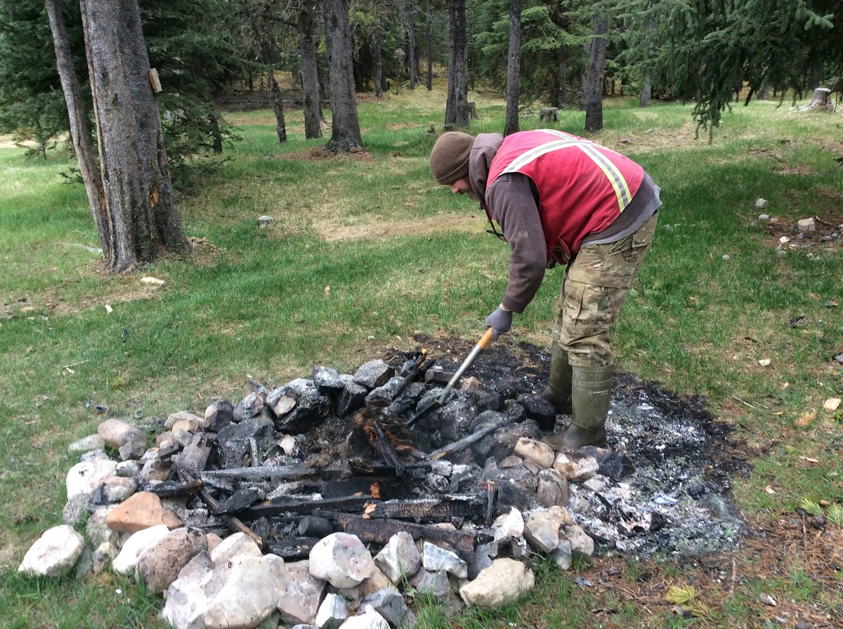
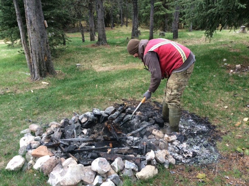
Putting out your fire:

  • Use water to douse that fire.  If the fire burns too hot, it can still catch fire when the wind picks up, so make sure everything that remains is soaked through.
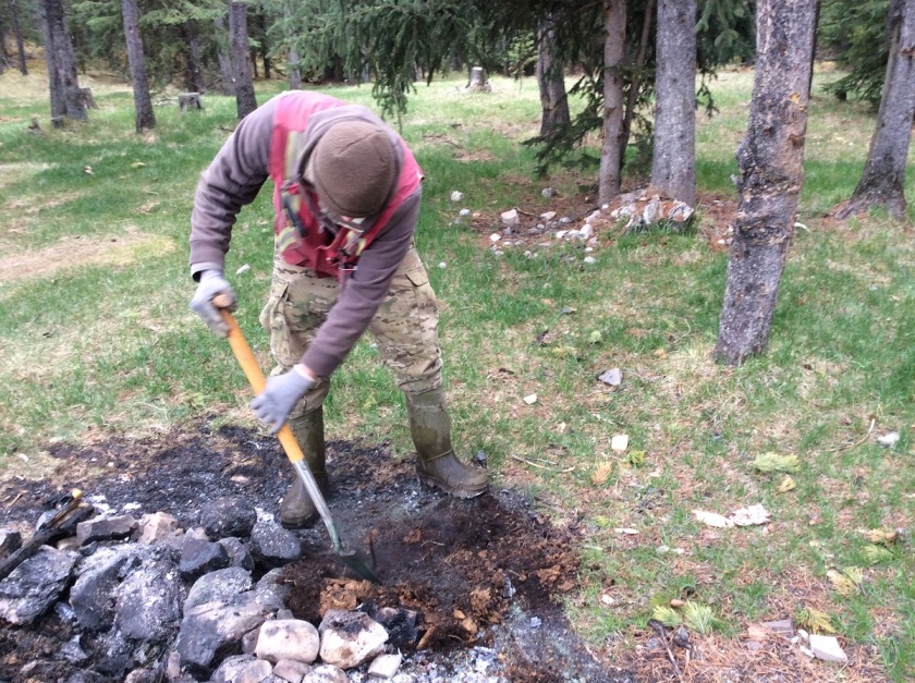
  • Use shovels or a stick to stir the contents making sure everything gets wet and cools down.
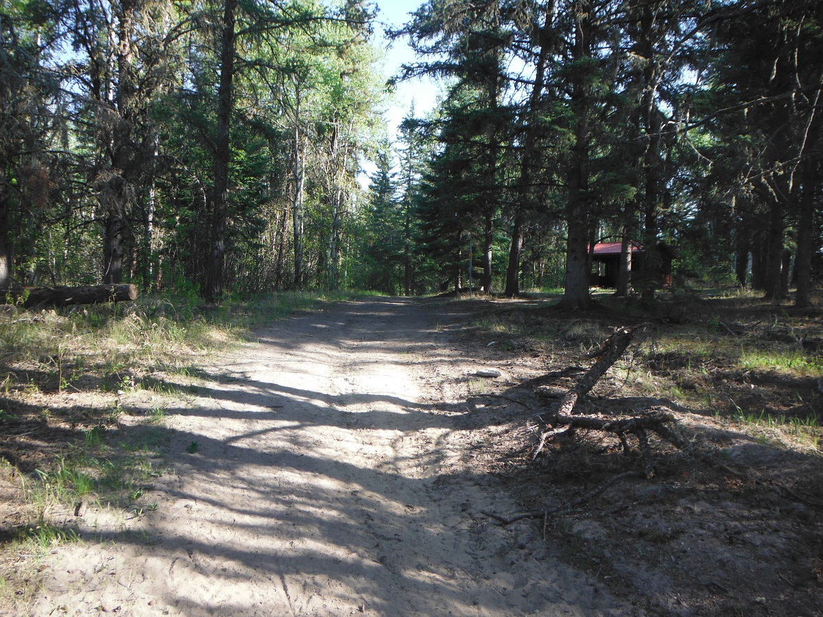
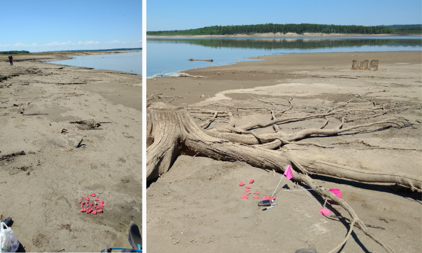
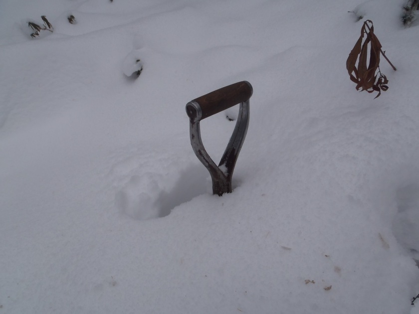
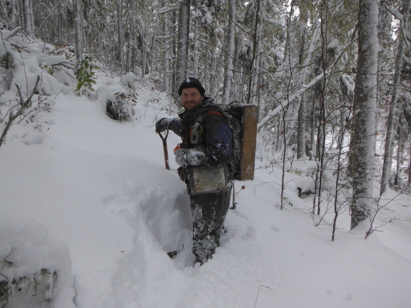
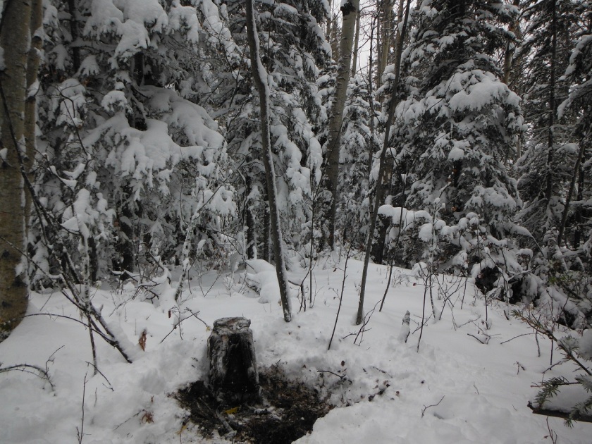
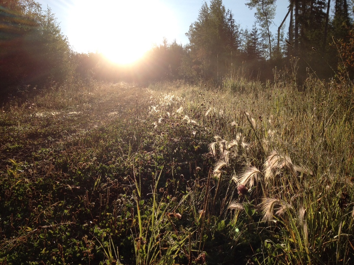
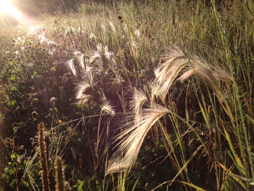
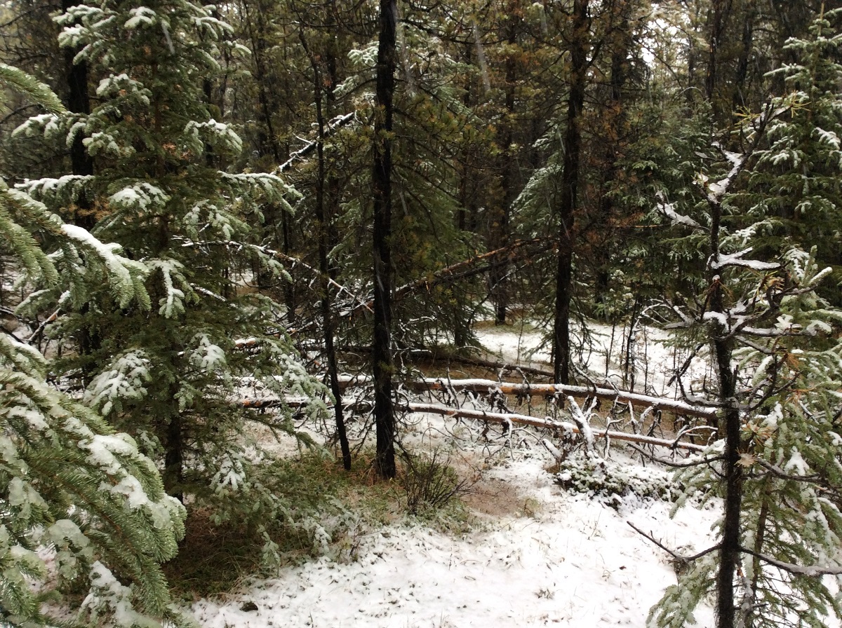
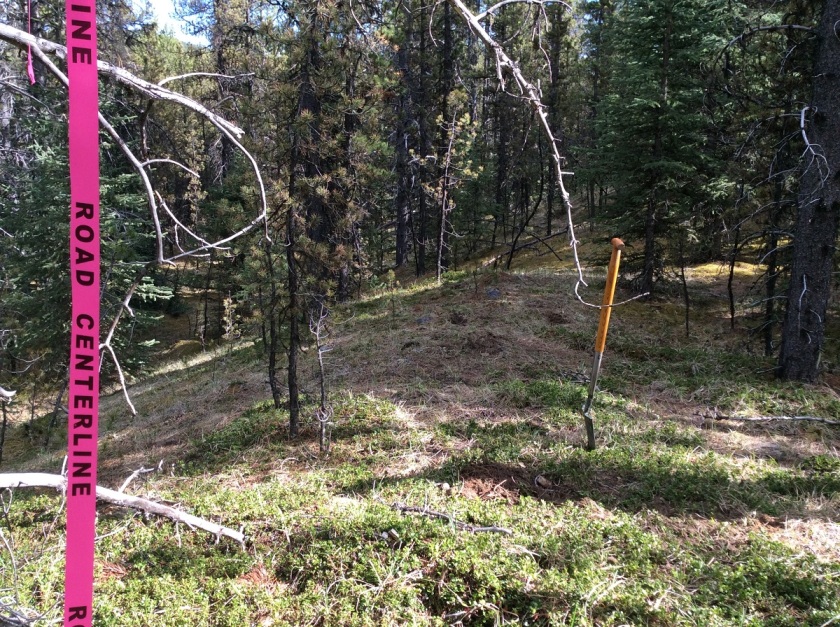
  • Touch it to be sure! People might think that they put out their fire, but debris (roots, moss etc) on or under the ground can catch on fire and spread the fire beyond the stone rings. You can see in the pictures that the area around this abandoned campfire has been burned.
IMG_0226 - Copy
Note the burnt ground under Brian’s feet clearly outside the intended fire pit area


IMG_0230 - Copy
Brian digging up earth around the fire pit to put out the fire

That is why it is so important to make sure that you have properly put out your fire. Please check out the Alberta Parks Website for great advice on campfire safety.

http://www.albertaparks.ca/albertaparksca/advisories-public-safety/outdoor-safety/campfire-safety/

http://www.ofc.alberta.ca/camping-and-outdoor-fire-safety

Also if you need to report a wildfire, call 310-Fire (3473). Never put yourself in danger.

We thought we would share this story in advance of the long weekend to remind people about campfire safety. Alberta is a great place and camping is an amazing way to experience it. So from us at Tree Time, we sincerely wish you a great long weekend and happy, safe camping.

Surface Exposure

Surface exposures are areas where there is no vegetation and the mineral soils are visible. These can occur naturally (areas of slumping, beaches, blow-out, or other natural erosional processes), or be caused by human activity (ATV trails, furrows created for site prep and skid trails just to name a few). Surface exposures can be great for covering a lot of ground during survey.

Public Archaeology at the Brazeau Reservoir

Public archaeological programs are an excellent opportunity for people with a general interest in archaeology or amateur archaeologists to learn what an artifact is, and to practice the techniques that are used to find and interpret them. Often these programs will have a dig component, where people join for a few days or a week, and learn excavation techniques in units laid out over a buried site.

The Brazeau Archaeological Project (BAP), sponsored in part by Tree Time Services Inc., provides a unique experience. The current sites being surveyed are almost entirely exposed by the continuously fluctuating water levels of the reservoir. This also means that the entire history of the area has been deflated to one level, rather than multiple occupation levels that can be apparent in excavations. The occupation of the Brazeau River by First Nations extends as far back as 12- 14,000 years ago. This allows participants to gain a better feel of how large and spread out an archaeological site can really be. The largest site surveyed so far spans almost 1 km!

DSC00028_jack brink - Copy
Bob Dawe (left) discussing boiling pits. Photo Credit: Jack Brink

The project invites members of the Strathcona Archaeological Society (SAS) to come out for a day or weekend to learn survey and excavation techniques, as directed by experienced or professional archaeologists. As most of the artifacts lay exposed on the surface due to the ever changing water levels of the reservoir, the experience is relaxed, family friendly, and can be conducted over a single day or weekend, rather than a week-long commitment.

participants_hilary mcdonalnd and madeline - Copy
Participants surveying, excavating, and generally having a good time!  Photo credit: Top and left – Hilary McDonald; right – Madeline Coleman

Participants learn what features to look for when looking for surface finds, such as material, shape, and modifications. By pairing participants up with experienced archaeologists we can point out the various ways an artifact, such a flake, can look; particularly how it can blend in or really stand out from its surrounding environment. For example, Amandah van Merlin, one of the co-ordinators, picked up a small, indistinct black pebble. The black pebble chert material, however, is a popular flint knapping material. As it turned out, Amandah had found a thumbnail scraper!

thumbnail - Copy
A small pebble with a big surprise!  Photo credit: Amandah van Merlin; inset – Madeline Coleman

Public archaeology programs are also a great way to explore new technology or try experiments. One participant brought his drone. He was able to take photos from a bird’s-eye view of the site, providing a totally new perspective on what these landforms look like along the shore, and the distances between the sites. Madeline Coleman, the other co-ordinator, laid out various sizes of brick pieces in order to examine how artifacts are affected by water movement (or perhaps even people).

ariel view - Copy
Ariel view of FfPv-1.  Photo credit: Robert Wambold
experiment - Copy
Laying out pieces of brick to monitor movement over time.  Photo credit: Madeline Coleman

The project is still in its infancy. The pilot survey in May 2015 occurred over one day and had 9 participants. In May 2016, the survey occurred over two days with over thirty participants joining for one or both days. This past May, there were over 20 participants that joined for the full weekend. In addition, for two days prior to the public survey, BAP worked with University of Alberta field school students. Here they practiced map making, shovel testing, and laying out excavation units.

Outreach is also a very important aspect of a public program, such to First Nations group, schools, and universities. The BAP has recently reached out to Paul First Nation, in whose traditional territory the Brazeau River lies, and whom are active in working to protect their heritage. BAP has also recently partnered with Katie Biittner at Grant MacEwan University to begin a hands-on catalogue experience for university students at Grant MacEwan and the University of Alberta. In addition, the original finders of the site, Sandy and Tom Erikson, worked to create a 3-case display at their hometown school in Edson. The case shows some of the finds and information from the periods they may have originated in.

edson display
School display in Edson. Photo credit Sandy Erikson

Working in the Winter

Specializing in forestry archaeology in Alberta, I haven’t had much opportunity to work in winter conditions. One of the nice things about forestry is its relatively long planning horizon and the flexibility to schedule our work.

Unfortunately, in fall 2012, a variety of factors conspired to push some of our fieldwork into late October, and then we got an unusually early and heavy snowfall in northwestern Alberta. The heavy snow prevented the ground from freezing, so we went ahead with our planned surveys of forestry cutblocks, conducting landform evaluation and shovel testing as normal.

PA240116 - Copy
unusually deep snow (our shovels are about 1 m long!)

Trudging through 50 cm of fresh powder gave me some perspectives on moving and living in the boreal forest under winter conditions that I hadn’t previously gained. I had wondered what effect snow cover would have on mobility patterns. Summer travel in the forest tends to follow linear features like river and stream valley margins, but I’d wondered if under winter conditions that would still be the case. This week it certainly was. We were working on the Chinchaga River valley, and found that travel along the valley margin was much easier than cutting cross country or on the slopes or lower terraces. I’d say the advantage was even greater than under summer conditions. The level backcountry had deeper snow than the exposed margins, and the snow on the slopes was even deeper than that. The grey overcast sky and falling snow also obscured the sun, which made it very hard to maintain a bearing cross-country without a compass. Without a landform to follow, I could have been walking in circles and wouldn’t know until I hit my tracks.

DSCF0398 - Copy
Trudging through the deep snow.

If I was camping under those conditions, however, I think I’d be choosing very different locations than I would in the summer. The distinct valley margins, corners and points that we tend to focus our surveys on had great views of the river and were on our preferred walking paths. But they were also very exposed to the biting wind coming out of the northwest. Even the south-facing edges were exposed. The most comfortable locations we found to break for coffee were just back from the edge, sheltered in stands of immature spruce. For the last couple seasons, I’d been suspecting that our focus on exposed corners and points was only finding one class of sites, and this experience reinforces that suspicion. I think that winter camps in particular, and possibly all larger camps, would be located back from the sharp landform edges that we’re targeting most. Drainage is still a factor, especially on warm winter days when the snow turns to mush, so we should still be looking for local elevation. But maybe we should be testing some less distinct elevated landforms a little back from the edges if we want to find sites occupied during less than ideal weather.

DSCF0384 - Copy
Snow is a little shallower in the protected areas under the immature spruce.

(This brief article was originally published in the Archaeological Society of Alberta Newsletter Vol. 1, January 2013)

Dewberry

We all especially enjoy working during the summer months when the berries are ripe and plentiful. Featured here is a dewberry, they are easy to recognize because the leaves and berries look similar to raspberries but they grow close to the forest floor and are not prickly. They taste similar to raspberries as well but are not as tart.

Glacial Flutes

Ryan is doing layout work to protect wetlands and streams during aerial herbicide application and he got this great shot of glacial fluting northeast of Calling Lake.

These parallel ridges were formed when the Laurentide ice sheet coming southwest from the Canadian Shield hit bedrock uplands at the east end of the Pelican Mountains. The base of the glacier formed a saw-tooth pattern that scoured these ridges and troughs for several kilometers.

Lidar flutes
This is how these glacial flutes appear on LiDAR.

Wild Weather

Weather can change very quickly in the foothills. From one day to the next, and within the day itself.

May 24 - Copy
This picture was taken May 24th. It was a beautiful day.

The following photos were taken all on the next day.

IMG_0241 - Copy

IMG_0252 - Copy

IMG_0274 - Copy

The weather can also change a lot depending on your elevation. In order to get out of the valley we were in we had to drive up and down a mountain pass. There was a lot more snow at the higher elevation than where we were working.  There was no snow on our drive in that morning.
IMG_20170524_151220 - Copy