What Projects Need HRA Approval, or “Clearance”?

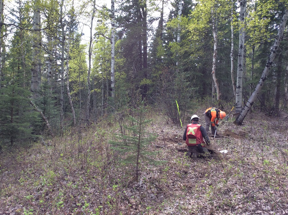
As Consulting Archaeologists, most of our work supports “regulatory compliance”.  We help developers get government approval by assessing and mitigating potential impacts to historic resource sites.  I’m frequently asked by developers whether a specific project requires Historical Resource Act Approval (or “Clearance”, as it was known before 2012).

This isn’t as easy a question as one might think.  Different projects have different levels of impact, and not every development requires approval.  Guidelines for developers are spread across numerous Bulletins and buried in the Instructions for Use of the Listing of Historic Resources.  To make life easier, I thought I’d try to summarize these rules in one place.  Please keep in mind that HRA regulations are constantly changing, so this is a snapshot of the state of the system in spring 2020. If you know of another trigger, or a development class I’ve missed, please let me know.

Alberta Culture uses a variety of triggering mechanisms.  The key tool for determining HRA Requirements is the Listing of Historic Resources.   The Listing was originally developed as a screening tool for small-scale oil and gas.  In response to requests from industry and regulatory agencies to provide more transparency and certainty, Culture is moving towards using the Listing for a wider range of developments. 

Parcels of land are registered on the Listing with a Historic Resource Value (HRV).  HRVs are ranked from 1 through 4  for known sites, or 5 for lands believed to contain a site (high potential).  Each entry on the Listing also has a class, which represents the type of resource.  Historic resources can include archaeological sites, paleontological sites, Traditional Land Use Areas, and historic buildings.  (You can read more about different types of resources here).  There are still many areas of Alberta that have historic resources potential that are not included in the Listing.  This is only one of of the many tools used during the screening process.
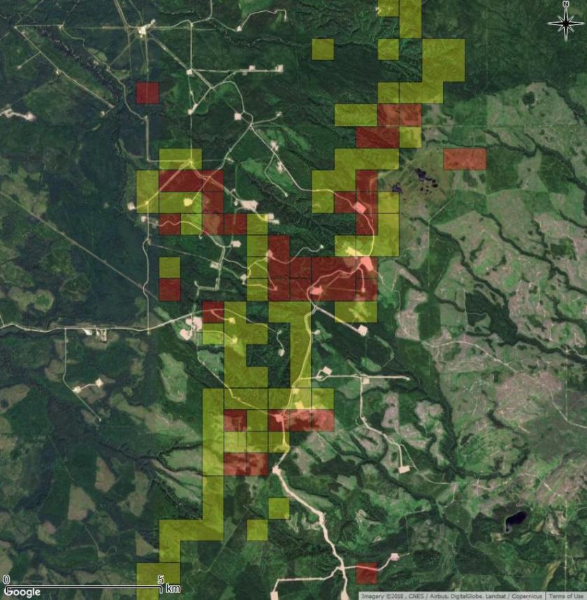
DeerMountain_HRV.jpeg
An example of the Listing of Historic Resources from Deer Mountain, near Swan Hills.  Red are HRV 4a (lands containing known sites). Yellow are HRV 5a (lands likely to contain sites). 

According to the Listing Instructions, there are several types of development that always require an application for HRA Approval:

  • Any project that requires an Environmental Impact Assessment (EIA): These applications generally result in a requirement for a Historical Resources Baseline Assessment.
  • Any project that requires National Energy Board (NEB) or Alberta Utilities Commission (AUC) Approval
  • Forest Harvest Plans: These can be managed through the special Forestry HRA Compliance process.  This is Tree Time’s specialty. Contact me before submitting an Application in OPAC.
  • Class 1 Pipelines
  • Projects requiring Conservation and Reclamation Approval by Alberta Environment. According to the Conservation and Reclamation Guidelines for Alberta this includes:
    • The construction, operation or reclamation of a well, battery, oil production site, pipeline, transmission line, telecommunication system, mine, pit quarry, peat operation or plant.
    • The conduct or reclamation of an exploration operation for coal or oil sands;
    • The construction or reclamation of a roadway
    • The reclamation of a railway
  • All Area Structure Plans and other long-term municipal planning documents.

Some development types use the Listing to selectively trigger requirements for HRA Approval:

  • Small-scale conventional oil and gas developments (wellsites, pipelines, access roads, etc)
    • HRA Approval is required if the footprint overlaps any HRV Listed lands.
  • Surface Materials (sand, gravel, clay, peat, etc. pits):
    • 5 ha or larger / Class 1 Pits: HRA Approval is always required.
    • Under 5 ha / Class 2 Pits: HRA Approval is required if the project area overlaps HRV 1, 2, 3 or 4 lands (known sites).
  • Subdivisions:
    • Most subdivisions: HRA Approval required if the project area overlaps any Listed lands (HRV 1-5).
    • Simple subdivisions (first parcel out, 80-acre split, lot / line boundary adjustment or parcel consolidation): HRA Approval required if the project area overlaps HRV 1, 2, 3, or 4 lands (known sites), but not HRV 5 (high potential).
  • Oil Sands and Coal Exploration operations (drilling programs and associated clearing, access and reclamation): HRA Approval required if the project footprint overlaps any Listed Lands (HRV 1-5).
  • Geophysical Programs (seismic): HRA Approval Required if the project footprint overlaps HRV 1, 2, 3 or 4, (known sites) but not HRV 5 (high potential).
  • Geotechnical exploration operations(drilling programs, including those in support of other projects). HRA Approval Required if the project footprint overlaps HRV 1, 2, 3 or 4, (known sites) but not HRV 5 (high potential).
  • Pipeline Integrity Digs (and similar operations, including all access, workspace, laydown, etc). HRA Approval Required if:
    • The activities will extend off the original disposition footprint, and overlap any Listed lands (HRV 1, 2, 3, 4 or 5), or
    • Any activities are on HRV 1, 2, 3, or 4C lands, even if they’re limited to the existing footprint.
  • Utility Distribution Services (including power, low pressure gas, and water supply projects that aren’t triggered by the EIA, NEB, or AUC processes): HRA Approval Required if:
    • The project footprint overlaps HRV 1, 2, 3, or 4 lands (known sites), or
    • The project footprint overlaps HRV 5 lands (high potential) and involves trenching on undisturbed land (eg. native prairie or forest).

Several other Regulatory processes trigger a review of the Listing and fall under the general Instructions for use of the Listing:

“In the absence of a Land Use Procedures Bulletin specific to the proposed project type and/or industry, the proponent must submit a Historic Resources (HR) Application”

  • Public Lands Dispositions:
    • the LAT (Landscape Analysis Tool) reviews all applications against the Listing and notes a Condition (2060) requiring HRA Approval for any dispositions in HRV 1, 2, 3, or 4 lands (known sites).
    • Dispositions not covered by the Bulletins above, such as miscellaneous leases (MLL), and licenses of occupation (LOC) may also be referred for HRA Approval for HRV 5 lands by approvals officers.
  • Water Act Applications: the Wetland Application Checklist requires submission of the results of a Historical Resources Act “Search”. Any developments that involve significant ground disturbance and overlap Listed lands (HRV 1-5) should be submitted for HRA Approval.
  • Temporary Field Authorization: The TFA Application form requires applicants to check the Listing and requires HRA Approval for all Listed lands (HRV 1-5).
  • Biophysical Impact Assessments: Some municipalities (eg. Calgary) include a check of the Listing, or a requirement for HRA Approval, as part of a Biophysical Impact Assessment.

Generally speaking, any development or activity should be referred to Alberta Culture for HRA Approval if it is:

  1. Located in Listed lands (HRV 1-5), and
  2. Involves disturbance of native prairie or forest, or deep excavation

If you don’t know where to start, or would like someone to review your project before you submit it to Culture, contact me (Kurt) or one of the team at 780-472-8878 or toll free at 1-866-873-3846. You can also email us at archaeology@treetime.ca. We’re happy to help!

Fort Edmonton Park Expansion

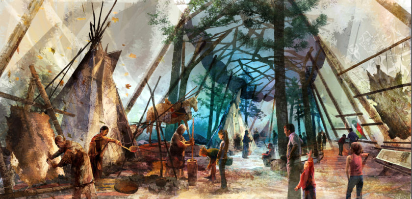
As part of the upcoming expansion of Fort Edmonton Park, an Indigenous Peoples Experience exhibit is being added. The multimedia exhibit will educate visitors about the Indigenous histories and cultures of the Edmonton region in an engaging and interactive way. The exhibit will include an outdoor amphitheatre, teepees, campsite recreations, and an indoor arena show.

FNE - Copy Sandra Green
Conceptual Design of Indigenous People’s Exhibit (subject to change). Photo Credit: Sandra Green.  Featured Image above – Bird’s Eye view of Indigenous People’s Exhibit (subject to change. Photo Credit : Brittany Cherweniuk.

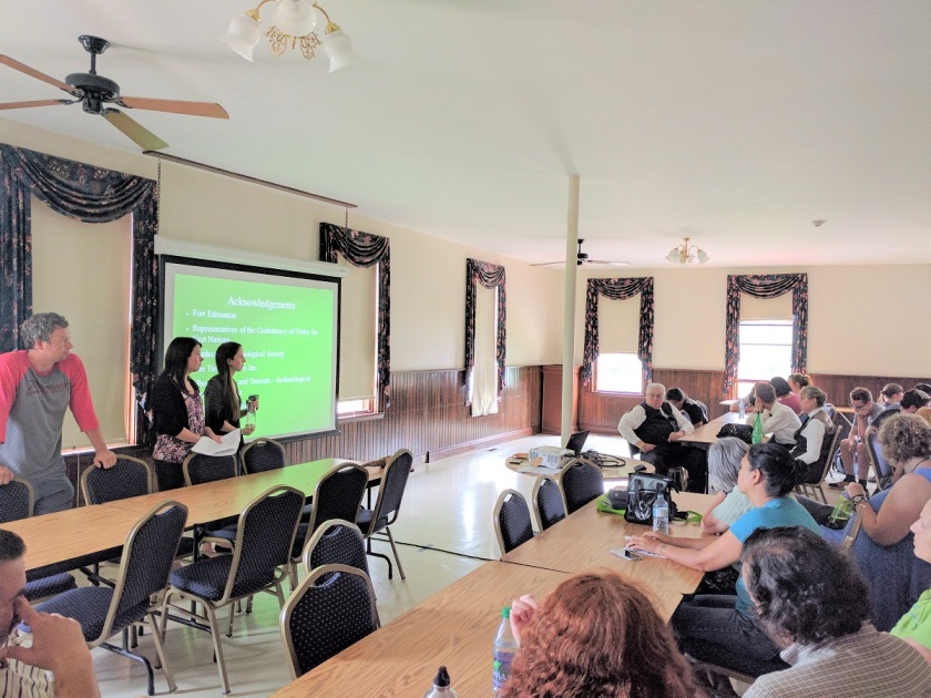
For the purposes of authenticity, the park contracted Corey and Brittany, with another independent contractor, Alexandra Burchill, to do historical research on the Edmonton region during the period of 1600-1850 AD. Their research will be used to inform the exhibit content and educate the interpretive staff. The team analyzed several different source materials including: primary sources, secondary sources, archaeological reports, archival records, and recorded oral histories.

fort_ed_presentation - Copy
The Research Team presenting at Fort Edmonton

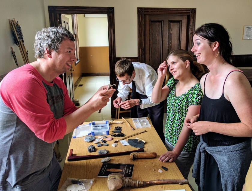
The team also took part in a training program for the interpretative staff. Corey, Brittany, and Alex spent two evenings with the Fort Edmonton Park interpreters presenting their research. They also had several artifact reproductions for the staff to touch and ask questions about. Several staff took the opportunity to try ancient tool technologies such as the bow drill and atlatl throwing.

IMG_20170727_181734 - Copy
Corey demonstrating tool use for the Fort Edmonton Interpretive Staff

As part of the research process, Treaty Six Elders were consulted and collaborated with to ensure the accuracy of research and identify areas that conflict with Indigenous knowledge, oral traditions, and culturally sensitive topics. Several stories told to us by the Elders were incorporated into the synthesis report including a story of an Elder that remembered his mother using a sharp obsidian flake to make small incisions on his temples to relieve headaches. We found this story to be an interesting addition to our discussion of the persistence of stone tool technologies after the introduction of European goods.

treaty Lodge - Copy Brittany Cherweniuk
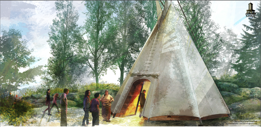
Conceptual image of the Treaty Lodge (subject to change). Photo credit: Brittany Cherweniuk.

The project was a very educational experience for the research team learning a lot about the history of the Edmonton river valley. But more importantly, the project brought us together with many different people, all united by a love of history and respect for the Indigenous past of the place we all call home.

Working in the Winter

Specializing in forestry archaeology in Alberta, I haven’t had much opportunity to work in winter conditions. One of the nice things about forestry is its relatively long planning horizon and the flexibility to schedule our work.

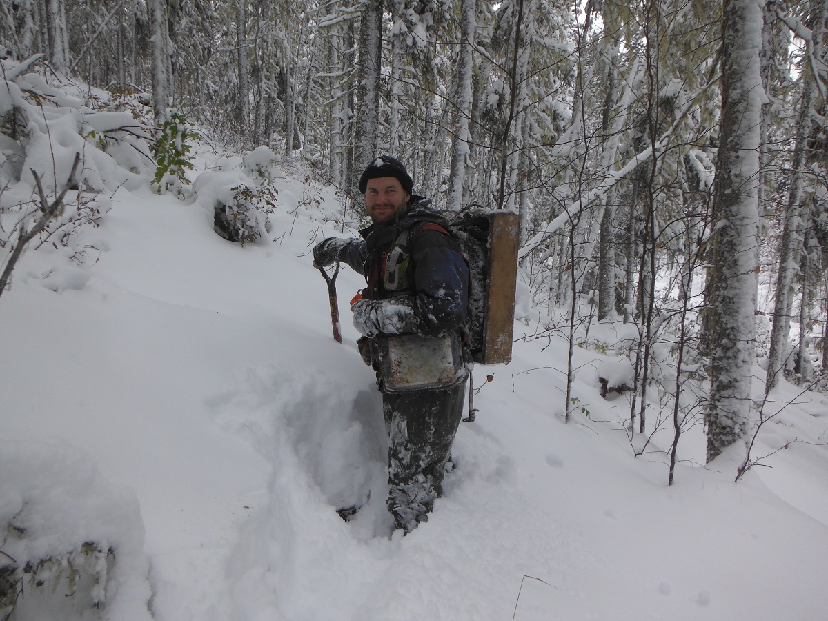
Unfortunately, in fall 2012, a variety of factors conspired to push some of our fieldwork into late October, and then we got an unusually early and heavy snowfall in northwestern Alberta. The heavy snow prevented the ground from freezing, so we went ahead with our planned surveys of forestry cutblocks, conducting landform evaluation and shovel testing as normal.

PA240116 - Copy
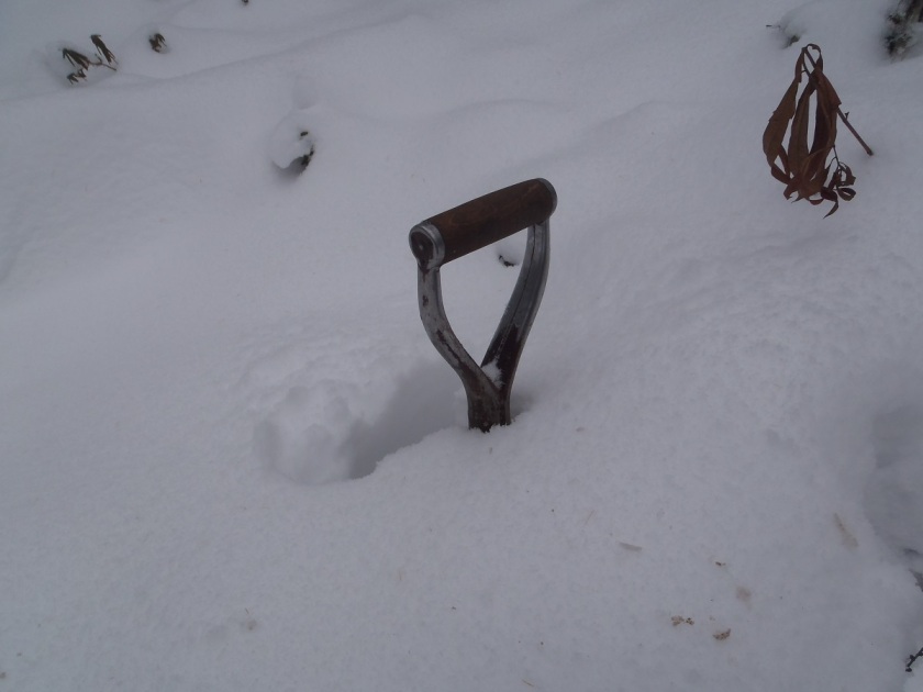
unusually deep snow (our shovels are about 1 m long!)

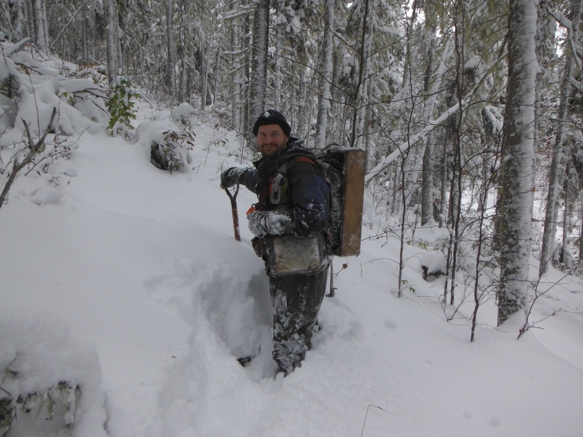
Trudging through 50 cm of fresh powder gave me some perspectives on moving and living in the boreal forest under winter conditions that I hadn’t previously gained. I had wondered what effect snow cover would have on mobility patterns. Summer travel in the forest tends to follow linear features like river and stream valley margins, but I’d wondered if under winter conditions that would still be the case. This week it certainly was. We were working on the Chinchaga River valley, and found that travel along the valley margin was much easier than cutting cross country or on the slopes or lower terraces. I’d say the advantage was even greater than under summer conditions. The level backcountry had deeper snow than the exposed margins, and the snow on the slopes was even deeper than that. The grey overcast sky and falling snow also obscured the sun, which made it very hard to maintain a bearing cross-country without a compass. Without a landform to follow, I could have been walking in circles and wouldn’t know until I hit my tracks.

DSCF0398 - Copy
Trudging through the deep snow.

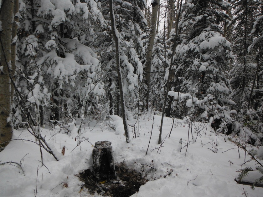
If I was camping under those conditions, however, I think I’d be choosing very different locations than I would in the summer. The distinct valley margins, corners and points that we tend to focus our surveys on had great views of the river and were on our preferred walking paths. But they were also very exposed to the biting wind coming out of the northwest. Even the south-facing edges were exposed. The most comfortable locations we found to break for coffee were just back from the edge, sheltered in stands of immature spruce. For the last couple seasons, I’d been suspecting that our focus on exposed corners and points was only finding one class of sites, and this experience reinforces that suspicion. I think that winter camps in particular, and possibly all larger camps, would be located back from the sharp landform edges that we’re targeting most. Drainage is still a factor, especially on warm winter days when the snow turns to mush, so we should still be looking for local elevation. But maybe we should be testing some less distinct elevated landforms a little back from the edges if we want to find sites occupied during less than ideal weather.

DSCF0384 - Copy
Snow is a little shallower in the protected areas under the immature spruce.

(This brief article was originally published in the Archaeological Society of Alberta Newsletter Vol. 1, January 2013)

Why do HRIAs (Historic Resource Impact Assessments)?

“Archaeological heritage is an essential element in the affirmation of our Canadian identity and a source of inspiration and knowledge. It is the policy of the Government of Canada to protect and manage this heritage.1

This sentiment is echoed through all levels of government and most provinces2, territories, and municipalities have either a piece of legislation, regulation, policy, or official plan in place that enables the government to protect heritage resources on lands within its jurisdiction.

For example, it’s stated in Alberta’s Historical Resources Act that when the Minister thinks a proposed operation or activity is likely to alter, damage, or destroy a historic resource, the Minister may order that person to undertake an HRIA3. This means that the Minister of Alberta Culture and Tourism (ACT) has the authority to require developers to conduct studies that assess the potential impacts of their development on historic resources. In Alberta, these studies are called “Historic Resources Impact Assessments” or HRIAs.

If the HRIA determines that there are historic resources located within the development footprint that may be impacted by the proposed development, ACT may require that the impacts be mitigated before the project will receive development approval (i.e. through modification of the development plan or the completion of a Historic Resource Impact Mitigation / HRIM). The goal of HRIA and HRIM studies is to ensure that significant historic resources are preserved through the development and land use planning processes. As such, the Minister may require the authority responsible for approving the proposed development (such as Alberta Environment and Parks, Agriculture and Forestry, or the Alberta Energy Regulator) to withhold or suspend the approval (or licence/permit/etc.) until the HRIA/HRIM requirements have been satisfied.

Have you been required to obtain a permit-status archaeologist to undertake an HRIA/HRIM? We’d be happy to discuss how Tree Time Services can best help you through the approvals process so you can focus on your core business. Call Kurt at 780-472-8878 or email archaeology@treetime.ca. 

To keep up to date on Historic Resource regulations and processes, you can also subscribe to our quarterly Regulatory Update email.

1 Archaeological Heritage Policy Framework, Department of Canadian Heritage, Ottawa, 1990.

2 “We value the natural heritage and human history of Alberta because they help us understand and value the past on which our present is built, and give us a deepened awareness of our common roots and shared identity.” The Spirit of Alberta: Alberta’s Cultural Policy, 2009:3

3 Alberta’s Historical Resources Act, Section 37.2

What is Mitigative Excavation?

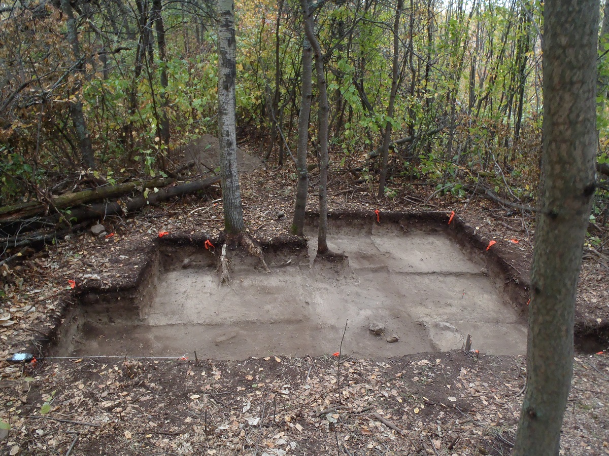
Mitigative excavation is the process of digging an archaeological site that is threatened either by development or natural erosion. Mitigative excavations have different goals than academic excavations. The goal of mitigative excavations is is to save as much information about the site before it is destroyed, whereas in academic digs the goal is to answer specific questions about how people were using the site in the past.

When a planned development is in direct conflict with a significant archaeological site our normal first recommendation is for a project redesign in order to avoid impacting the site. When a project redesign is not a viable option a mitigative excavation might be required.

Before the excavation begins additional shovel testing may be required to ensure that the boundaries of the site have been confidently established and to identify the most important or valuable part of the site. Using what we have learned from the shovel testing we select areas for excavation blocks. We try to target the places where we’ll get the best return, in scientific information, for the investment of time. These excavation blocks are usually excavated in 1×1 m units. During the excavation layers of a predetermined depth are carefully removed. The sediment is screened and artifacts are collected. While excavating each layer is carefully described and locations of artifacts within the layer are recorded. Any changes in the soils or unusual staining is also described in detail. As each layer is removed photos are taken to further document the process. Once the unit is excavated to its final depth photos and drawings are taken of the unit walls. These photos and drawings will help us to understand the natural formation of the site area by studying the statigraphy. Looking at the layers of the soil can help us to determine if some artifacts in the site are older than others and can help us to understand how long or often the site was used by people in the past.

Mitigative excavations in Alberta typically do not involve excavation of the entire site as you might see in academic research excavations; instead archaeologists first consult with the developer and the government and excavate a sample of the site that focuses on the area of impact, and maximizes the information value of the dig.

Once the mitigative excavation is complete and the final report describing the project has been approved by the government the development will be allowed to proceed.

Mitigative excavations usually move along at a faster pace than academic excavations. This is related to time restrictions associated with development planning and budgetary concerns, as well as our focus on efficiency, and maximizing the return on investment. Academic excavations often take place over many field seasons but mitigative excavations have to be completed before the developer begins construction.

Mitigative excavation is our best tool to preserve archaeological heritage when avoidance isn’t an option, but it’s still a net loss in heritage value. Archaeological sites are non-renewable resources, once they have been destroyed, whether by excavation or development, no more information can be collected about the site.

HRV 4C – What Happens Now?

You have made a plan for a development and reviewed your plan against the Listing of Historic Resources. You’ve found that you have a conflict on your land parcel, it is listed with an HRV of 4C. What does that mean?

An HRV of 4C indicates that an historic resource site is located on that parcel of land, and that one or more First Nations groups have reported that the site is of cultural significance to them. These sites are usually Traditional Use Sites with a historic component, or spiritually significant or religious sites. Some examples include historic cabins or trails, community campsites, prayer trees or other spiritual sites, burials, cemeteries, rock art sites, and mission sites.

Before you can proceed you or your historic resource consultant must submit a Historic Resource Application through OPAC (the Online Permitting And Clearance system) to the Aboriginal Heritage Section of Alberta Culture & Tourism. Aboriginal Heritage will review the development plans against their confidential records of the site and determine whether impacts are likely. If impacts to the HRV 4C site are likely, Aboriginal Heritage will issue site-specific Consultation requirements.

This means you may have to Consult with the First Nations who have Listed the site. More than one group may have an interest in the site because of shared history and land use. Be sure to consult with all interested parties in this matter. Consulting with only one group on overlapping Listings is not sufficient. Alberta Culture will inform you if Consultation is required or not, and with which groups site specific Consultation is required (Listing of Historic Resources, Instructions for Use). It’s very important to understand that any Site-Specific Historic Resource Consultation requirements are separate from and in addition to any other standard Consultation requirements regarding Treaty rights and land use. You may have to go back to First Nations you’ve already Consulted about your project in general, and may have to Consult with different groups or individuals.

Whether you are required to Consult with First Nations groups or not, an HRV of 4C may also result in a requirement for an Historic Resources Impact Assessment. The fact that a specific historic resource has been identified within your land parcel does not mean that the rest of the area has been surveyed and that there is only the one site there. It only indicates that an historic resource site has been reported. An historic resources impact assessment requirement is likely because areas that are considered culturally significant today usually have been considered important for centuries, or millennia. Areas with an HRV of 4C have a high potential to contain additional historic resources such as archaeological sites.

You may be required to redesign your project to avoid the HRV 4C historic resources site. If the site can’t be avoided, mitigation may be required. Mitigation of archaeological and historic sites typically requires extensive shovel testing, detailed block excavations proportional to the percent of the site to be impacted and detailed mapping of the site. Mitigation of impacts to a Culturally Significant site would likely be site-specific, and determined in collaboration with the affected communities.

Our recommendation for HRV 4C conflicts is to identify them early, discuss them with communities in advance, avoid them at the planning stage.

If you don’t know where to start, or would like someone to help you Consult with First Nations contact Kurt or Madeline at 780-472-8878 or toll free at 1-866-873-3846 or email us at archaeology@treetime.ca. We are happy to help.

What is an Historic Resource Site?

The majority of Tree Time’s archaeological work is done in the context of Historic Resources Impact Assessments, but what is an Historic Resource?

People are sometimes confused about what constitutes an historic resource because it is a very broad category. The first thing to come to most people’s mind would likely be the contents of a museum but as discussed below, historic resources encompass far more than the displays at museum. In the simplest sense an historic resource is anything of significant interest to a community, a cultural group, historians, archaeologists, or other scientists.

Alberta’s Historical Resources Act defines Historic Resources as:

any work of nature or humans that is valued for its palaeontological, archaeological, prehistoric, historic, cultural, natural, scientific or aesthetic interest.”

A Historic Resource Site is any place where Historic Resources are found. When we say “site” people most commonly think of an archaeological site, but this is only one type. Alberta Environment and Parks has defined six categories of Historic Resource sites – archaeological, cultural, geological, historic, natural and palaeontological. However, an Historic Resource site can fall into multiple categories – one doesn’t take precedence over another. Some examples of this are the Big Rock Erratic at Okotoks which is classified as both a geological and an archaeological historic resource site and the Frank Slide which is both a geological and historic site.

The government of Alberta keeps track of all the known historic resource sites in the province. To do this they use a tool called the Listing of Historic Resources. This listing is a database that contains information about historic resource sites such as their location and a description of what they are and what condition they are in. It is important to be aware that not all historic resources are recorded in this listing as many of them have not been recorded yet and the listing is not updated every day.

Some examples of Historic Resources sites found in Alberta:

Archaeological Sites

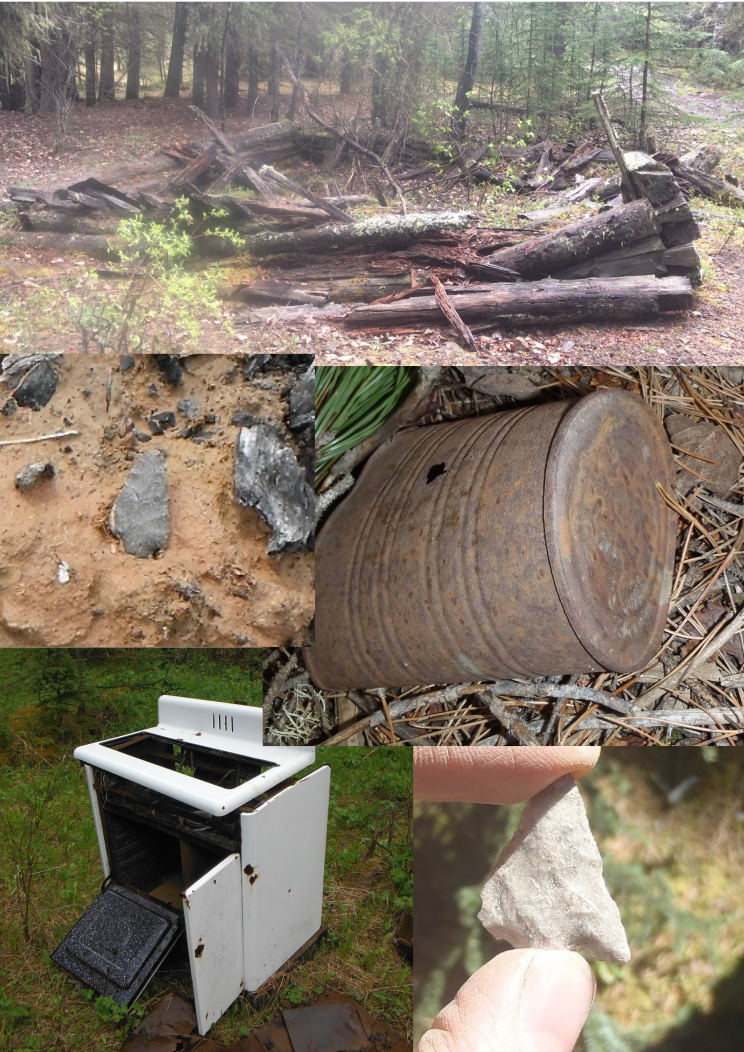
Archaeological sites are areas that have been occupied by humans in the past and have evidence of that occupation in the form of artifacts found on or under the earth’s surface. Some examples of archaeological sites common to Alberta include precontact campsites, rock art, tipi rings, buffalo pounds, homesteads, trails and medicine wheels. Some well known examples of archaeological sites in Alberta include Head Smashed-In Buffalo Jump and the Bodo Archaeological Site.

Cultural sites

Cultural sites are sites that have been identified as significant to a specific cultural group by members of that group. These sites often include historic villages, cabins and community campsites, burials, prayer trees and other ceremonial sites. The majority of Culturally Significant sites are of First Nations origin, but not all are. Some examples are Pierre Grey’s Trading Post, the St. Charles Mission Site, the Grande Cache Dinosaur Tracks site, the Ukrainian Cultural Heritage Village and Áísínai’pi (Writing-on-Stone) rock carvings and paintings. Culturally significant historic resources often overlap with archaeological and historic period sites.

Geological sites

This site type will often have overlap with other types of Historic Resources. Geological sites are areas of the province with unique geological features like the Canmore Hoodoos, Hetherington Erratics Field and the Whitecourt / Woodlands Meteorite Impact Crater.

Historic Sites

Historic sites are places that can usually be related back to specific people or events in history. This category is a little more complicated because it includes heritage structures, historic places and districts, and historic period archaeological sites.

The most common Historic Sites are places with preserved historic buildings. The Province tracks historic buildings in a database called the Heritage Survey. Any structure older than 50 years is eligible to be added to this list. This of course includes old buildings, like houses, grain elevators and train stations, but also includes other types of man-made above-ground structures, including earthworks, preserved wagon trails, and early 20th century oil wells. Historically significant structures or places can be designated as Municipal or Provincial Heritage Resources, and protected. Some examples of these include include the Brooks Aqueduct, the Alberta Pacific Grain Elevator near Castor, the Parliament Building in Edmonton and old houses in the Highlands neighbourhood of north Edmonton.

Other Historic sites are areas with known historical significance. While these sites may not have retained any standing structures they are places where significant events are known to have taken place or important historic figures visited. These include the locations of many historic fur trade posts and forts. Some of these sites have been recreated for public enjoyment and educational purposes. Some examples of this are Fort Victoria, Lac La Biche Mission and Historic Dunvegan. Other historic sites in Alberta include the Victoria Settlement, Frog Lake Massacre Site, and the Grand Rapids Portage on the Athabasca River.

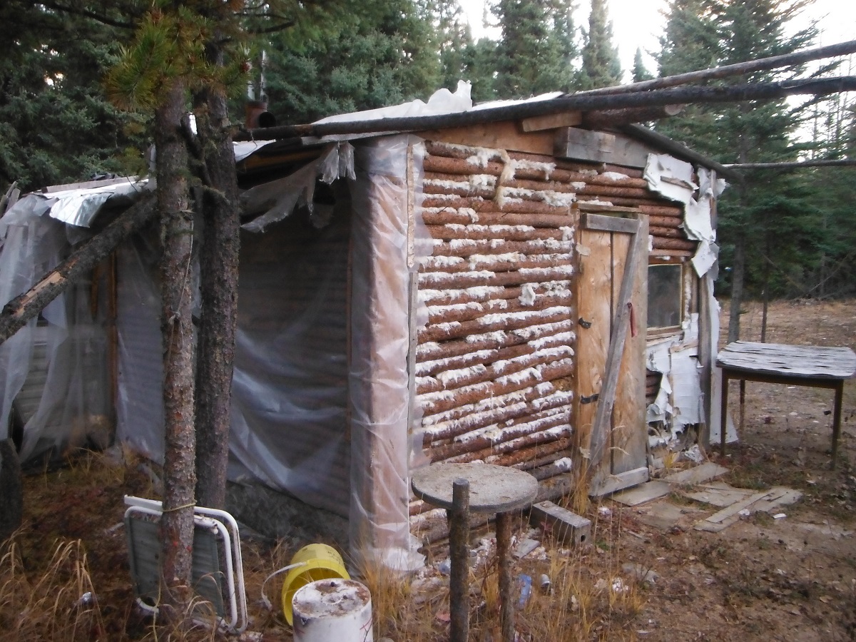
Historic period archaeological sites are the most common example of overlap between two categories. These are places with underground material evidence of the past (archaeological resources) from the historic period. At these places, archaeologists have documented the presence of historic period artifacts, ranging from fur trade beads and tools, to early 20th century cans and bottles. We may or may not have written records about these sites. Common examples of this site type are fur trading posts, pioneer homesteads, and early trapping cabin locations. A less common example would be this plane crash.

Natural sites

Natural sites are areas of special and sensitive natural landscapes of local and regional significance. These sites often have overlap with archaeological and historic site types. Some examples are Eagle Butte, Purple Springs and the Rumsey Natural area.

Palaeontological sites

These are sites where fossils can be found. Fossils of plants, animals and even dinosaur bones fall into this category. Examples include Dinosaur Provincial Park near Brooks and Pipestone Provincial Park near Grande Prairie.

Index to Alberta Homestead Records 1870 to 1930

Many people are interested in researching their family history and genealogy. The Index to Alberta Homestead Records are an excellent place to start your research. The following blog will give instructions on how to use the Index. If you wish to learn what the homestead records are, or how they can help archaeologists, please check out our previous posts.

The Index to Alberta Homestead Records 1870 to 1930 was a project created for the 100th anniversary of Alberta joining the confederacy. The members of the Alberta Genealogical Society and friends created an all name index to the homestead files to help researchers. There are 686 reels of microfilm that contain homestead records from 1870 to 1930. With this index, the researchers would be pointed to the exact reel and file number. For more information on this project or the Alberta Genealogical Society please visit their website (http://www.abgenealogy.ca/).

You can search the homestead record index by different methods including surname, legal description, or place name. Once you have that information either visit the Alberta Genealogical Society’s website and under resources click on Alberta Homestead Index then search the index or click on the following link: http://www.abgenealogy.ca/ab-homestead-index-page.

If you are doing research on your own family history, you can search by surname. When we were conducting research on the cabin that we found near Peace River, we searched the area by the legal land description.

legal search

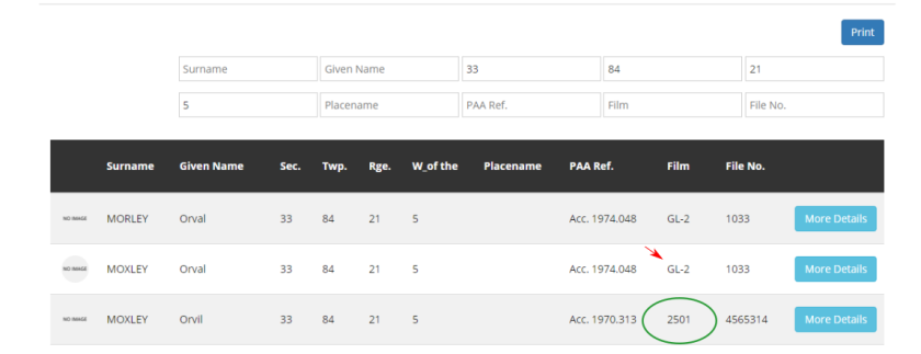
Once you fill in the information you have, the search results will automatically appear. You can see part of our results below.

Index search results

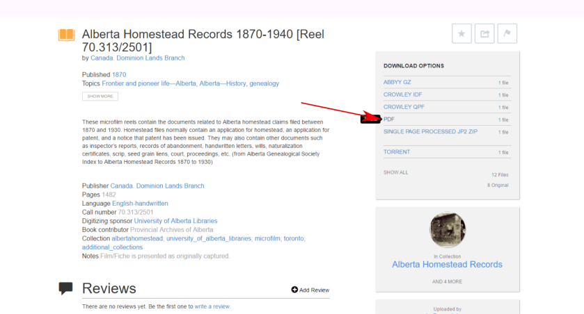
If you want to see the scanned microreel file of the homestead records, you will need to copy the film number and the file number. The film number for the homestead records only consists of numbers. The one we were searching for is circled in green. The red arrow is pointing to a different file type (grazing lease) and it consists of letters and numbers. Once you have the film and file number, go to https://archive.org/. In the search area type in Alberta homestead with the film number you wish to search for as we did below.archive search

The reel with your homestead record should pop up. Click on the link (where the red arrow is pointing).

reel results

Then you can download it in the format that you wish. Personally I prefer downloading it as a PDF.download

The next step is the longest part of the process. You will have to look though the reel until you find the file number associated with your previous search. This may take some time because reels can contain hundreds of files. As mentioned in the previous blog post, the file number is associated with a quarter section of land and the first page often contains the file number. If you searched by a person, you might find that the results will have multiple file numbers (maybe even on multiple reels), indicating claims on different sections.

If you are not able to do the research yourself, you are able to order the homestead records (or other research) from the Alberta Genealogical Society. Check out the following link for more information

http://www.abgenealogy.ca/content.php?nid=1550&mid=1155

The Alberta Homestead Index is a wonderful tool directing researchers to the required reel or reels. Before this index was created you can imagine how long it would take to search through all of the records. This is especially true when searching by surname since the only way to tell if someone tried to homestead multiple sections would have been to search though every single record. Thanks to the Alberta Genealogical Society this is no longer the case. Happy researching!

The Alberta Homestead Process

Homestead records are a valuable research tool for archaeologists, historians and for people researching their own family history or genealogy. If you want to see how homestead records can help archaeologists please read our previous blog post. Before I explain how to use these records, I will give a brief description of the homesteading process and what type of files you might find in the records.

In order to gain land under the Dominion Lands Act, people who wished to homestead had to apply at the local land agency office. These offices were under the Dominion Lands Branch in Ottawa. For a $10 filing fee, an applicant could apply to homestead a quarter section (160 acres). Once a quarter section was homesteaded for the first time it was given a file number. All documents related to that section of land were then filed under that number. As we saw in the previous blog post about the cabin we found near Peace River, multiple people might apply to homestead on one section.

The first page of the file for a quarter section typically looks just like this (see below). The number circled in red is the file number.

file number

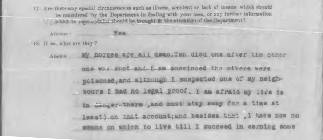
After filing, the homesteader then had three years to ‘prove up‘ their homestead claim. The requirements changed over the years as did the requirements for eligibility of the applicants. If you did not complete the process in three years, you would have to ask for an extension. One file contained a statement of a homesteader asking for an extension because his neighbor (allegedly) killed his horses.

horses

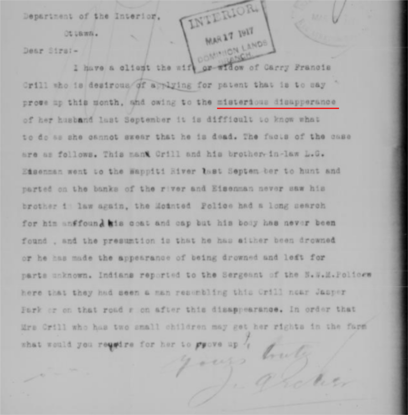
Applicants typically had to be male, meet the age requirement, and be a British subject (or declare an intention to be one). The required duties were that the person had to occupy the land for a set amount of time and had to undertake certain improvements upon the land within three years. The improvements usually included the construction a house and fences, and breaking and cropping a portion of the land. If you “proved up” your homestead you could apply for a patent which would give you legal ownership of the land. There were special exemptions to these rules. For example in some cases widows could apply for patents upon the death of their husbands, or as in the case below their “mysterious disappearance”.

widow

For more information on the changes to the original Dominion Lands Act, check out this website:

http://www.saskarchives.com/collections/land-records/history-and-background-administration-land-saskatchewan/homesteading

The files normally include an application for homestead, an application for patent, and a notice that the patent has been issued.

The application for entry is the first form that was filled out when someone wanted to homestead a quarter section. This form would capture information about the applicant’s age, birthplace, last residence, prior occupation, and the number of people in the household.

Below is a picture of what the top half of an application for entry looks like. You can see that the file number is recorded on the page.

appplication for homestead

When we were researching the cabin near Peace River, the forms that we found were all application for entry. This usually indicates that the land was abandoned and wasn’t successfully homesteaded before 1930. After 1930 the homestead process changed as control of natural resources was transferred to the province.

The application for patent is the form that was filed to gain the patent (title) for the land. In order for the patent to be granted the applicant had to complete the required duties. These forms contained information about the applicant’s, age, occupation, nationality, number of people in the household, residency information, post office, as well as work they’d done like breaking, cropping, buildings, fencing, and livestock.

The notification of patent is the letter granting the patent (title to the land). It demonstrates that the applicant was successful and gained legal ownership of the land and it contains the date it was issued.

Sometimes the application was not for a homestead but for a pre-emption or a purchased homestead. A pre-emption allowed a homesteader to obtain a second quarter section of land next to their homestead entry. They had requirements that had to be fulfilled in addition to the requited duties of the homestead. Purchased homesteads were typically bought for $3 an acre. The accompanying files for both pre-emptions and purchased homestead are typically the same as those for the homestead applications.

The files can contain additional documents such as inspector’s reports, witness affidavits, records of abandonment, handwritten letters, court proceedings, wills, naturalization, and even poetry and pictures.

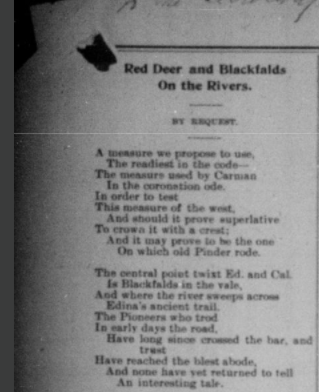
photo of poet

poem

The above images are of the poet and poem found in the same file. Although this is by far not what the typical file looks like, until you look at the file you will never know what type of information you can find! If you want to learn how to use the Alberta Homestead Index for research keep an eye out for our next blog post.

Glacial Flutes

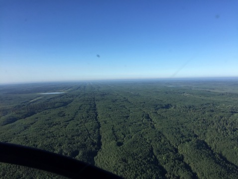
Ryan is doing layout work to protect wetlands and streams during aerial herbicide application and he got this great shot of glacial fluting northeast of Calling Lake.

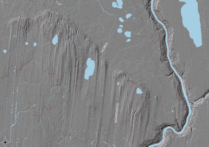
These parallel ridges were formed when the Laurentide ice sheet coming southwest from the Canadian Shield hit bedrock uplands at the east end of the Pelican Mountains. The base of the glacier formed a saw-tooth pattern that scoured these ridges and troughs for several kilometers.

Lidar flutes
This is how these glacial flutes appear on LiDAR.