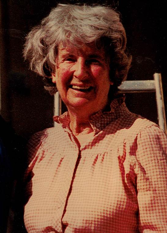
Cecily Margaret Guido (Peggy Piggott)

Books and movies, like The Dig (author John Preston and director Simon Stone), reintroduce us to people in our archaeological history that have either been forgotten or downplayed by societal norms of the time. They encourage us to dig into the past to discover who these people were, and how they contributed to the advancement of our field. Cecily Margaret Guido, or Peggy Piggott, as she was known at the time of the Sutton Hoo excavations in 1939, was in the right place at the right time. She discovered the first item of the large collection of artifacts from the famous ship burial. But this was was such a small snippet of a long and productive career. Peggy was a very busy woman!

Lily James plays Peggy Piggott in the new film The Dig

Margaret Guido (b. August 5, 1912, d. September 8, 1994) was an English archaeologist known for methods, field-leading research into prehistoric settlements, burial traditions, and artifact studies. Her career spanned sixty years, and was defined by high field standards, and rapid, high-quality publications. At the time of the Sutton Hoo discovery in 1939, she was already an accomplished archaeologist with plenty of fieldwork experience, and not as inexperienced or “bumbling” as portrayed in the The Dig. In 1933 she excavated under the tutelage of Mortimer and Tessa Verney Wheeler, at the Roman town, Verulamium (Hertfordshire, England). In 1934 she earned a “diploma” from the University of Cambridge, as they did not award degrees to women at the time. By 1936, she had completed a post-graduate diploma from the Institute of Archaeology in London, where she focused on Western European Prehistory. In 1937, at the age of 25, she directed an excavation at the Latch Farm (Hampshire) Middle Bronze Age barrow and urnfield cemetery, wrote up the excavation of an Early Iron Age site at Southcote (Berkshire), and published a study on the pottery from Iron Age Theale. In 1938-39 she worked on research excavations at the Early Iron Age site of Little Woodbury (Wiltshire), and published the results of work conducted at the Early Iron Age site at Langton Matravers (Dorset).
Original photograph by Barbara Wagstaff © Trustees of the British Museum, digital image © National Trusthttps://www.nationaltrust.org.uk/blogs/archaeologists-blog/personal-reflections-on-the-digs-and-discoveries-at-sutton-hoo

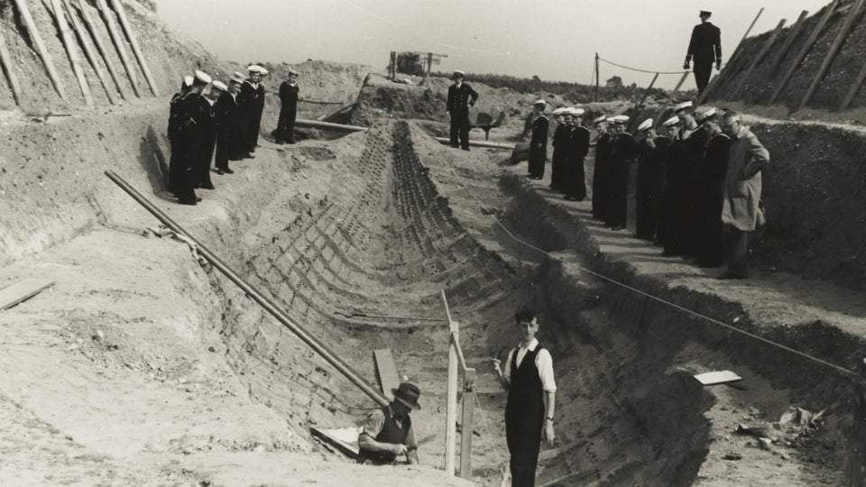
In July 1939, Guido and her then husband, Stuart Piggott, arrived at the Sutton Hoo location to aid Charles Phillips, who had assumed control of the excavations under the British Museum, the Office of Works, Cambridge University, Ipswich Museum, and the Suffolk Institute. On July 21, not long after her arrival at site, Guido had discovered the first of 263 items that confirmed the ship was a burial mound, and that the Anglo-Saxon Dark Ages were in fact a rich cultural period.
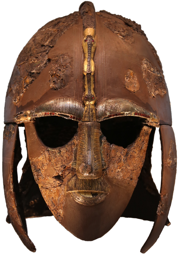
https://en.wikipedia.org/wiki/Sutton_Hoo_helmet

Over the next two decades, Guido’s work forged her into one of the most important British prehistorians. She conducted extensive excavations at six hillforts, excavated for the Ministry of Works during WWII, and produced approximately fifty publications for British Prehistory which advanced the fields of Bronze Age burial traditions, Late Bronze Age artifact studies, Later Bronze Age and Iron Age settlement studies (especially roundhouse architecture and hillfort chronologies). Later in her career she produced the definitive texts on Prehistoric, Roman, and Anglo-Saxon glass beads that are still used today. By the age of 32 she was elected a Fellow of the Society of Antiquaries of London due to her contributions to the study of British prehistory. In 1987 she was President of the Wiltshire Archaeological and Natural History Society, a position she held until her death at the age of 82.

Her work on hillfort studies (both field methods and interpretations) are some of the most influential work on the understanding of early British prehistory. In 1948 she excavated Hownam Rings, Hayhope Knowe in 1949, and Bonchester Hill in 1950, and published the results within the same year. The field methods she used at Hayhope Knowe was a combination of the best parts of the Wheeler and Bersu schools of excavation, but modified to allow for quick assessment. This was the first time these were used on northern Iron age sites. As a result, in one season Guido was able to open 520 sq. m in targeted open-area trenches, which were used to investigate three houses and their enclosure sequence.
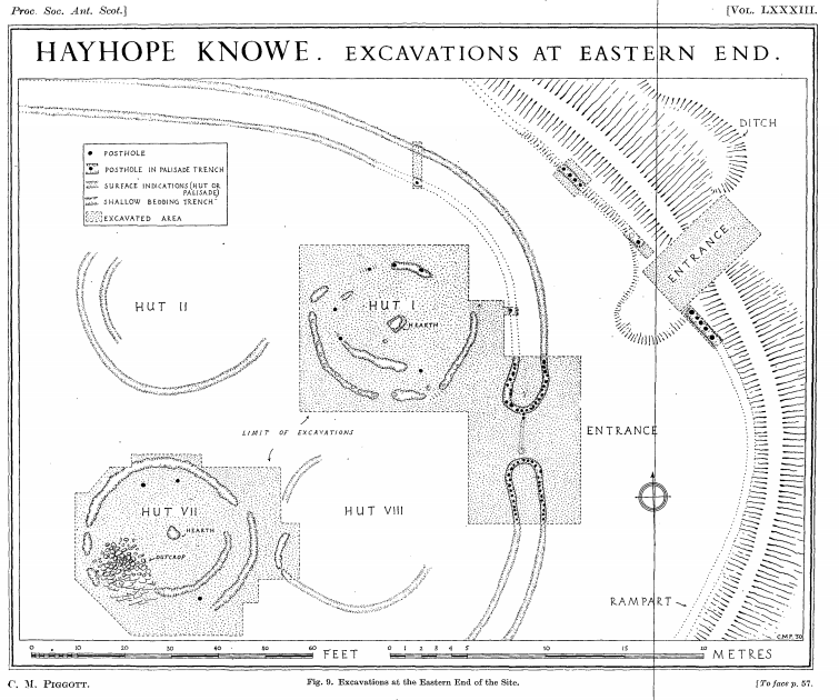
Hayhope Know Excavation map – Fig. 9 from “The Iron Age Settlement at Hayhope Knowe, Roxburghshire. Excavations 1949. By C.M. Piggott, Proceedings of the Society of Antiquaries of Scotland, 1951.

Hownam Rings became the type-site for hillfort development, known as the Hownam Paradigm. The paradigm indicated that the progressing complexity of enclosures (pallisade to multivallate earthworks) also represented complexity of cultural development. This paradigm remains valid to this day. Guido also used this site to discuss for the first time the problems of archaeological survival, slope erosion, and the vestigial nature of timber features. She also tested and refined the CBA model, allowing her to provide a relative chronological framework for later prehistoric settlement in southern Scotland. This was a major leap for prehistoric studies in the days before the use of radiocarbon dating became prevalent.

In the later part of her career in the 70s and 80s, Guido focused on researching ancient British glass beads. Her first volume covered both prehistoric and Roman period beads, and the second volume (published posthumously by Martin Welch in 1999) on Anglo-Saxon beads. She co-founded the Bead Study Trust (in 1981), and the Peggy Guido Fund for research on beads. Both volumes remain the primary reference works on the topic.

If you want to read more about the works of Margaret Guido, check out the following links!

https://peoplepill.com/people/margaret-guido/

https://trowelblazers.com/raising-horizons-queens-of-the-castles/

https://en.wikipedia.org/wiki/Margaret_Guido

Harriet Boyd Hawes

To celebrate International Women’s Week, I present Harriet Boyd Hawes (1871 to 1945), a pioneer in the field of classical Greek archaeology. Her anthropological approach to fieldwork and the understanding of past lives were well ahead of the times and helped the discipline move away from arm-chair studies focused on high status artifacts and museum exhibits. You can read more about her in Ladies of the Field: Early Women Archaeologists and Their Search for Adventure, by Amanda Adams. This is an excellent book for anyone interested in learning more about early women archaeologists and their contributions to the field.

Harriet Boyd Hawes was born Harriet Ann Boyd in Boston, Massachusetts on October 11, 1871. She was raised by her father and brothers, since her mother died when she was a child. Her brother Alex, was instrumental to her career in archaeology, encouraging her to explore Classical studies. In 1892, she received her B.A. in the study of Classics from Smith College in Northampton, Massachusetts.

3623579250fe7a50294918f35fb2f3fc--archaeology
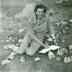
Harriet taking notes (Notorious Women Podcast)

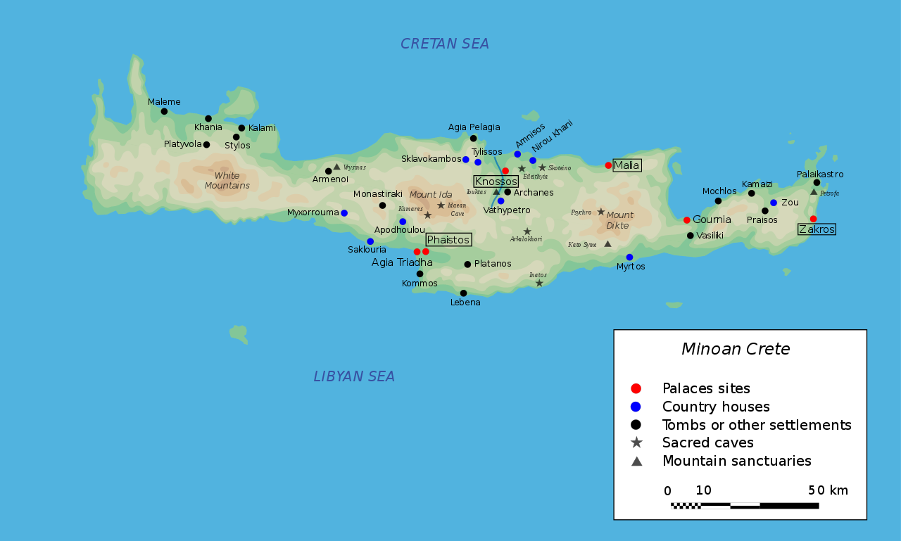
Early in her career, Hawes was drawn to Greece and furthered her education at the American School in Athens. She found it quite difficult to break into the male-dominated field and was excluded from the prestigious excavations around Athens, since digging in the dirt was not a woman’s place. Frustrated by this, she decided to move her academic pursuits to the island of Crete. This was not an easy task, as at this time Crete was war-torn and considered quite hostile. Despite this, Harriet Boyd Hawes, discovered and excavated many sites, and was the first woman ever to direct a major field project in Greece. She was also the first woman to ever speak before the Archaeological Institute of America, where she reported findings from her discovery and excavation of the Minoan (Bronze Age) town at Gournia, Crete.

http://metamedia.stanford.edu/imagebin/minoan%20crete%20map.JPG
Map of Minoan Crete (Wikapedia)

Eventually Harriet began teaching Archaeology, epigraphy, and modern Greek at Smith College, while working on, and receiving, her M.A. She also taught at Wellesley College in Cambridge, Massachusetts. Harriet married Charles Henry Hawes, an English archaeologist in 1906, and had two children together. And although studying the people of the past was her passion, she did not neglect those of the present. Several times throughout her life, Harriet put aside her archaeological endeavours and worked as a war nurse. She treated sick and injured soldiers during the Greco-Turkish War, the Spanish-American War and World War I. Later the couple moved to Washington D.C. where she continued teaching and eventually died at age 73 on March 31, 1945.

Hawes differed from many of her contemporaries in that she was more interested in the daily lives of the people she studied, rather than the gold, jewels and palaces of the higher classes. Her publications and discussions concerning her work are technical, and not filled with romance and stories like those of many of her contemporaries. She was well published and received an honorary doctorate from Smith College in 1910. Harriet not only made major contributions to archaeology study, but she also broke down the barriers of her male-dominated field and paved the path for future generations of women in academia. She was truly a pioneer of modern archaeological investigations.

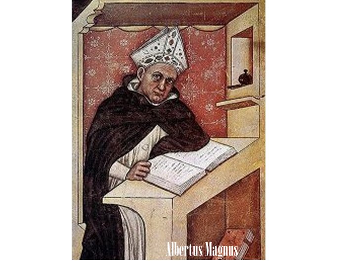
Albertus Magnus – Patron Saint of Archaeology

The religious tradition of designating a patron saint to a profession or activity is a long standing one, and it is of no surprise that a heavenly protector, or advocate, has been claimed by archaeologists. When it comes to patron saints, archaeologists, like many other professions have claimed more than one patron. Some consider St. Helena of Constantinople (Emperor Constantine the Great’s mother) to be the patron saint of archaeology, since she was attributed to finding and excavating the True Cross. However, other archaeologists feel that they are more than mere excavators of history and are a part of the larger scientific community. Such archaeologist may chose to claim the patron of the natural sciences as their own. It just so happens that Kurt (our TTSI division manager) lives in a town that chose the same patron saint as its namesake, St. Albert.  So who was St. Albert and why was he chosen from amongst hundreds of saints to be the heavenly guardian of those who chose to practice the natural sciences, and thus, archaeologists.

Albertus Magnus (c. 1200 – November 15, 1280), also known as Saint Albert the Great, Albert of Cologne or Albert of Lauingen, was a German Catholic Dominican friar and bishop, who spent his life teaching, writing and investigating the natural world. Early in his life, Albert attended university in Padua, Italy and joined the Order of St. Dominic. He gained his Doctorate while in Paris and taught theology at several universities. He was appointed to many positions within the Catholic Church, including the Master of the Sacred Place (the Pope’s theologian) and the Bishop of Ratisbon. However, Albert never remained in these positions for long as he did not wish to be away from teaching and his work. He is most well known as the mentor of St. Thomas Aquinas  and for the wealth of knowledge that he provided for future generations, most of which is considered to be very accurate even by modern standards.

Although Albertus Magnus was known during his lifetime as a Doctor universalis, he was not beatified until 1622 and was not canonized as a saint until 1931. In 1931 he was also distinguished as one of 36 Doctors of the Catholic Church, which is one of the highest post-humus honors that may be bestowed upon a saint, and was declared to be the patron of the natural sciences in 1941. St. Albert’s feast day is on November the 15, which commemorates his death and the end of his inspiring career.

The reason why he is chosen as the patron saint of the natural sciences is simple: he dedicated his life to investigating the natural world. St. Albert was avid reader of philosophy and extensively studied the works of Aristotle. He is attributed with preserving much of Aristotles writings, and in an age mostly governed by mysticism, he utilized the teachings of the ancient philosophers to study the natural world and critically examine the assumptions of others. His prolific writings were collected in 1899 and placed into 38 volumes, which range in topics from zoology and chemistry to love and friendship. He stated that “the aim of natural philosophy (science) is not simply to accept the statements of others, but to investigate the causes that are at work in nature”

St. Albert was truly a great man, and considered by some to be one of the greatest minds in history. Since excavating the past is only a small part of the profession, and the modern archaeologist must have at least a working knowledge of many different disciplines within the natural sciences, I find Albertus Magnus to be a very fitting patron. Whether you are a religious person or not, I believe that his contributions to philosophy, science, and humanity deserve a toast from all us archaeologists on his next feast day!


Tree Time Gals!

International Women’s Day is a great opportunity to talk about women in our past that have paved the way in some fashion. Without the Famous Five women would not have been recognized as persons in Canada as early as we were. Women like Zelia Nuttal, challenged the norm and pursued something she truly loved, expanding our understanding of archaeology and ancient cultures in the process. Thanadelthur and Flores LaDue showed everyone just how strong, creative, and persevering women can be!

To end our posts this week, however, I would like to give a shout out to all the women archaeological consultants in Alberta today. On a daily basis in the field they face the elements, wildlife, and the unknown of what they may or may not find during survey. Those of us that work in the boreal forest have the added challenge of remote access, long hikes with 30-40 lbs of gear, no trails, exhaustion, and the sheer joy of being places people have rarely visited in the recent past. Many of these women lead archaeological survey projects large and small, while others conduct the surveys and are gaining the experience they need to become permit holders. Our permit holders manage the crews, budgets, research designs, safety, data analysis, reporting, and outreach.

In 2017, 62 people applied for a permit in Alberta in order to complete an Historic Resource Impact Assessment (HRIA), of which 23 were women. In Edmonton we have three major forestry CRM companies (Circle CRM, Western Heritage Services, and Tree Time Services) that currently employ 16 permit holders, 8 of which are women, in addition to seasonal and annual archaeologists. At Tree Time, we currently have 4 women (3 permit holders) on a 9 person team: Teresa Tremblay, Brittany Romano, Elenore Hood, and me (Madeline Coleman). We work side by side with our other team members improving our survey techniques, increasing our site identification rates (who doesn’t want to find more?), and annually increasing our understanding of where sites are in our project areas. All of these ladies have inspired me!

Teresa has really improved our understanding of site locations in the High Level area, which typically has very hard access, often needing helicopters. With helicopter access there are so many additional planning and safety considerations to take into account, creating a very challenging project, which she tackles with enthusiasm. In the Sundre area she works with developers on predicting where sites will be, allowing them to avoid areas. That doesn’t stop her from identifying over 30 sites a year in the planned harvest areas, though! She is one of our fastest diggers, and out-tests me on a regular basis. She also has several years teaching experience, preparing our next archaeological generation. She’s worked extensively in Ontario before moving to Alberta, and is working on expanding Tree Time into BC.

Brittany Romano has started to specialize in the Fort Vermilion area but has worked all over the province. Her problem solving skills for access, stuck quads, or site evaluations are excellent. She has recently been heavily involved with developing our outreach programs, which includes school visits. She’s put together our activity stations and worksheets to get young kids really involved and interested in archaeology. She keeps everyone at Tree Time on their toes with light-hearted practical jokes!

Elenore is one of the toughest field archaeologists I have ever met. No holds barred but at the same time the nicest person you could ever hope to work with. She takes no guff from bears, either. She built her career in BC and Alberta and has a keen sense of where on the landforms sites are located. She often finds artifacts in spots I would not have thought to test. She has been the lead of our blog series, and has kept a great balance with articles and featured artifacts. She has recently taken leave to work on a Master’s Degree. The next step is a Permit Archaeologist!

I’ve spent most of my career here, specializing in the Slave Lake region. Over the last few years I’ve been working on better understanding where we find sites in muskeggy regions. I love field archaeology but also really love the analysis part and outreach with First Nations groups. I’ve been working on improving our artifact analysis process, including its photography. I’ve also started working in the realm of public archaeology, which provides everyone with an opportunity to give archaeology a try.

And of course, there are so many other women archaeologists in the province. These include employees at the Archaeological Survey of Alberta, professors, students, volunteers at all our organizations around the province, and even the people who started out as archaeologists but have stepped away (you never really stop being one!). Women are a part of archaeology at every level in Alberta, and they are passionate about what they do.

Keep digging and researching, ladies!!

Mary Townsend Sharpless Schäffer

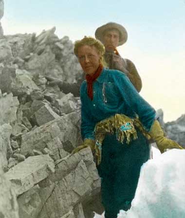
Have you been to Maligne Lake? If so, you’ve seen some of Mary Schäffer’s work, for her survey of Maligne Lake was used when the area was incorporated into the Jasper National Park.

In 1911, Mary was asked to survey Maligne Lake by the Geographical Board and Geological Survey of Canada. This was incredibly unusual as Mary wasn’t a trained surveyor and government policy at the time prevented women from accompanying survey parties, let alone leading one.i However, Mary’s position was unique; she and her friend Mollie Adams had been the first non-Aboriginal women to see the lake and had already completed several exploratory expeditions in the Rockies by the time of the government’s request.

An American by birth, Mary got her start in the Rockies after she and her husband took a rail trip to the west in 1889. Afterwards, the couple decided to spend their summers undertaking botanical studies in the Canadian Rockies. Mary’s husband, Charles, suffered poor health and this kept them close to the railway line for their research. After Charles’ death in 1903, Mary began to travel further into the Rockies in order to complete the illustrations for the guidebook she and her husband had planned on creating. Along the way, she got much help from guides, outfitters, and Aboriginal people and developed friendships there. By the time she finished collecting specimens in 1906, she was hooked on exploration.

Mary had developed a friendship with a geography teacher from New York named Mollie Adams. The women spent two summers exploring the valleys and lakes north of Lake Louise. The goal of their 1907 expedition was to explore the headwaters of the Saskatchewan and Athabasca Rivers, but they were also hoping to find a hidden lake known only to the local Stoney Nakoda First Nations and called Chaba Imne (beaver lake).ii Mary and Mollie had no luck in locating the lake that year, but when they were returning to the railway at the end of their field season, they met a group of local First Nations people and joined them for dinner at the cabin of Elliot Barnes in the Saskatchewan River Valley. One of the men recalled visiting Chaba Imne with his father around 20 years earlier. This man’s name was Samson (also written Sampson) Beaver and from his decades old memories he was able to draw Mary a map outlining the route. The following year, Mary was able to use the map to make her way to the lake, which she named Maligne Lake.

Mary wrote about her 1907 and 1908 expeditions in Old Indian Trails of the Canadian Rockies. This is her most famous book. It is an important work because it contributed to the protection of the Maligne Lake area through raising its public profile, but it’s also important because it reflects the social standards of the time and part of what life was like for women and First Nations in Canada at that time. For example, it wasn’t proper for women to be leading such adventurous and dangerous expeditions, especially with men who were not their direct relatives, and so you’ll see that very little is said of her male guides and companions, especially in comparison to her horses. The book also illustrates the colonial practice of changing Indigenous place names and the idea that areas already known to local people were “discovered” by Euro-Canadians.

Mary took many photographs during her explorations. Many can be found at the Whyte Museum in Banff. Here you can see photos Mary took and hand-coloured of Sampson Beaver and his family, nature scenes, and shots of the expedition, as well as some of her possessions.

Zelia Nuttall

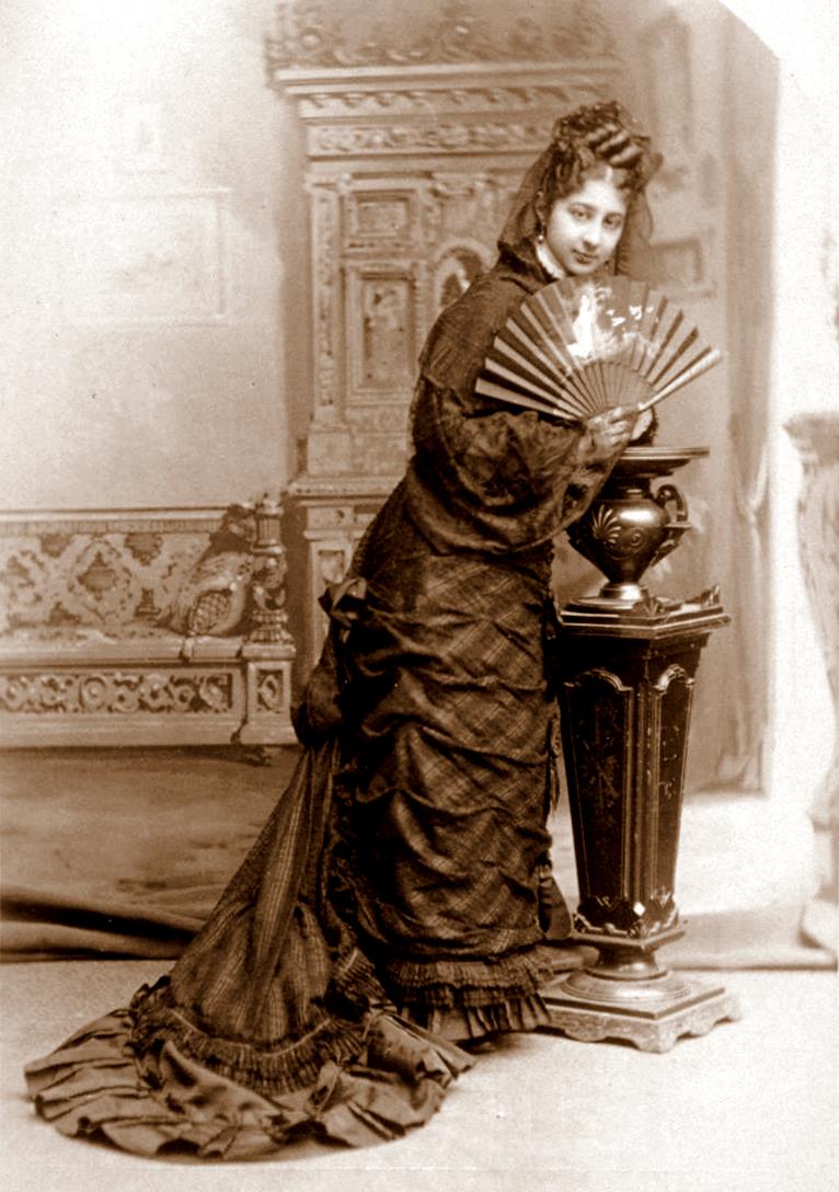
Zelia Nuttall was a prominent anthropologist specializing in Mexican archaeology during the Victorian Era. This was a time when archaeology wasn’t as firmly established as a discipline and it definitely wasn’t considered as a suitable career choice for women. ‘Appropriate’ work for women was typically connected to the domestic realm and included jobs like serving, sewing, washing, shoe-making, cleaning, etc. Archaeology, which might require leading large crews of men, attending university, physical labor, and traveling to remote locations, was squarely in the realm of ‘masculine’ work. Nuttall would often face the challenges of these conceptions, but she persevered and helped advance archaeology as a discipline.

Nuttall’s interest in Mexican archeology began at a very young age. She was born in San Franciso on September 6, 1857 to Dr. Robert Kennedy Nuttall and Magdalena Parrott. Magdalena was born in Mexico and, perhaps to connect her young daughter with her heritage, she gave her the book Antiquities of Mexico. This book helped awaken Nuttall’s interest in Mexican archeology.

Nuttall first visited Mexico in 1884. During this trip, she studied and wrote a paper on terra-cotta heads that she had collected from Teotihuacán. Her article was published in the American Journal of Archeology and she immediately started to gain recognition for her work. Before the age of 30, she was elected to the American Association for the Advancement of Science and the Special Assistant in Mexican Archeology at the Peabody Museum of Archeology and Ethnology at Harvard.

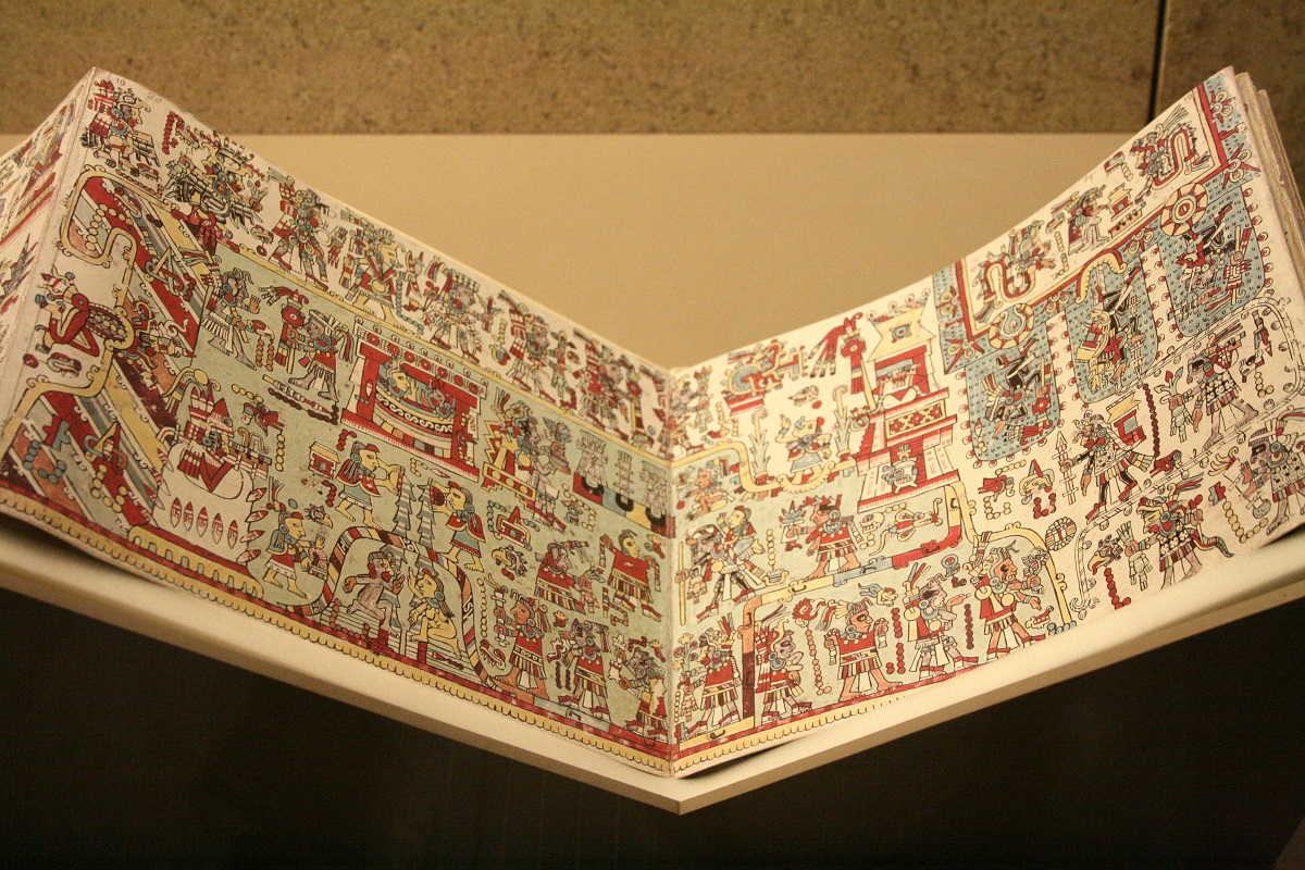
Nuttall was an expert in pre-columbian Mesoamerican manuscripts. One of her more famous discoveries was the Zouche-Nuttall codex. The codex is made out of 14 sections of animals skins that fold together like a screen. It is covered with a thin coat of fine lime plaster and painted with bright colors. She located the codex in England in private location after tracing it from the San Marco Monastery in Florence. Prior to this, its existence had been forgotten and lost. Her research on the codex demonstrated codices were not merely pictures as many assumed. Instead, the codex was an account of the historic events of the Mixtec. Another famous archival discovery was locating the Drake manuscripts which chronicled Sir Francis Drake’s journey on the Golden Hind.

Codex_Zouche-Nuttal_wikapedia
Photo Source: Michal Wal – Wikapedia

Her accomplishments would not stop there. She was given an Honorary Professorship of Archeology at the National Museum of Anthropology in Mexico and she helped set up the International School of American Archeology and Anthropology in Mexico. However, she would eventually resign in anger from her Honorary Professorship of Archeology as a result of her unfair treatment. In 1909, Nuttall visited the Island of Sacrificios. Observing the potsherds on the beach, she returned to take a closer look at the island. She soon discovered a large painting of Quetzalocatl (an important feathered serpent deity) on an ancient wall. Recognizing the importance of the deity, she made plans to return to document the site. She became an expert on the island’s history, finding accounts of the island from 1510 detailing the structures and the sacrifices that occurred there. She created plans to excavate the ruins and applied to the government for financial support. She was dismayed to learn that her funding for the project was less than half of what she had been assured she would receive and that she had to limit the exploration to a small section of the island. She was further outraged when she was told she had to be supervised by Salvador Batres because she was a woman. To add salt to the wound, Batres had a reputation of smuggling artifacts and she did not think he was a competent or ethical archaeologist. She resigned in protest. When Batres tried to claim the discovery of the island, she wrote an article outlining her research and methods, and harshly criticizing Batres and his work using specific examples for the American Anthropologist. Although she had lost the project, her article restored her reputation while destroying Batres.

This is just some of the highlights of Nuttall’s work. If you wish to read more about her accomplishments and her personal life, read Ladies of the Field by Amanda Adams. Not only does this book have more information about Nuttall and other Victorian Era female archaeologists, but it is an entertaining and informing book.

Sources for this article:

Ladies of the Field by Amanda Adams.

Index to Alberta Homestead Records 1870 to 1930

Many people are interested in researching their family history and genealogy. The Index to Alberta Homestead Records are an excellent place to start your research. The following blog will give instructions on how to use the Index. If you wish to learn what the homestead records are, or how they can help archaeologists, please check out our previous posts.

The Index to Alberta Homestead Records 1870 to 1930 was a project created for the 100th anniversary of Alberta joining the confederacy. The members of the Alberta Genealogical Society and friends created an all name index to the homestead files to help researchers. There are 686 reels of microfilm that contain homestead records from 1870 to 1930. With this index, the researchers would be pointed to the exact reel and file number. For more information on this project or the Alberta Genealogical Society please visit their website (http://www.abgenealogy.ca/).

You can search the homestead record index by different methods including surname, legal description, or place name. Once you have that information either visit the Alberta Genealogical Society’s website and under resources click on Alberta Homestead Index then search the index or click on the following link: http://www.abgenealogy.ca/ab-homestead-index-page.

If you are doing research on your own family history, you can search by surname. When we were conducting research on the cabin that we found near Peace River, we searched the area by the legal land description.

legal search

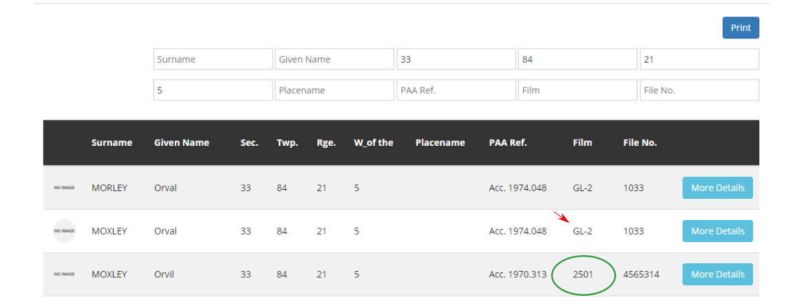
Once you fill in the information you have, the search results will automatically appear. You can see part of our results below.

Index search results

If you want to see the scanned microreel file of the homestead records, you will need to copy the film number and the file number. The film number for the homestead records only consists of numbers. The one we were searching for is circled in green. The red arrow is pointing to a different file type (grazing lease) and it consists of letters and numbers. Once you have the film and file number, go to https://archive.org/. In the search area type in Alberta homestead with the film number you wish to search for as we did below.archive search

The reel with your homestead record should pop up. Click on the link (where the red arrow is pointing).

reel results

Then you can download it in the format that you wish. Personally I prefer downloading it as a PDF.download

The next step is the longest part of the process. You will have to look though the reel until you find the file number associated with your previous search. This may take some time because reels can contain hundreds of files. As mentioned in the previous blog post, the file number is associated with a quarter section of land and the first page often contains the file number. If you searched by a person, you might find that the results will have multiple file numbers (maybe even on multiple reels), indicating claims on different sections.

If you are not able to do the research yourself, you are able to order the homestead records (or other research) from the Alberta Genealogical Society. Check out the following link for more information

http://www.abgenealogy.ca/content.php?nid=1550&mid=1155

The Alberta Homestead Index is a wonderful tool directing researchers to the required reel or reels. Before this index was created you can imagine how long it would take to search through all of the records. This is especially true when searching by surname since the only way to tell if someone tried to homestead multiple sections would have been to search though every single record. Thanks to the Alberta Genealogical Society this is no longer the case. Happy researching!

The Alberta Homestead Process

Homestead records are a valuable research tool for archaeologists, historians and for people researching their own family history or genealogy. If you want to see how homestead records can help archaeologists please read our previous blog post. Before I explain how to use these records, I will give a brief description of the homesteading process and what type of files you might find in the records.

In order to gain land under the Dominion Lands Act, people who wished to homestead had to apply at the local land agency office. These offices were under the Dominion Lands Branch in Ottawa. For a $10 filing fee, an applicant could apply to homestead a quarter section (160 acres). Once a quarter section was homesteaded for the first time it was given a file number. All documents related to that section of land were then filed under that number. As we saw in the previous blog post about the cabin we found near Peace River, multiple people might apply to homestead on one section.

The first page of the file for a quarter section typically looks just like this (see below). The number circled in red is the file number.

file number

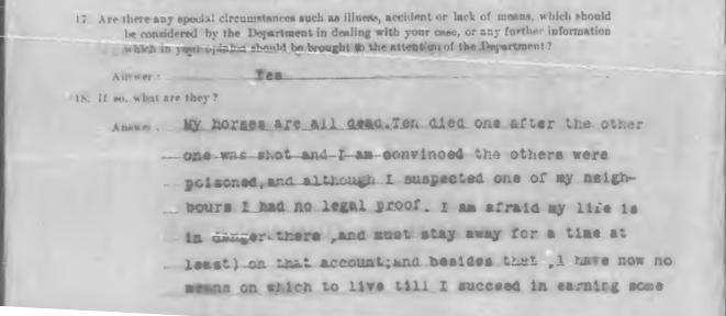
After filing, the homesteader then had three years to ‘prove up‘ their homestead claim. The requirements changed over the years as did the requirements for eligibility of the applicants. If you did not complete the process in three years, you would have to ask for an extension. One file contained a statement of a homesteader asking for an extension because his neighbor (allegedly) killed his horses.

horses

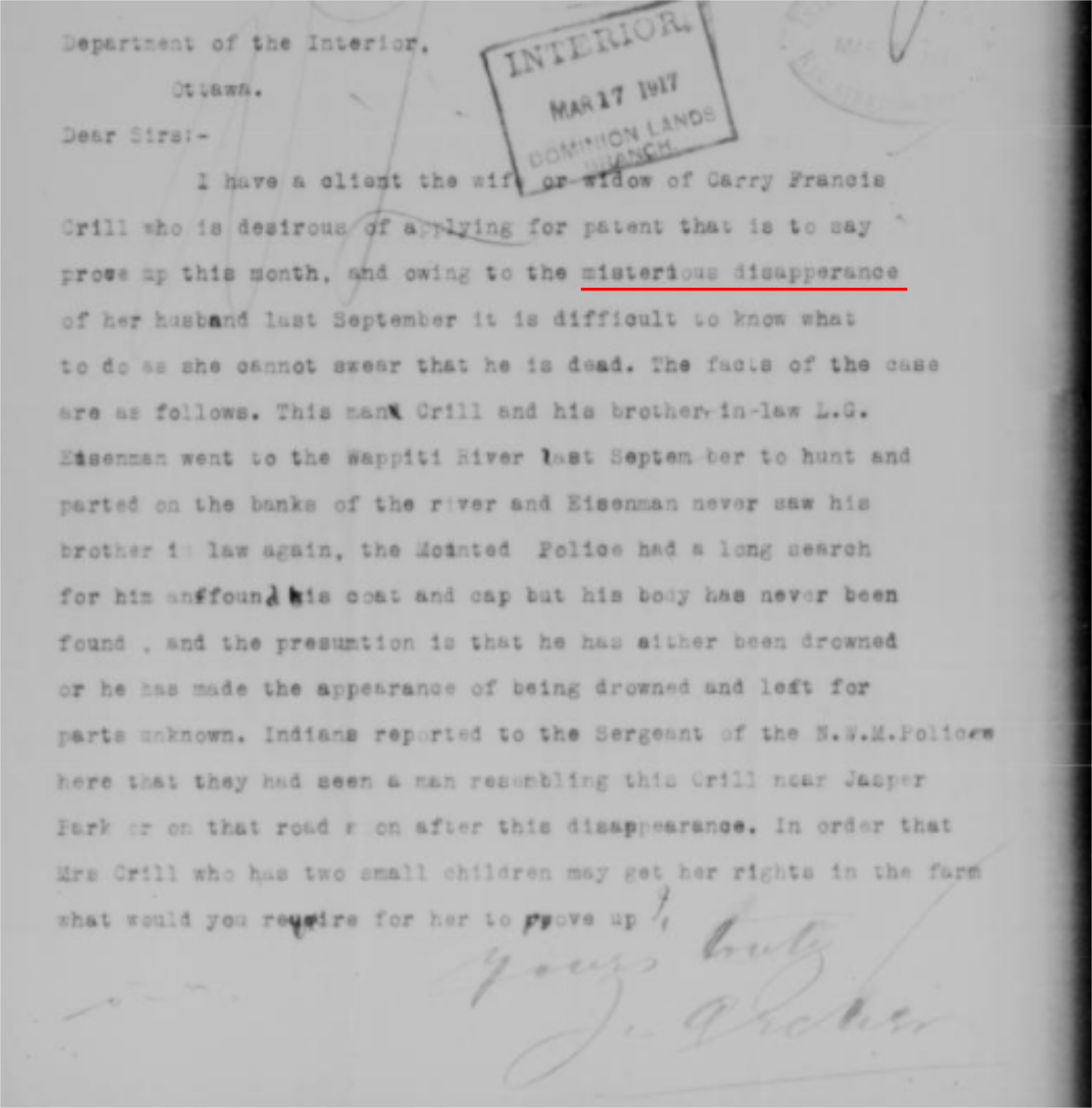
Applicants typically had to be male, meet the age requirement, and be a British subject (or declare an intention to be one). The required duties were that the person had to occupy the land for a set amount of time and had to undertake certain improvements upon the land within three years. The improvements usually included the construction a house and fences, and breaking and cropping a portion of the land. If you “proved up” your homestead you could apply for a patent which would give you legal ownership of the land. There were special exemptions to these rules. For example in some cases widows could apply for patents upon the death of their husbands, or as in the case below their “mysterious disappearance”.

widow

For more information on the changes to the original Dominion Lands Act, check out this website:

http://www.saskarchives.com/collections/land-records/history-and-background-administration-land-saskatchewan/homesteading

The files normally include an application for homestead, an application for patent, and a notice that the patent has been issued.

The application for entry is the first form that was filled out when someone wanted to homestead a quarter section. This form would capture information about the applicant’s age, birthplace, last residence, prior occupation, and the number of people in the household.

Below is a picture of what the top half of an application for entry looks like. You can see that the file number is recorded on the page.

appplication for homestead

When we were researching the cabin near Peace River, the forms that we found were all application for entry. This usually indicates that the land was abandoned and wasn’t successfully homesteaded before 1930. After 1930 the homestead process changed as control of natural resources was transferred to the province.

The application for patent is the form that was filed to gain the patent (title) for the land. In order for the patent to be granted the applicant had to complete the required duties. These forms contained information about the applicant’s, age, occupation, nationality, number of people in the household, residency information, post office, as well as work they’d done like breaking, cropping, buildings, fencing, and livestock.

The notification of patent is the letter granting the patent (title to the land). It demonstrates that the applicant was successful and gained legal ownership of the land and it contains the date it was issued.

Sometimes the application was not for a homestead but for a pre-emption or a purchased homestead. A pre-emption allowed a homesteader to obtain a second quarter section of land next to their homestead entry. They had requirements that had to be fulfilled in addition to the requited duties of the homestead. Purchased homesteads were typically bought for $3 an acre. The accompanying files for both pre-emptions and purchased homestead are typically the same as those for the homestead applications.

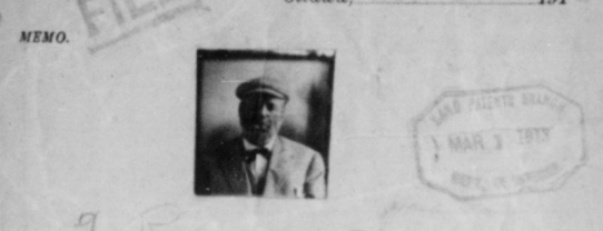
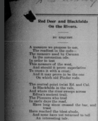
The files can contain additional documents such as inspector’s reports, witness affidavits, records of abandonment, handwritten letters, court proceedings, wills, naturalization, and even poetry and pictures.

photo of poet

poem

The above images are of the poet and poem found in the same file. Although this is by far not what the typical file looks like, until you look at the file you will never know what type of information you can find! If you want to learn how to use the Alberta Homestead Index for research keep an eye out for our next blog post.

Blasting Powder Cans

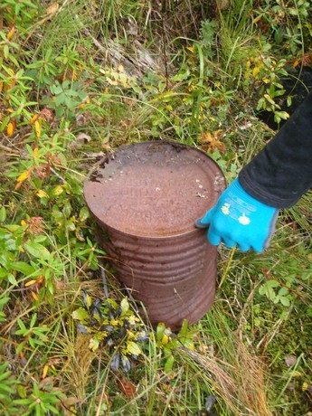
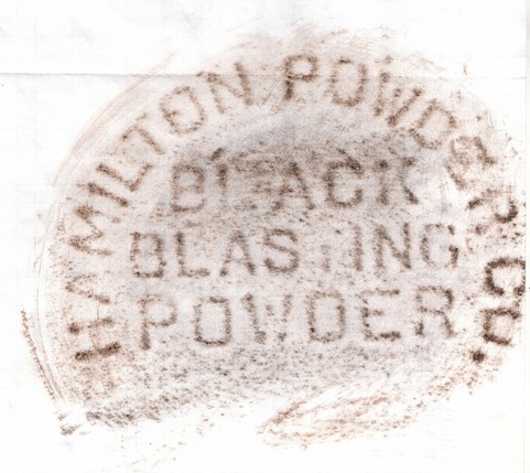
Here is an example of a unique artifact type – it is a large metal can that once contained blasting powder. We often find these cans associated with the old historic railways found throughout the province. This particular can has an inscription on the base which helps us to identify the contents of the can. In this case it also has the name of the producer. This information can help us to narrow down the age of the can.

black blasting powder
This is a rubbing from the base of the can, it sure makes it easy to identify what the can once held.

12 Foot Davis

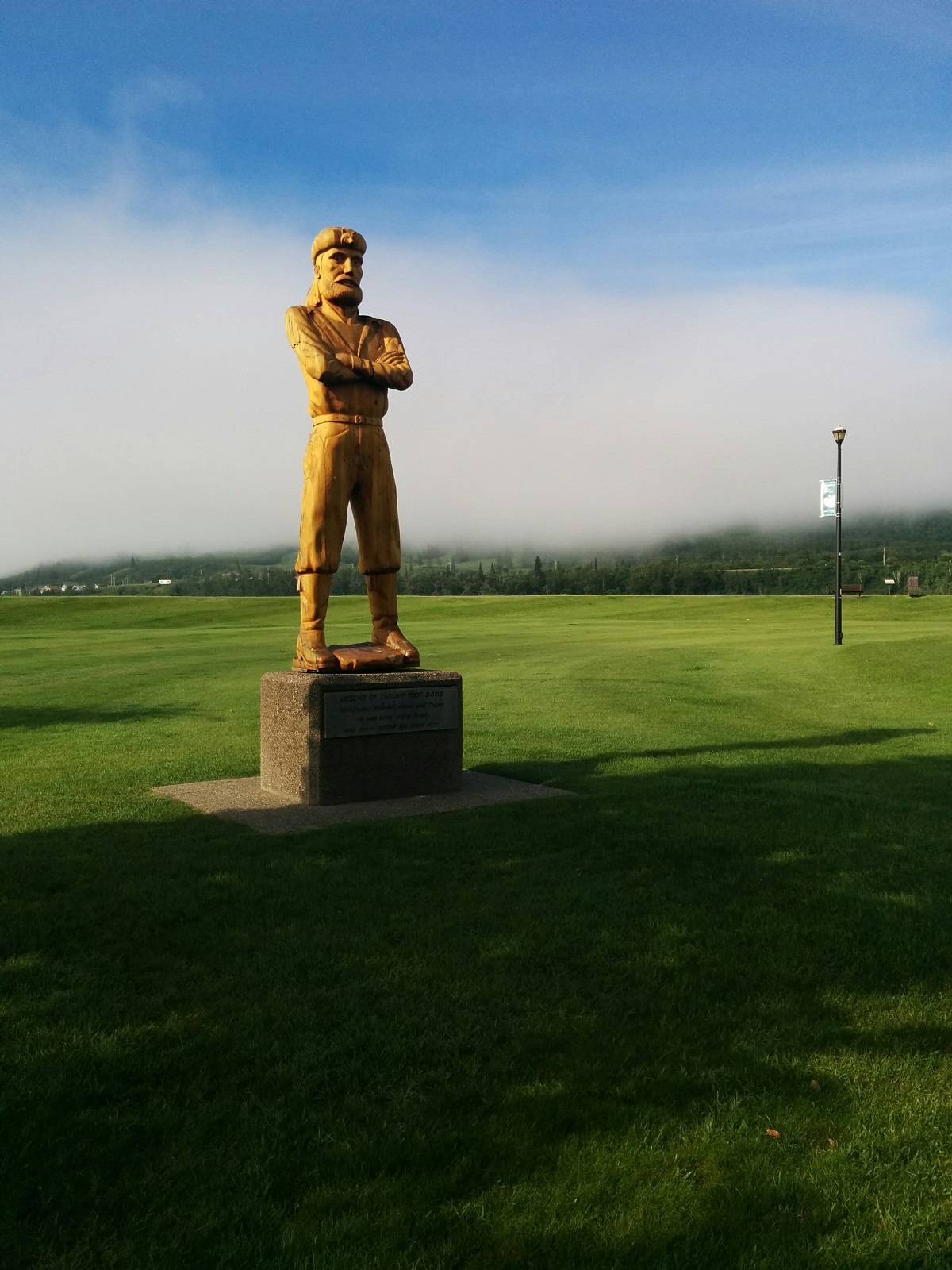
When we get the chance we like to get to know the communities that we work in and around. One day last year after finishing work in Peace River, we stopped at the 12 Foot Davis memorial site. Henry Fuller Davis earned his nickname not because of his height, but because of a 12 Foot gold claim in Northern B.C. This claimed gained between $12,000 and $15,000. This new found wealth helped him to establish his role as a fur trader on the Peace River. Based out of Fort Vermilion in 1886, he traded in opposition to the Hudson’s Bay Company. Eventually in accordance with his wishes, he was buried in a location overlooking the town of Peace River.

For more pictures and directions to the memorial and scenic picnic area please visit the website below

http://mightypeace.com/places/sights-experiences/12-foot-davis-site/