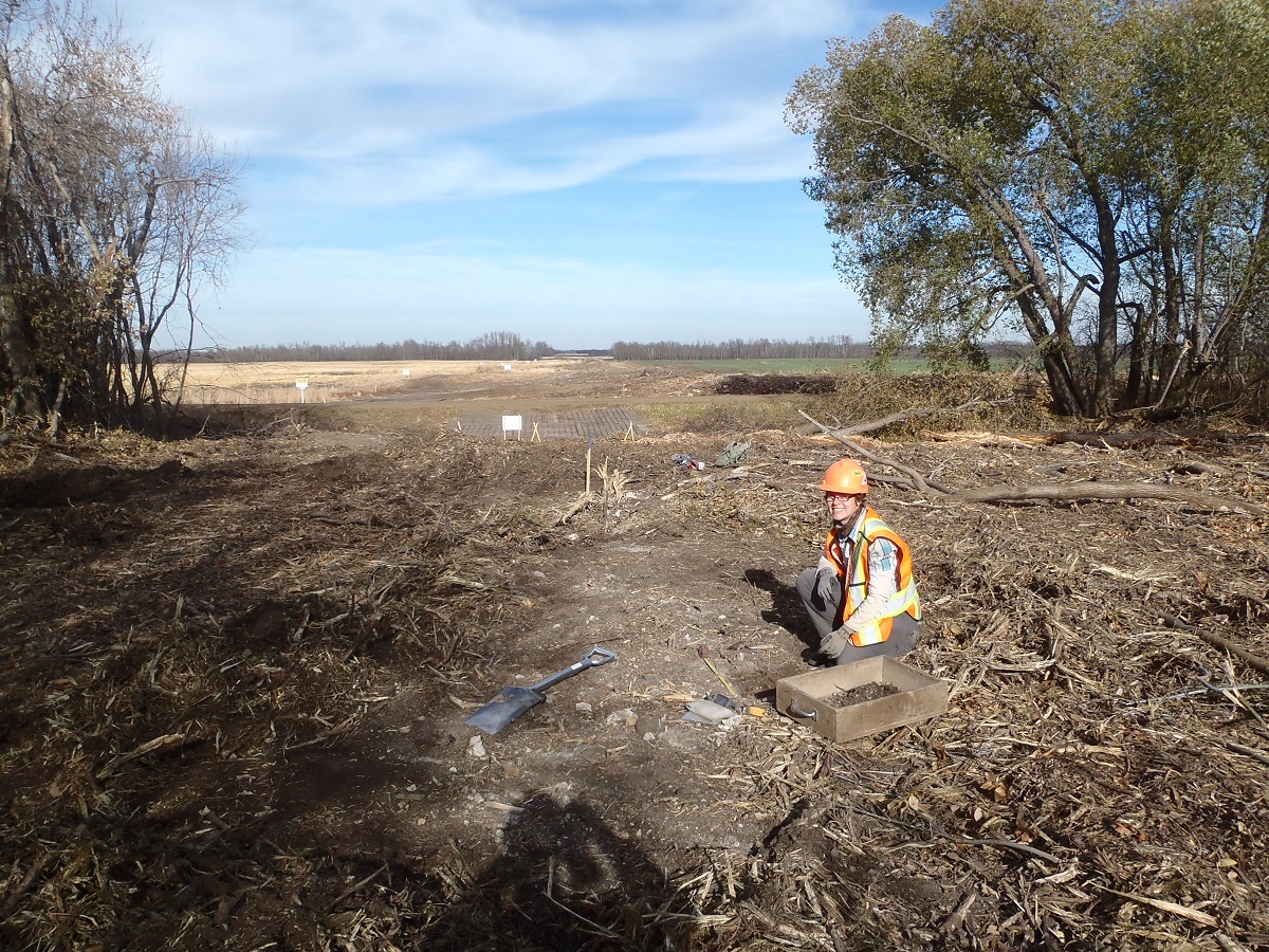
In 2013 Tree Time archaeologists got a chance to work on a relatively rare type of historic period site in Alberta: a historic schoolhouse. The Kolomea school site was brought to the attention of Tree Time Services by construction personnel for a transmission line project. The site consists of three concrete foundations surrounded by non-native bush. Local informants identified the foundations as a school, a teacher’s residence and a stable where students’ horses were housed during school hours. The school served the nearby Ukrainian community and was named Kolomea after a region in Ukraine.
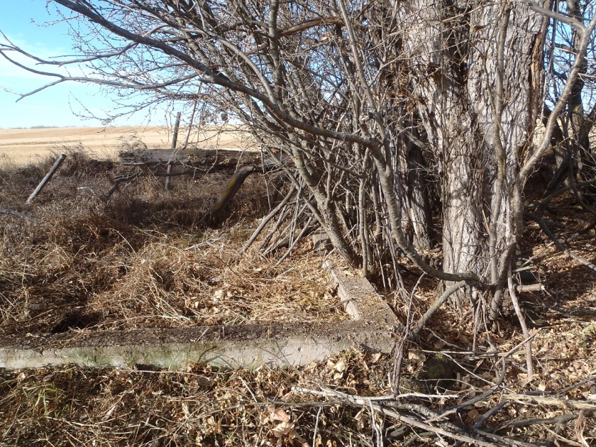
Concrete foundation identified as the teacher’s residence.
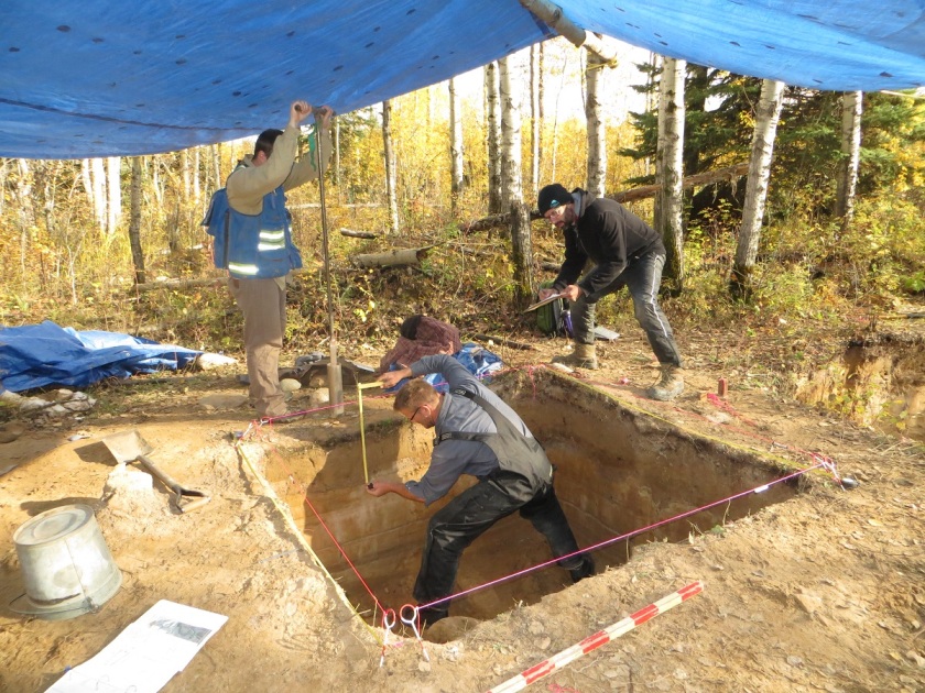
Tree Time undertook investigations at the school with the goals of assessing if the site was a historic resource; confirming the function and age of the foundations; determining the significance of the site to the surrounding community and to the province, and making recommendations regarding future management of the site. These normal objectives of Historic Resource Impact Assessment were complicated by the fact that construction had already started, and the site was partially inside the transmission line right of way.
To confirm the function and age of the foundations we referred to archival airphoto searches, historic land title searches, local history books, provincial archive searches, interviews with local informants and current landowners, and conducted small test excavations.
Using the Glenbow Museum Archives School Districts Database website we were were able to perform a search by legal land description to find out which school district our site was located within. This search indicated that the site was the Kolomea school. Having the name of the school helped us to pursue the next step – an historic land title search which further corroborated what we had learned through the Glenbow Museum Archives.
Local histories and archival searches through the Provincial Archives of Alberta confirmed that a one-room schoolhouse was built at this location in 1906. These records indicated that the one-room schoolhouse was replaced with a larger school in 1929. The construction date of 1929 for the large school confirmed that the site is a historic resource. We were able to find archival photos from the 1920s of the one-room school house and one from the 1930s showing the larger school. The photo of the larger school matches the location and general shape of the large foundation currently at the site.
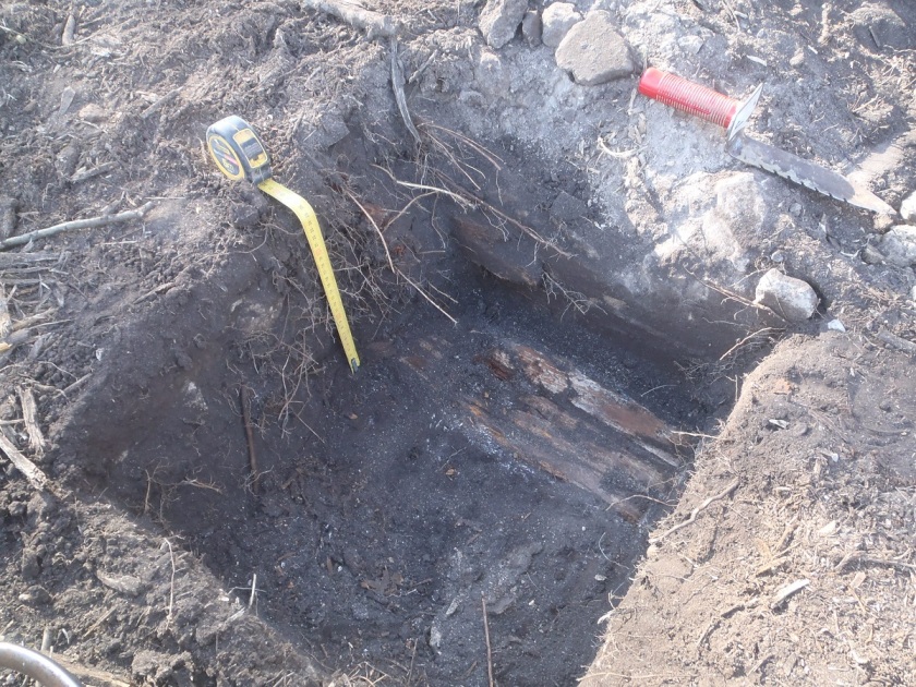
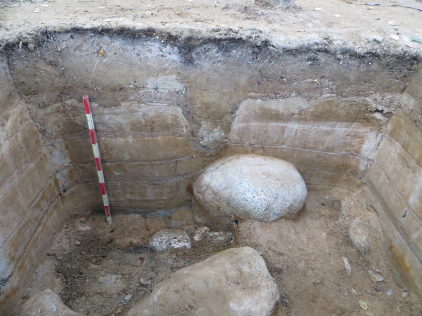
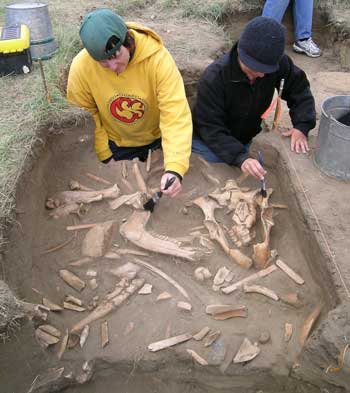
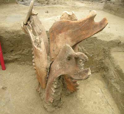
To test and corroborate the archival and historical information, and to confirm the functions of the three buildings, four 50 x 50 cm test units were excavated at each of the foundations. These excavations resulted in the recovery of historic construction debris (concrete, brick, nails, window glass), buttons, fragments of glass vessels, porcelain, clinker (slag from coal heaters in the buildings), bone (probably burned in the stoves), tin and possibly bakelite (early plastic). Excavations in the house foundation uncovered a possible floor board. At the start of the project we had identified the northernmost foundation as the barn or stable, but owing to the discovery of a potential floor board during the excavation of this foundation we determined that it was more likely the house foundation and the southwestern foundation was the stable. We were hoping to find artifacts like jacks or marbles that would clearly represent the presence of children, but we had no luck in that department.
Excavation unit with possible floor board.
Historic documents indicate that the school was closed in 1952 and the building was moved to Lavoy, AB by the Catholic Church, where it still functions as a church today. The barn was also moved from its original location but is still located on the same quarter section. The teacher’s residence appears to have been moved or demolished, but we didn’t find any records of its history. Archival airphoto searches and interviews with local informants were not successful in identifying the location of the original one-room school house. We suspect that the foundation that has been identified as the house might have been the original one-room schoolhouse which was re-purposed as a teacher’s residence when the new school was built.
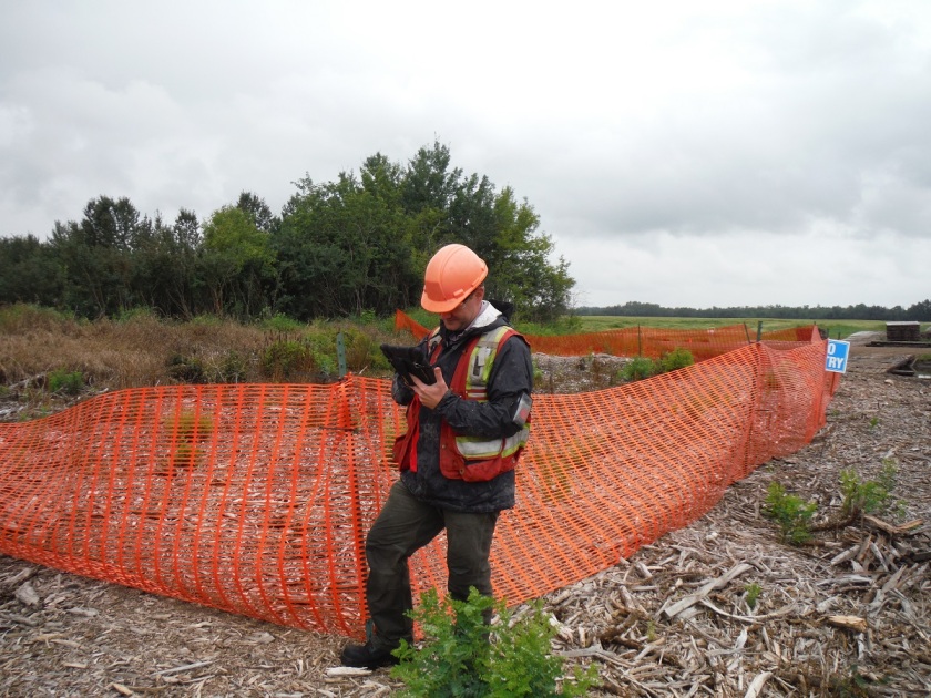
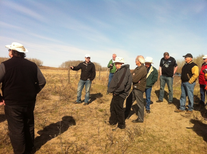
Kolomea school is a unique site that is strongly associated with the Ukrainian settlement of northeast central Alberta and can shed light on the poorly-documented lives of rural children in the mid-20th century. While we didn’t find any direct evidence of children at the site (except a few lost buttons) further explorations at the site would likely turn up some interesting and nostalgic material. The site was protected by temporary fences around the foundations while construction was completed to avoid any accidental impacts. The government of Alberta has granted the site an Historic Resource Value of 4h,a (historic and archaeological). This means that no more development can happen at this site without archaeologists doing a lot more work here.
The stable foundation protected by temporary fencing.
As Canada celebrates 150 years since Confederation it is important to remember that the history of the land we call home goes back thousands of years. Tree Time Services staff discussed some of the most important archaeological sites in Alberta and created a top ten list. Several of these sites can be visited by the general public and a few have public excavation programs that allow volunteers to participate in the digs!
A UNESCO World Heritage site, interpretive centre, and museum located near Fort MacLeod, AB. For thousands of years the Blackfoot and other First Nations guided bison down drive lanes to the jump where they would plunge to their death or be rendered immobile from the fall and weight of the herd. At the base of the cliff these animal carcasses were butchered and distributed between the members of the hunt.
Did you know the name “Head Smashed In” does not refer to the skull crushing demise many of the bison suffered at the site but rather a Blackfoot legend? According to the story a young man wanted to watch the bison fall off the cliff from below but was unfortunately buried by the falling animals. He was later found with his head smashed in (Jack Brink pers comm).
Figure 1: The cliffs at Head Smashed In Buffalo Jump (Madeline Coleman).
Figure 2: Interpretive Centre and Jump (Madeline Coleman)
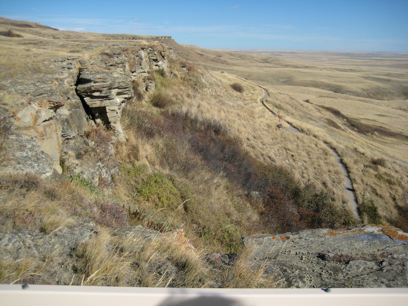
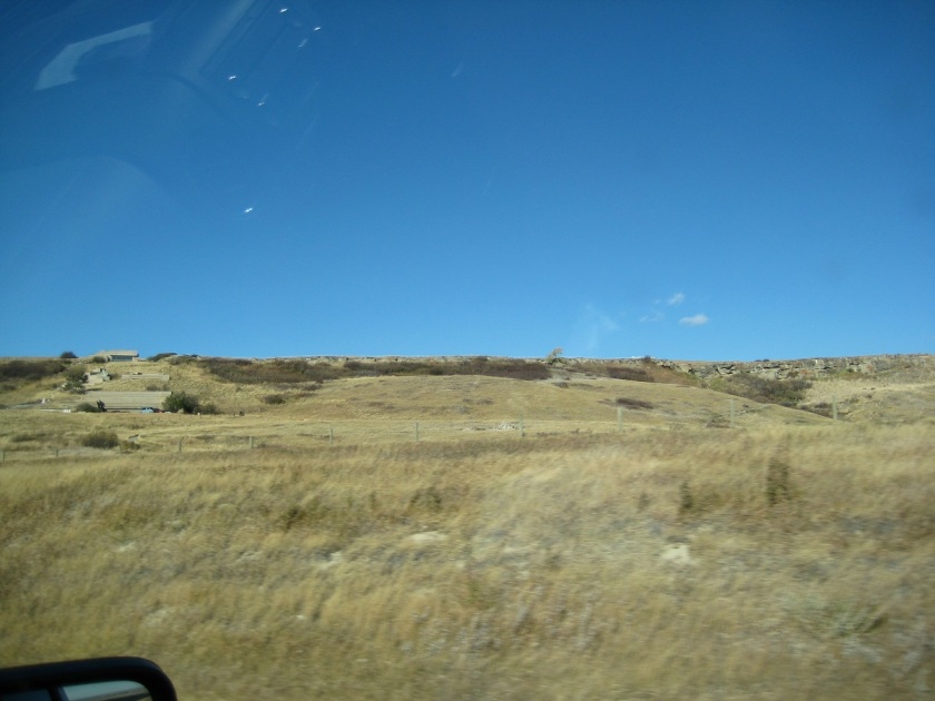
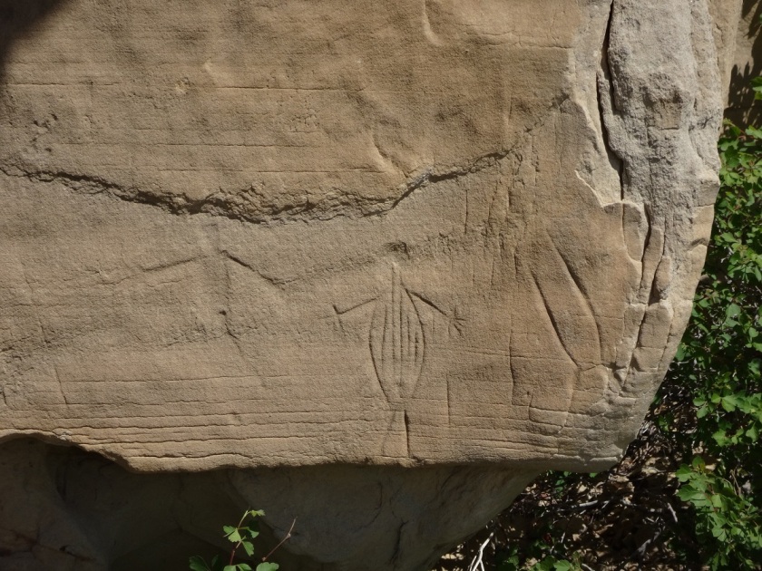
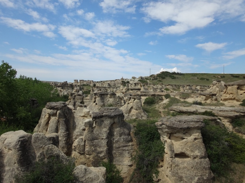
The Writing-On-Stone Provincial Park is located near Milk River, AB, almost on the Montana border. Many rock carvings (petroglyphs) and rock paintings (pictographs) can be found as one wanders through the sandstone valleys and hoodoos. These rock art sites were created by Aboriginal groups visiting the area, telling stories of battles, hunts, and great deeds of individuals. There are also many images of ceremonial nature that depict spirits and the spiritual world.
These images were likely created over thousands of years by the Blackfoot people and other native groups that travelled through the southeastern plains of Alberta. While rock art cannot be directly dated some of the images can be positively dated to after 1700 AD due to the depiction of horses and items introduced by Europeans, like muskets.
Figure 3: Petroglyphs at Writing-on-Stone Park (Vincent Jankunis)
Figure 4: View of Writing-On-Stone Park (Vincent Jankunis)
3. Quarry of the Ancestors
Located north of Fort McMurray near the community of Fort McKay, the Quarry of the Ancestors is a quarry site and the primary source of Beaver River Silicified Sandstone (BRSS), a highly valued material for making stone tools. The principal use of the site for quarrying BRSS and making stone tools was between 9800-5500 years ago.
Beaver River Sandstone is found throughout the Alberta Oilsands region which was once thought to be sparsely occupied. However, due to the ongoing work occurring in advance of oil sands extraction the region is now considered one of the most densely occupied in Northern Alberta during the thousands of years prior to the arrival of Europeans.
Figure 5: Reid Graham assisting in the excavations at Quarry of the Ancestors (Robin Woywitka)Figure 6: Profile of excavation unit, natural ice heave visible (Robin Woywitka)
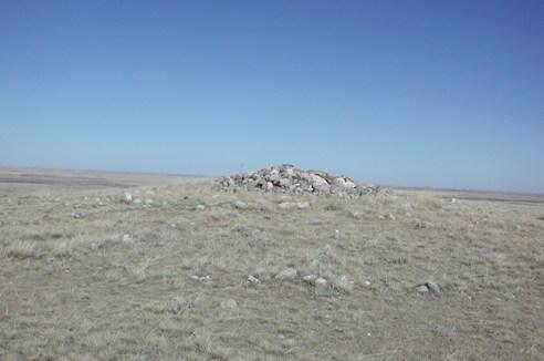
The Majorville Cairn and Medicine Wheel is an ancient Blackfoot ritual centre that shows evidence of use as early as roughly 4500 years ago, and continues to be used today. The site consists of a 9 m wide central cairn (rock pile) which is connected to a surrounding 27 m wide stone circle by 28 spokes. The site is located on a large hill west of the Bow River in southern Alberta near Bassano, AB.
Figure 7: The Majorville Cairn and Medicine Wheel (Alberta Environment and Parks)Figure 8: Aerial view (Alberta Enviornment and Parks)
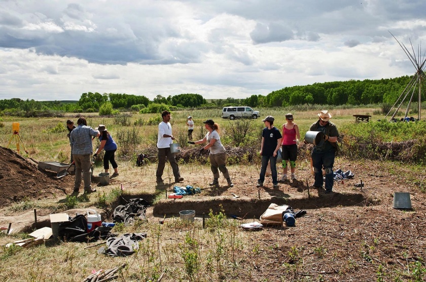
Located in the town of Bodo, on the Saskatchewan boundary half an hour south of Provost, this seven square km site is one of the largest pre-European contact archaeological sites in Canada. The site contains several repeat occupations of the area, with large intact bison pounds and campsites. Tens of thousands of bison bones have been recovered from the site as well as projectile points, scrapers, and pottery sherds.
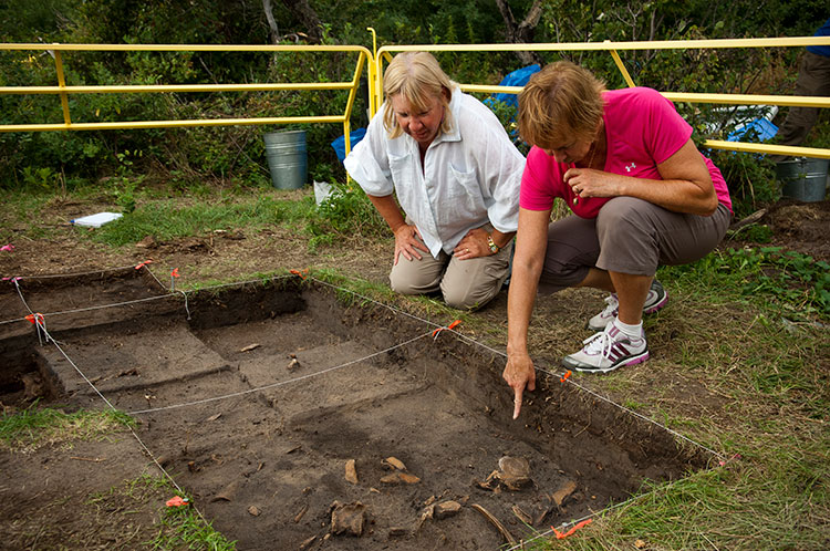
Unlike many of the other sites on this list, this site encourages visitors to get down and dirty and help uncover Alberta’s past. The Bodo Archaeological Society allows the general public to dig at the site under the supervision of professional archaeologists. The site was also the subject of Tree Time’s own Kurtis Blaikie-Birkigt’s Masters research!
Figure 9: Kurtis Blaikie-Birkigt discussing the excavations at Bodo during a visit to the site by the Archaeological Society of Alberta in 2014 (Corey Cookson)Figure 10: Volunteers excavating at Bodo (Christie Grekul)
6. Wallys Beach
This ice age kill and butchering site is located in southern Alberta at the St. Mary’s Reservoir near Cardston, AB. The site contains the bones and footprints of extinct animals, including the North American horse and camel, as well as mammoth and caribou. Wally’s Beach was one of the first sites in North America containing evidence of hunting horses.
Originally thought to date to the beginnings of the Clovis era (ca. 13,000 ya), advanced radiocarbon dating techniques now dates the site to approximately 13,300 years ago.
Figure 11: Butchered camel remains at Wally’s Beach (Brian Kooyman / University of Calgary)Figure 12: Mammoth tracks at Wally’s Beach (Brian Kooyman / University of Calgary)
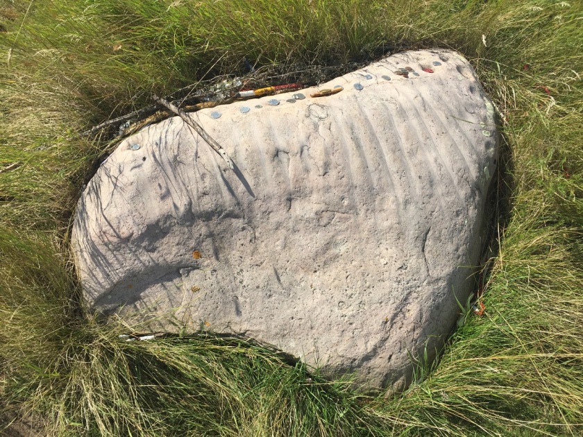
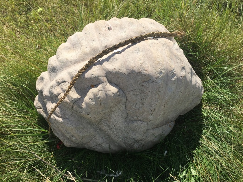
Located approximately 11 miles east of Viking (southeast of Edmonton) are the Viking Ribstones, two large quartzite boulders on top of a high hill. The boulders are carved with a series of grooves interpreted as a representation of a bison vertebrae and rib cage. There are also several circular pits grooved into the boulder which may represent arrow or bullet holes. The pits have also been interpreted as an attempt to recreate the pock-marked surface of the Iron Creek Meteorite, another revered monument.
The bison were extremely important for many First Nations of central and southern Alberta and these rock carvings may have served as a shrine or ceremonial location. Hunters would visit the ribstones to leave offerings of sweetgrass, tobacco, beads, or coins prior to and/or after a successful hunt. There are other ribstone sites in Alberta but all other ribstone sites have been disturbed or removed entirely from their original context.
Figure 13: View of Viking Ribstone and offerings (Corey Cookson)Figure 14: View of Viking Ribstone and offerings (Corey Cookson)
8. Banff Pithouses
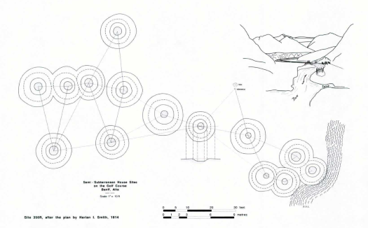
The Banff Pithouses were located along the Bow River and are now lost to the expansion of the Banff Springs golf course in 1928. Documented in 1913 by Harlan Smith, an early archaeologist in the province, the site is one of the first pre-European contact sites to be preserved in Canada. The site contained 14 large (8-10 feet across) circular depressions (1-2 feet deep) with nine of the depressions arranged in an irregular line.
These semi-subterranean houses are common in the British Columbia interior plateau region but are rare in Alberta. The group that built these homes likely crossed the continental divide to hunt bison. For a period of time this was the only site of this type identified in Alberta. Fortunately, several other housepit sites have now been identified in Banff National Park and are currently being researched.
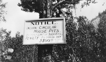
Figure 15: Notice announcing the semi-subterranean house sites located between Mount Rundle and Bow River, Banff, Harlan I. Smith, 1913 Canadian History Museum, 24014Figure 16: 1913 Blueprint of housepits on golf course (LAC RG 84, Vol. 2073, File A4128-1, Vol. 1 Redrawn by R. Lalonde)
An unusual site for the Southern Plains, the Cluny fortified village is located in the valley of the Bow River on the Siksika First Nation Reserve south of Calgary and is part of the Blackfoot Crossing Historical Park. At the site, dwellings made from logs and earth were surrounded by defensive features including a palisade wall and trenches.
The Cluny Fortified Village site dates to the Late Pre-contact period (Mid 1700s) where the First Nations of the Canadian Plains had not yet had direct contact with explorers of European descent but had access to European goods through trade with other First Nations groups. It is believed that the group that constructed the village migrated to the region from the Dakotas, due to similarities of artifacts with those of the Middle Missouri region. The University of Calgary will be hosting a public archaeology program from May 23rd to June 23rd, 2017 where people can volunteer to excavate at the site. Contact their administrative staff by e-mail at pubarky@ucalgary.ca, or by phone at 1-403-220-8537 for more details.
Figure 17: Aerial view of the Cluny earthlodge village (Harrison Boss)Figure 18: Volunteers and students excavating at the site in 2012 (University of Calgary)
10. Fincastle Kill Site
Recently named one of the top discoveries of 2015 by Western Digs, the Fincastle site is located in the sand dunes of southern Alberta, near Lethbridge. The 2,500 year old bison kill site contains over 200,000 fragments of bone along with hundreds of stone projectile points representing two cultural groups: the Besant and Sonota.
The most interesting aspect of the site is the discovery of 8 upright arrangements of bison bones placed in sculptural patterns. These are unusual and rare in archaeological sites and the purpose of the upright features remains a mystery. Dr. Shawn Bubel of the University of Lethbridge notes that the bone arrangements are not utilitarian but were intentionally placed in patterns with unique examples of one upright, for example, features a tibia, or lower leg bone, surrounded by four jaw bones, all set on end with the teeth facing outward.
Figure 19: Students excavate a small section of Fincastle bison-kill site (Shawn Bubel)Figure 20: One of the eight arrangements of bison bones standing on end (Shawn Bubel)
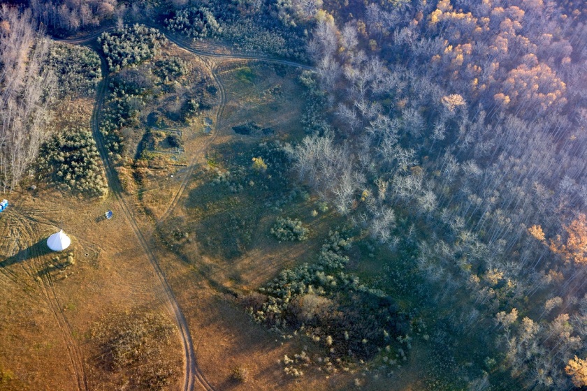
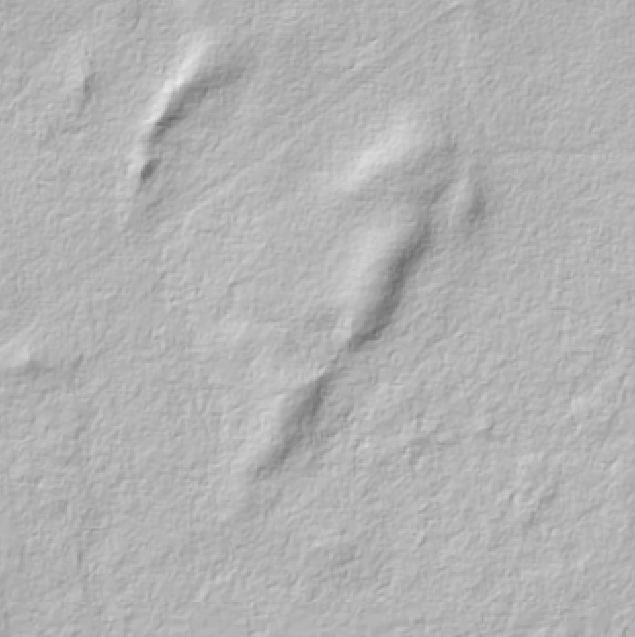
In recent months, news feeds have been erupting with stories of “Lost Maya Cities discovered using LiDAR”, “revealing the secrets of Stonehenge using LiDAR”, “LiDAR uncovers ancient city near Angkor Wat”, and the popularity of “space archaeologist” Sarah Parcak, but this technology is not limited to finding the remnants of “lost civilizations” in far reaching corners of the globe. LiDAR is used by archaeologists in Alberta to assist in the locating of potential archaeological sites that are threatened by development.
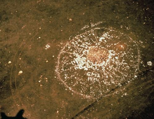
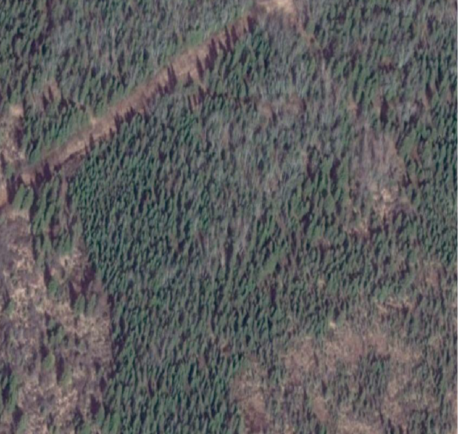
Light detection and ranging (LiDAR) is the process of mounting a laser on an aircraft and bouncing light pulses off the ground and measuring the time it takes for the laser to return. The process can take 2000-5000 measurements per second and makes the surface appear treeless, revealing surface features that cannot be seen using simple satellite imagery or aerial photos (Figure 1). However, using LiDAR to find archaeological sites in northern Alberta is not as easy as it can be in other parts of the world. LiDAR is great for identifying building structures, walls, and other features common of archaeological sites in other parts of the world. In northern Alberta these features are absent from Indigenous archaeological sites. To study the human history of northern Alberta prior to European contact we have to look at the landscape and identify landforms that would have been suitable for camping and hunting activities.
Figure 2. Satellite imagery of ridge overlooking marshFigure 3. LiDAR hillshade of the same ridge
In the above images, the first image is a satellite image of a ridge where we found an archaeological site (Figure 2). With just satellite imagery the area appears to be predominantly flat which is not a good area to camp or hunt. This is because the area would be thought to be poorly drained and with limited visibility of the surrounding terrain. When using LiDAR imagery (Figure 3) we notice there is a complex of distinct hills and ridges that would be ideal for making camp.
This technology has revolutionized the process of finding archaeological sites in Alberta and is revealing more about the history of people in the boreal forest. The ability to pinpoint the best landforms without having to do extensive on-the-ground survey has greatly increased the inventory of sites found in northern Alberta. This benefits our clients who will pay less money for the survey of their developments and we can make more accurate predictions about site locations which allow them to modify their developments to avoid potential sites.
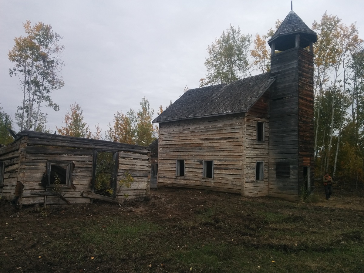
We get to do a lot of traveling around Alberta during the summer. Sometimes when time permits, we get to stop at local attractions. During a recent trip to Fort Vermilion we made a stop at St. Louis Catholic Church in what is locally referred to as ‘Buttertown’. This church was built in 1906-1909.
Check out the Fort Vermilion Heritage Center website for more information about the church and other attractions in the area
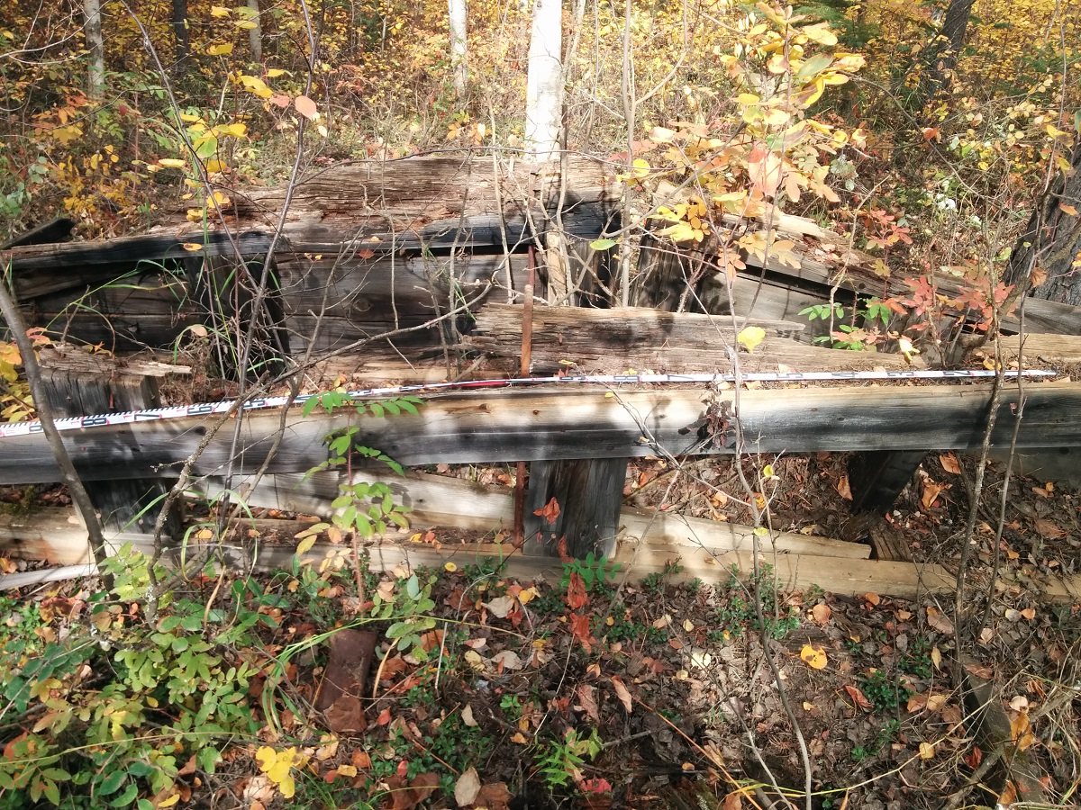
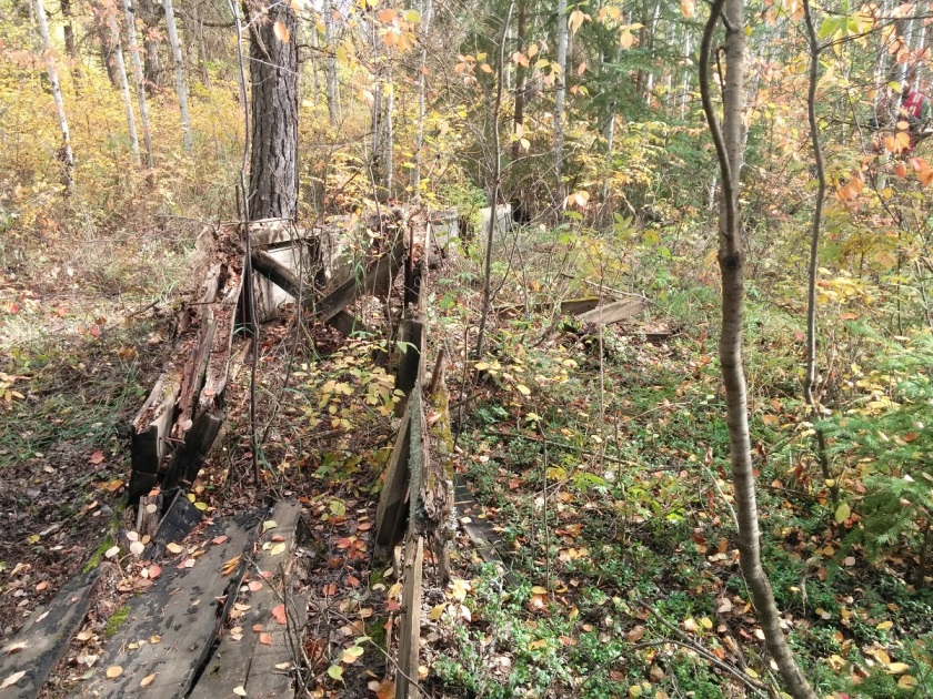
The most common wooden structure we find in the forest are cabins. However, once in a while we find something a little bit different. During a recent trip to Fort Vermilion, we found what we think could be an old ferry.
On Friday, April 15th at 7 PM Tree Time Services Sr. Project Archaeologist Kurtis Blaikie-Birkigt will be presenting at the High Prairie and District Museum on ongoing research on Deer Mountain, Alberta. On the weekend, Tree Time will be at the High Prairie Gun & Sportsmen’s show with a display of artifacts and replicas to help identify your finds.
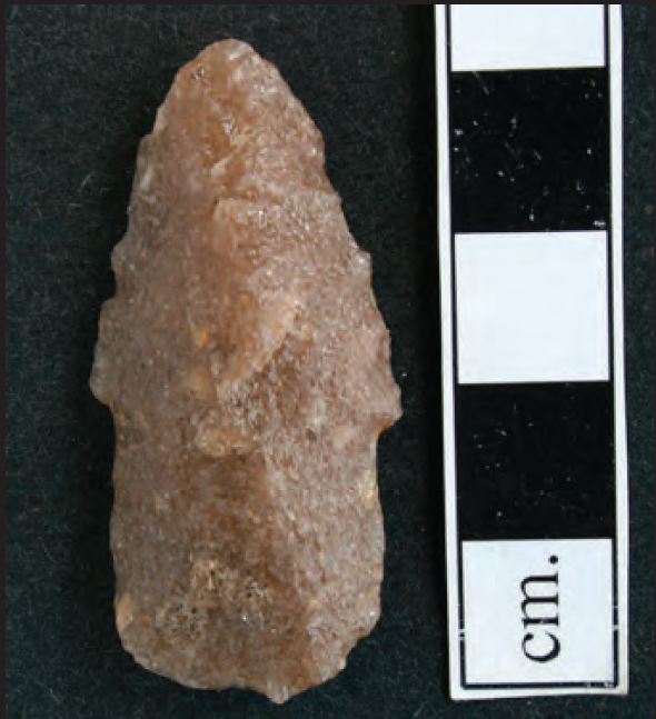
Figure 1. Stemmed projectile point found by Darryel Sowan of Swan River First Nation during archaeological survey by Western Heritage Services for Alberta Plywood Ltd. (From Cloutier, 2006. Courtesy of Western Heritage Services)
Early archaeological research on northern Alberta was focused on big lakes. Large campsites were found on major lakeshores and were assumed to be related to seasonal fisheries. It was assumed that past people’s hunting forays into the hills and hinterlands wouldn’t have left much of an archaeological trace. When we started doing archaeological surveys for forestry cutblocks in 2001, we didn’t expect to find very much. The typical sites we’d find would be small scatters of stone chips and flakes left from making stone tools like arrowheads. Even those sites were almost always very close to major streams or other waterbodies.
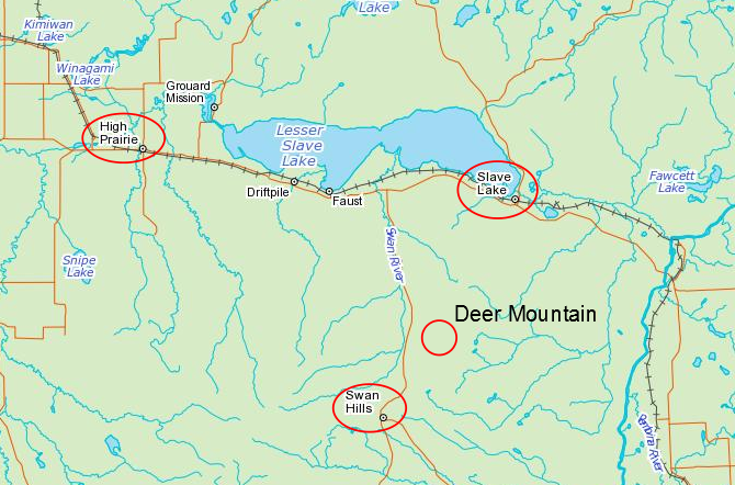
Figure 2. Location of Deer Mountain. Note the distance from major waterbodies.
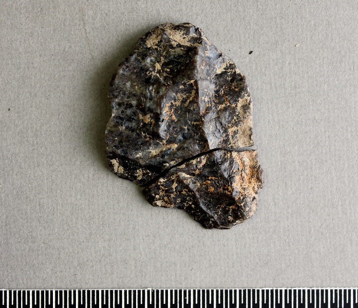
In 2005, I was part of a crew that did some pre-harvest archaeology surveys for Alberta Plywood on Deer Mountain (Figure 2). Earlier surveys had found a few sites there, more than would be expected in a place so far from major waterbodies. Even knowing there were sites there, our findings in 2005 surprised us. We found quite a few sites, they were richer than expected, included a unique local stone called Grizzly Ridge Chert (Figure 3), and we found a spear point similar in style to ones that date to 8000 years ago (Figure 1). Deer Mountain was an unusual place, archaeologically speaking, and was very eye opening to me.
Figure 3. Grizzly Ridge Chert retouched / utilized flake found on Deer Mountain in 2015.
Last year, I got to revisit some of the same areas for Alberta Plywood, with the benefit of another 10 years of experience, high resolution LiDAR imagery, and significant improvements in survey and site evaluation methods. We found more sites, bigger sites, and more interesting sites in places we didn’t even think to look in 2005. I came away with an even greater appreciation for how interesting Deer Mountain is, and for how much I’ve learned over the intervening years.
In this talk, I’ll touch on careers in archaeology, archaeological methods, how industry and government manage risks to archaeological sites, and a really interesting area in Alberta archaeology that’s barely been studied.
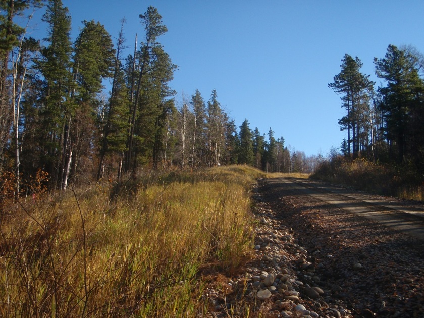
Figure 4. View to significant site GfPt-3 on Deer Mountain.
References:
Cloutier, Riel
2006 Heritage Evaluation of West Fraser Slave lake (Alberta Plywood Ltd. Division) 2005/2006 Annual Operating Plan Forest Harvest Developments, Slave Lake, Alberta. Archaeological Research Permit No. 2005-378. Report on file, Archaeological Survey of Alberta, Edmonton.