Cabin in the Woods

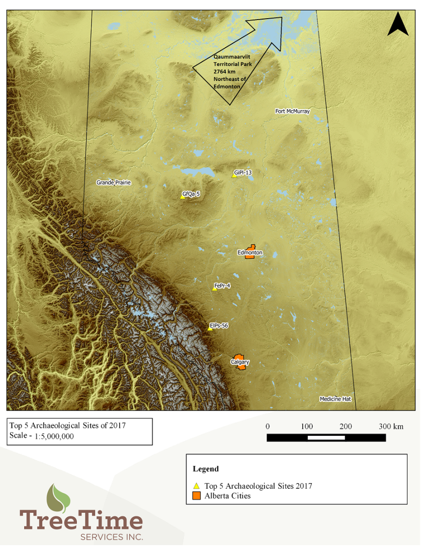
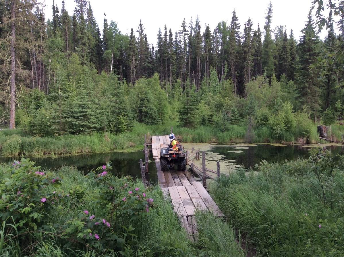
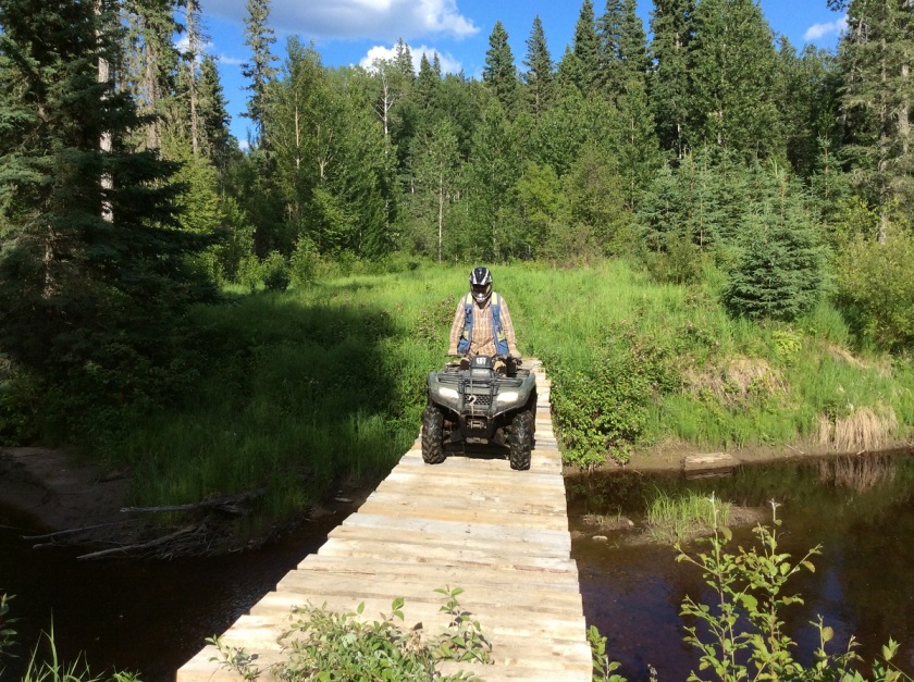
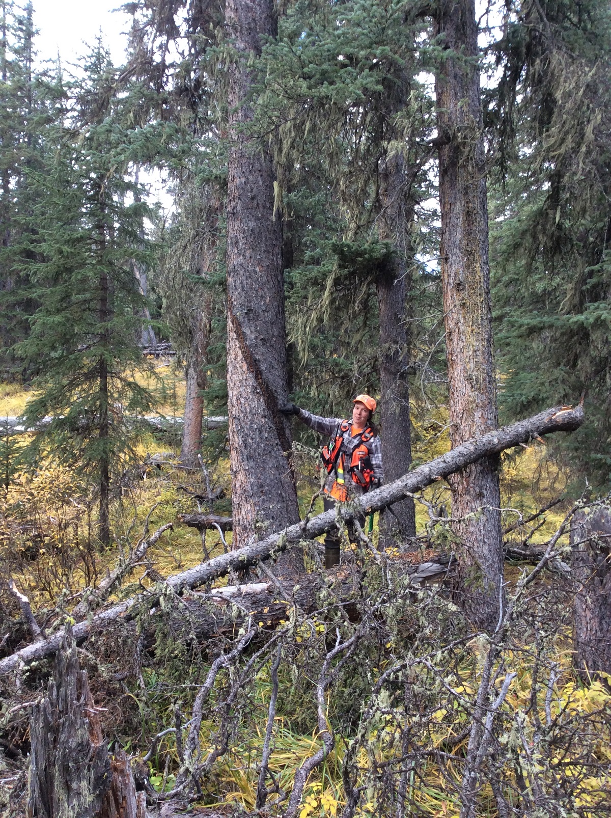
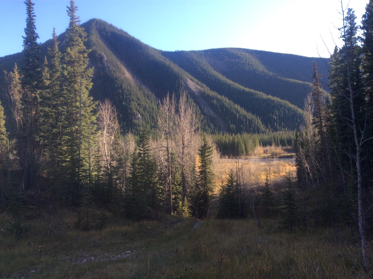
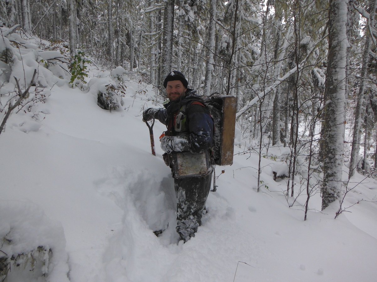
One day last fall, Vince and I went to revisit an old cabin that had been found deep in the Swan Hills. This cabin had been found during an historic resource impact assessment back in 2009, and we just need to check to make sure that the new harvest block was going to avoid the site. The cabin, GfQa-2, was located on the tip of a narrow point along the East Prairie River valley, approximately 60 km south of Driftpile, Alberta.

IMG_20170930_135614 - Copy
Looking out over the Swan Hills

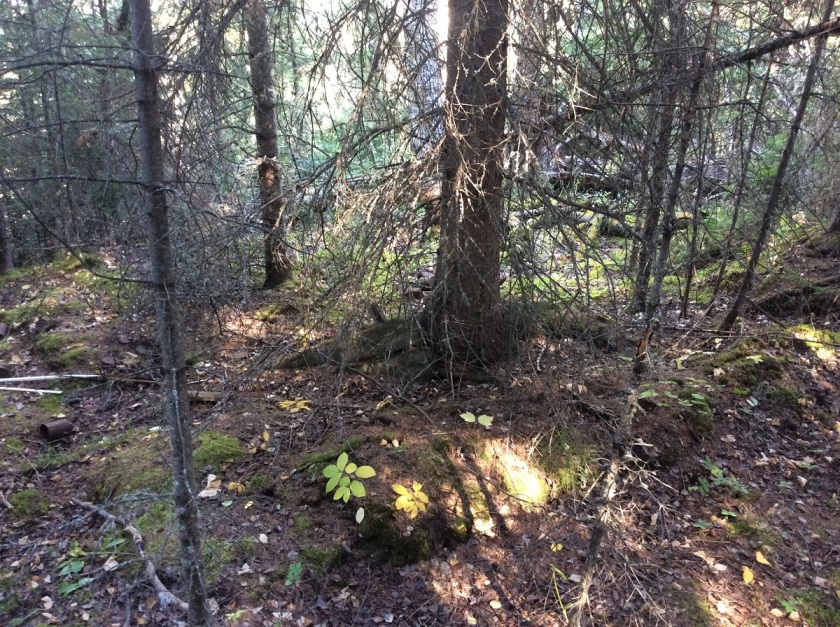
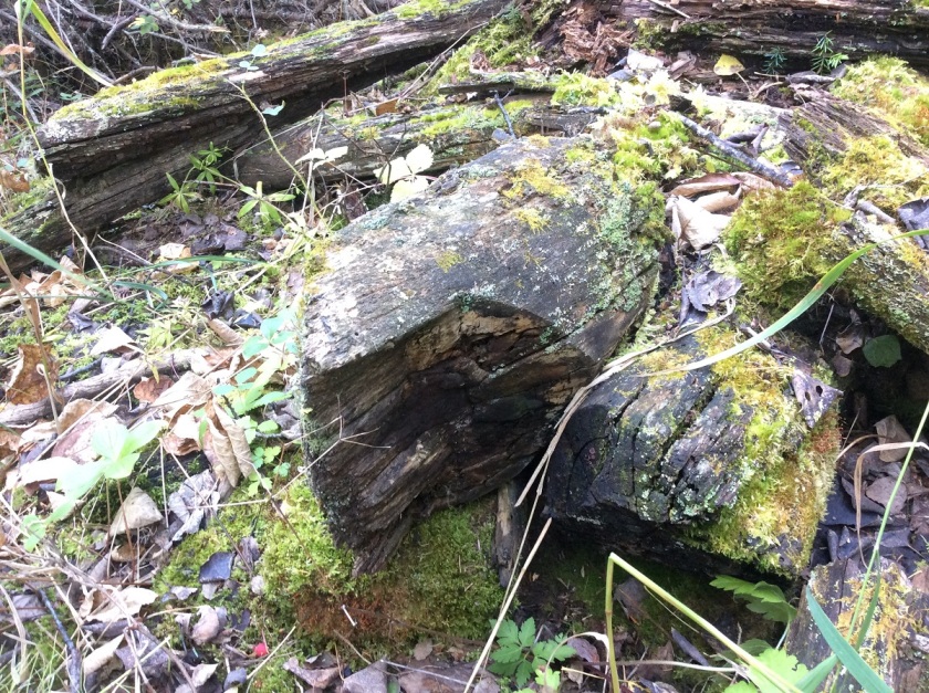
After a long hike through dense fir, we finally reached the recorded spot for the cabin. Unfortunately, there wasn’t much of a structure to see on the surface. It took us a few minutes to find the 5 by 5 meter square outline of the cabin foundations, right on the river valley edge. It was hard to see as there was only one course of saw-cut logs remaining from the walls and even these were covered in a thick layer of moss and lichen. The cabin had been collapsed for so long that even a large white spruce tree was growing over one of the corners.

cabin remains - Copy.jpg
Remnants of the cabin walls at GfQa-2, with a white spruce tree growing over the corner
logs - Copy
Hand-cut logs used in the construction of the cabin

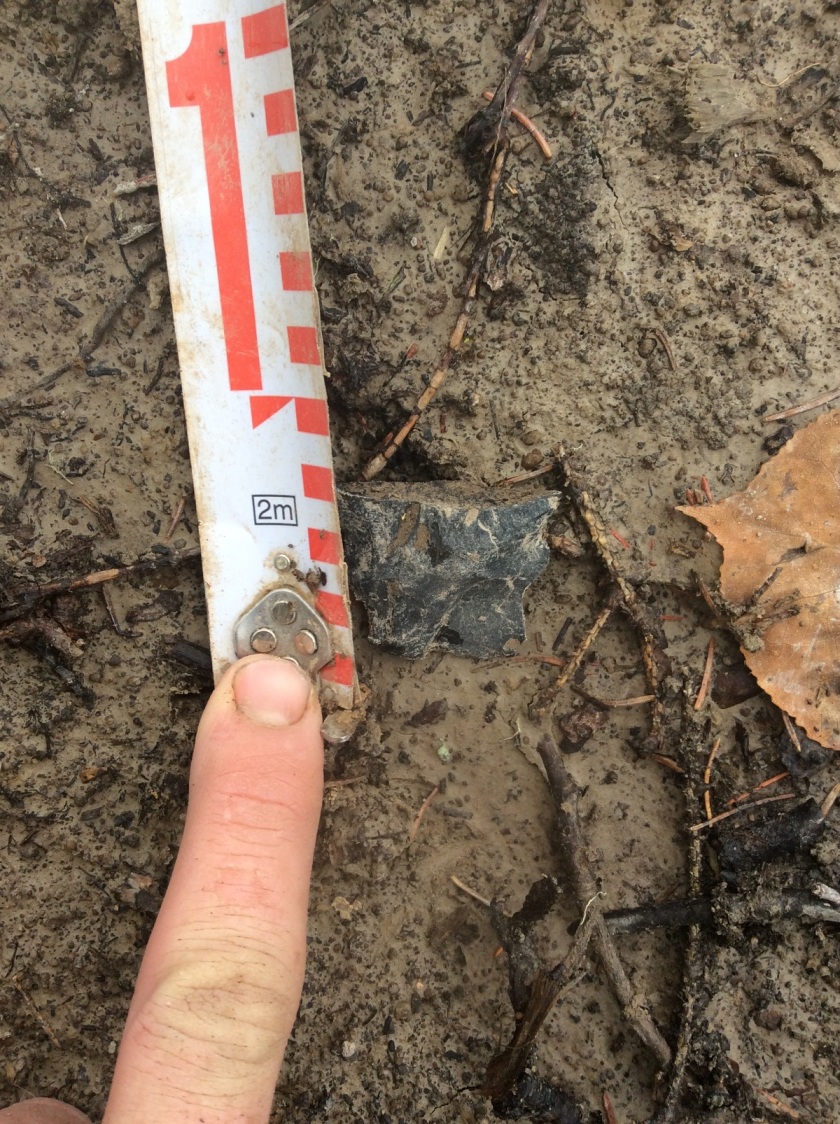
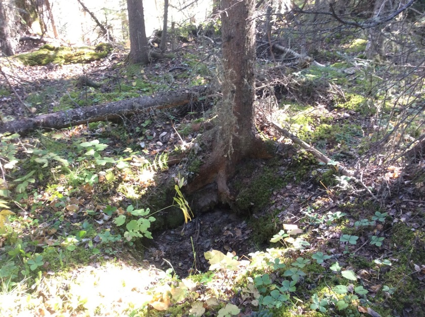
We also noticed two small pits near the cabin walls. The smaller of the two pit features (roughly 1 m in diameter and 60 cm deep) was about 15 meters southeast of the cabin. The second larger pit (2 by 1 m and 60 cm deep) was location a few meters northeast of the cabin wall. We couldn’t find any artifacts in these pits, but we concluded that the smaller pit was likely the privy and that the bigger one may have been some type of root cellar.

IMG_1617 - Copy
The smaller pit, right up against a small white spruce tree

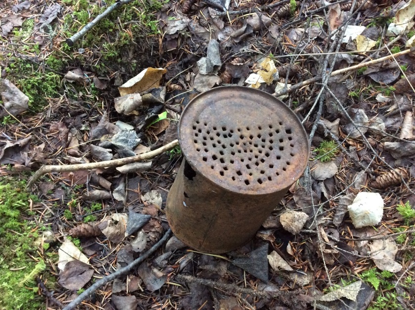
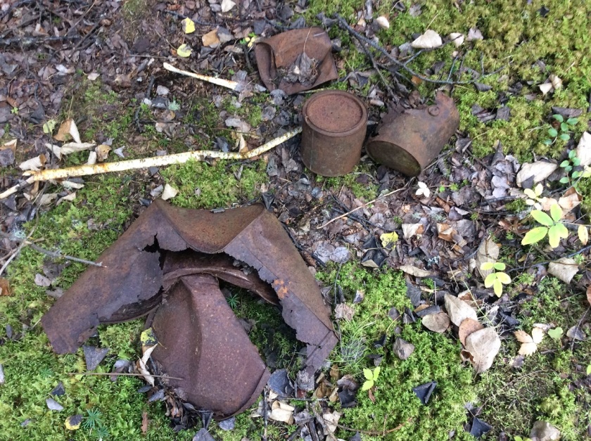
In contrast to the cabin itself, it was much easier to find the piles of historic artifact around the cabin entrance. Lying on the mossy surface of the site were a number of a metal buckets, glass mason jars, and several rusted metal cans. Artifacts like these are fairly common at historic cabin sites, and at first glance, these artifacts might seem like rusted bits of garbage. However, Vince and I were actually able to find out a lot about the site by looking at these artifacts. For example, one of these cans found a second life as a strainer. The label had long since rusted off of this can so we can’t tell what it originally held, but the bottom of the can had been repeatedly punched with a square nail or metal punch. I suspect that the people living at the cabin weren’t cooking up pasta, instead this can may have been used to wash berries or any number of small food items.

IMG_1609 - Copy.JPG
Can with perforated bottom at GfQa-2

The three artifacts that revealed the most about the people who lived at the site were a set of cans with the labels still preserved. With these labels, we can identify what kinds of food products were brought to the site, and the time period when they were purchased. Certain important changes to labeling laws, like the introduction of the metric system in 1976, can help us to determine age brackets for an artifact (Must be younger or older than X date). Certain styles of labels can also help us to isolate a time period (like a ‘Phantom Menace’ commemorative Pepsi Can that could only date to 1999). By comparing the artifacts to preserved examples of different branded products, we can begin to isolate when this historic cabin was occupied. Unfortunately, the labeling style of different brands that were used in the past has not been well documented, so it is difficult to precisely date a can, even when there is a label.

sugar can - Copy
On the left a can from GfQa-2, on the right a can of Roger’s Golden Syrup from the BC Sugary Refinery (Kneehill Museum, Three Hills AB).  The details on the building are slightly different, but the company name is still largely preserved along with the red strip around the top.

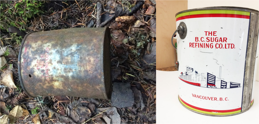
The first can we identified was a 20 lb can of Roger’s Golden Syrup from the BC Sugary Refinery. This company began the production a variety of sugar-based products in 1891 and we still buy Roger’s Sugar products today in our grocery stores. There is no date listed on the can but the style of the label seems to match examples of preserved cans from the 1940’s and 50’s.

klim - Copy
On the left an artifact from GfQa-2, on the right a preserved Borden Company Klim can. Note the similar type font and printing at the bottom and the similar corners on the label background. One difference is that the preserved label was green as opposed to brown, but it might just represent a different manufacturing period or that the colour has faded from brown to green over time.

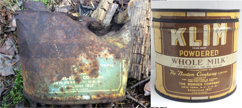
The second can that we were able to identify was a tin of Klim from the Borden Company. Klim is a brand of powdered or condensed milk, that was extremely popular throughout the 1900’s. Originally produced by the Merrell-Soule Company in New York, Klim was marketed with the slogan, “Spell it Backwards’. In 1927, the brand was purchased by the Borden Company and remarketed as a Borden Company product. We can only see part of the label on the artifact preserved at the cabin, but the type font and labeling matches other examples of Borden Company Brand Klim. The Klim brand now belongs to Nestle, who continue to produce Klim powdered milk products around the world.

IMG_1603 - Copy
Unidentifiable can

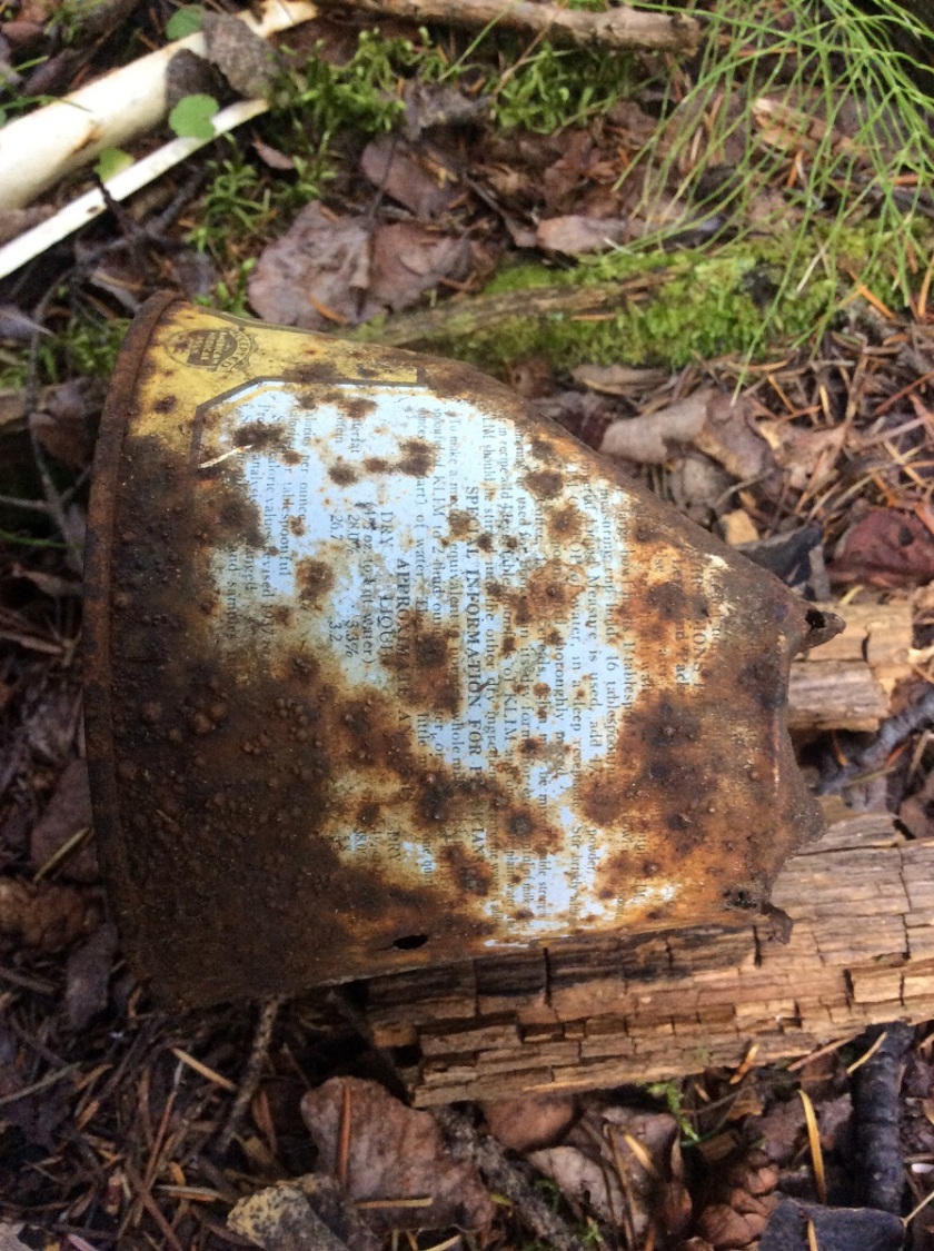
The third can was the most difficult to identify, as most of the label has been covered with rust and the company name was not preserved. It does seems, however, that this is another can of Borden Company Klim. This is largely based on the shape of the label border and the colour of the can, which is similar to the front of the other preserved label. There was a fair bit of interesting material to read on this label. There is a seal of approval from the American Medical Association (bottom left of label). In 1929, the American Medical Association started a committee to approve the quality and safety of infant formula and other food products. Similarly, one portion of the label reports that the product adheres to the 1937 standards for caloric values. Throughout the 1930’s in Canada and the United States, there was a large push to create a framework for people to maintain optimal health, as well as to combat false or inaccurate claims for food products. The instructions printed on the can also list how to best mix the Klim with water or coffee, as well as a set of special information for physicians to make the equivalent of whole milk. So based on this, it seems likely that this was a can of Klim, produced some time after 1937.

Looking around at the other type of cans we found at the site, a number of them have a similar size and design to the Rogers Golden Syrup container, as well tins of Klim. It seems then that the owner of the cabin had a bit of sweet tooth when it came to their meals. Another intriguing possibility is that the Klim and syrup were used for baby formula, as these are common ingredients in early 20th century baby formulas. During the 1930’s through 1960’s, it was common for mothers to mix powdered milk with honey or syrup to used as infant formula. This was a practice that was recommended by many doctors at the time as the mixture was fattening, even though earlier condense milk products during this period lacked any significant amount of nutrients or minerals (These were added later once doctors realized that we need them to survive). So we might be seeing evidence that a family was living at this cabin, but it is hard to say conclusively that this was the case.

IMG_1593 - Copy
Examples of other cans found at the site. Most are similar in size to the syrup and Klim cans. We also found a broken tape measure from the archaeologists who found the site, circa 2009!

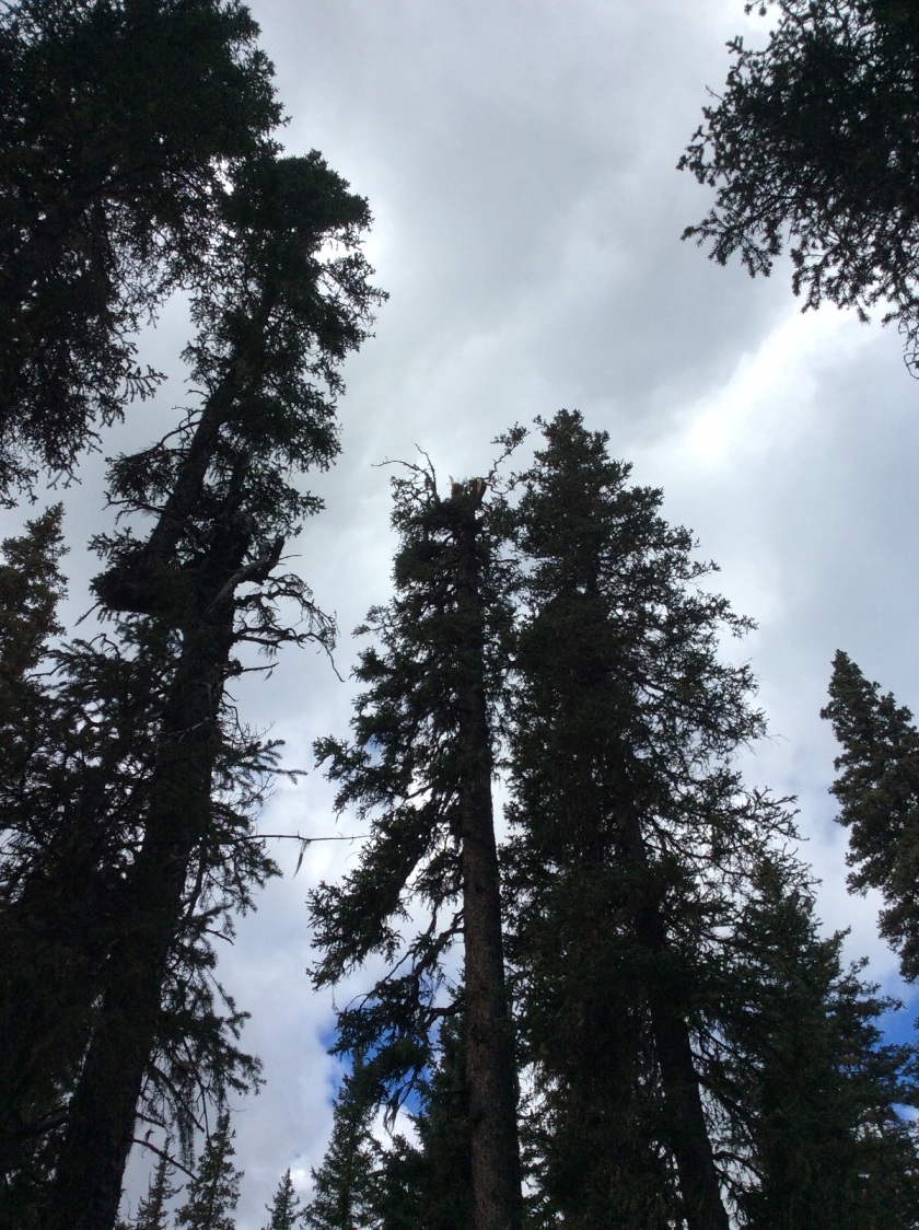
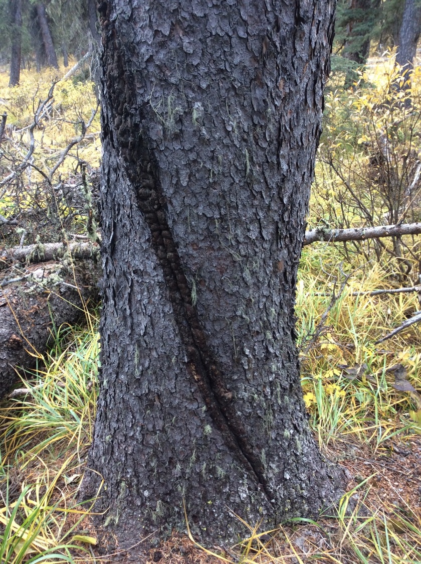
Based on the kinds of artifacts we were able to identified, we can reasonably guess that the cabin was built some time after 1937 and probably used during the 1940’s or 50’s. But how long did people continue to live at the cabin? The structure is largely gone, so we know that it has been left for some time. However, it is hard to know how long a place has been abandoned. Historic structures can often go through different phases of use, from a permanent residence to a seasonal home or travelers rest stop. One way to determine this is to look at the local vegetation and see how much has grown over the site. At this site, there is a dense growth of balsam fir and white spruce over the site, so it appears to be abandoned for some time. There was also one particularly large white spruce with a diameter of about 30 cm, growing over the south corner of the cabin. This is the perfect situation to determine the amount of time since the cabin was abandoned, because that tree could only start growing after the roof and walls of the cabin had collapsed. Tree growth rates vary considerably based on local conditions, but it would likely take approximately 40 to 60 years for a white spruce to reach that diameter and height. So, given what we know from the artifacts at the site, we can conclude then that this cabin was occupied some time between 1937 and abandoned some time after the 1960’s.
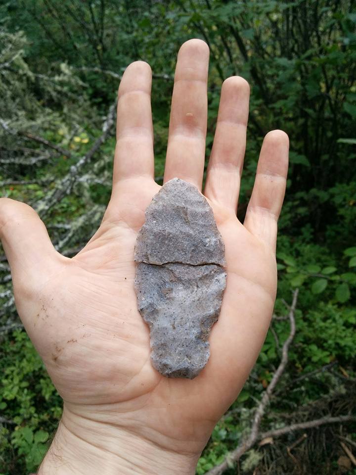
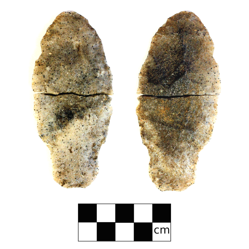
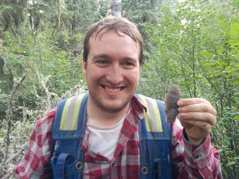
From a few cans in the middle of the forest, deep in the Swan Hills, we can get a snap shot of life from almost 70 years ago. We can see the kind of food that people were eating and what they considered important enough to carry 60 kilometers into the bush with them. Even though this little neck of the woods might seem secluded, so remote that you’d think nobody would visit, but just over 2 kilometers away from this cabin, on a little ridge, we found a 10,000 year old spear point. From the Ice Age to the Modern Age, it goes to show how even the most remote places can have the deepest history.

Reid with Point - Copy

Authors Note: If you feel like you can better identify these cans, or if you feel like you know who could have lived at this cabin, please feel free to leave a comment or contact us directly about it. Any information that you share will be greatly appreciate and will also help us to tell the stories of the areas we visit.

Camp Fire Hazards

It’s that time of year again! Living in Alberta, we all know how disastrous a forest fire can be. No one wants to see fires tear through their homes and communities, like what has happened previously to Fort McMurray or Slave Lake.  These fires are dangerous, unpredictable, and destructive.  Many of us at Tree Time have walked though the remains of a burned forest and have seen what is left behind.  So here are some tips to remember while you are out camping and enjoying your campfire.

PB230804 - Copy
An area that was partially burned by a forest fire

Building your fire:

  • Check for a fire ban in your area. May can be a dry month, and it only takes one spark to start a forest or brush fire.
  • Use an existing fire ring if you can, rather than build a new one.  Make sure all vegetation or flammable materials (like leaves, sticks, spruce/pine needles, etc) has been cleared away up to 10 ft.
  • If you have to build a new one, dig a pit 1 ft into the ground first and circle it with rocks.
  • Select an open area with no overhanging branches, dense dry grass, logs, etc.
  • NEVER LEAVE IT UNATTENDED!

Putting out your fire:

  • Use water to douse that fire.  If the fire burns too hot, it can still catch fire when the wind picks up, so make sure everything that remains is soaked through.
  • Use shovels or a stick to stir the contents making sure everything gets wet and cools down.
  • Touch it to be sure! People might think that they put out their fire, but debris (roots, moss etc) on or under the ground can catch on fire and spread the fire beyond the stone rings. You can see in the pictures that the area around this abandoned campfire has been burned.
IMG_0226 - Copy
Note the burnt ground under Brian’s feet clearly outside the intended fire pit area


IMG_0230 - Copy
Brian digging up earth around the fire pit to put out the fire

That is why it is so important to make sure that you have properly put out your fire. Please check out the Alberta Parks Website for great advice on campfire safety.

http://www.albertaparks.ca/albertaparksca/advisories-public-safety/outdoor-safety/campfire-safety/

http://www.ofc.alberta.ca/camping-and-outdoor-fire-safety

Also if you need to report a wildfire, call 310-Fire (3473). Never put yourself in danger.

We thought we would share this story in advance of the long weekend to remind people about campfire safety. Alberta is a great place and camping is an amazing way to experience it. So from us at Tree Time, we sincerely wish you a great long weekend and happy, safe camping.

Tree Time’s 2017 Top Five Sites

Now that all the reporting is done, we thought it was a good time to look back on some of the exciting sites we worked on from the past year. We usually find over 100 sites every year but these sites stand out either because we found interesting artifacts or the site is unique compared to the sites we generally find. It doesn’t matter how many points an archaeologist has found throughout their career, they will still get really excited when they pull a projectile point out of the their screen! In fact, compiling this list got me really excited to get out of the office and back into the field where an archaeologist belongs.

alberta_top_5 - Copy

ElPs-56: Found while assessing a proposed cutblock for Sundre Forest Products near the South James River. It’s located on a distinct corner, so we couldn’t miss the landform. What makes this site exciting is that Brian found a Beasant point! We don’t often find these during a shovel test program (compared to excavations). It was likely dropped there by a past hunter while looking out over the valley below. We also found several flakes and a hammerstone which suggests people were also making tools at this location.

FePr-4: Found while assessing a proposed cutblock for Weyerhaeuser Pembina Timberlands. The site was located on terrace edge overlooking an old oxbow of Wolf Creek. The site has a very diverse artifact assemblage consisting of various materials including mudstone, petrified wood, chalcedony, and quartzite. The most interesting find was a piece of obsidian. Obsidian is volcanic glass and only comes from areas with volcanic activity. The presence of obsidian suggests either long distance trade outside of Alberta, or long distance movement of people.

GfQa-5: Found while assessing a proposed cutblock for North Central Woodlands. At this site we found a salt-and-pepper quartzite spear point preform on a small ridge in the Swan Hills. The point likely broke in half during the manufacture of the tool. The site is interesting because spear points such as Alberta or Hellgap points (which are similar to this point stylistically) are typically dated to approximately 10,000 to 8,000 years ago. Also recovered at the site were the molars of an adult moose but unfortunately in a different context than the point. Further testing at the site may recovered datable materials that can be associated with the point.

GiPl-13: This site was found near Howard and Fawcett Lake by the layout crew of Tolko Slave Lake Industries. We visited the site to document and confirm what type of site the flagging crew found. Upon visiting the site we found six collapsed structures, five mounded rectangles, and lots of mechanical and other types of debris. Our initial interpretation was that the site was an old forestry camp. Further background research revealed that area was known to have a WWII prisoner of war camp, where POWs often worked for the forestry sector. It’s possible this camp may have been related to the work they did. We analyzed the artifacts identified at the site and found one of the pieces of ceramic had a makers mark that read “Medalta Made In Canada.” This ceramic seal dates to between 1937 and 1943. Further research is needed at the site to confirm it is a POW camp from WWII. If it is, the site is very significant for learning how POW’s were treated, lived, and contributed to industry during WWII.

KkDo-1: Kurtis and Vince spent a week excavating a sod house on a remote part of Baffin Island in the Qaummaarviit Territorial Park last October. This was a unique opportunity for us because we typically only work in Alberta. However, Vince’s experience from his graduate research on a historic Inuit house in Newfoundland made him well suited to the project. While excavating the house they found spears, harpoons, and projectile points while working along side the local descendant community. In fact, one of the Inuit team members, Naulaq Inookie, is a direct descendant of the people who lived there. The sod house dates to between 1200-1800 AD and will be eventually reconstructed as a tourist attraction.

DSC03064 - Copy
Setting up the excavation units at the Sod House
DSC03090 - Copy
View of the camp at night!

Features of a Flake

Back in 2015 I was dropped off by a helicopter in the middle of a large muskeg to assess a cutblock for Alberta-Pacific Forest Industries. After trudging my way through the swamp to the cutblock, I found a very prominent but small hill. I put my shovel in the ground and I found one large, beautiful flake. I tested out the rest of the landform but found nothing else. I flagged the site for avoidance by harvesters and made my way back through the muskeg to be picked up by the helicopter.

When I got there I told the pilot that I found a site. He responded “Really? This is the middle of nowhere. Why would anyone be out here?” To which I replied, “People were everywhere, man.” The pilot was skeptical and asked to see what I found. He said, “That’s just a rock that was broken by your shovel.” I responded by saying, “I can give you eight reasons why this is a legitimate artifact…”

flake_features

The above artifact is the “textbook flake” that I found that day. It has all the features that we typically look for in determining if it is natural or a rock that was broken by a human in the past. These features are:

1. Bulb of percussion: A bulb that forms directly below where the hammerstone struck the core. This is what causes the flake to be popped from the core. If a rock is broken by heating or freeze-thaw this bulb will not be present.

2. Platform: The flat area where the flintknapper would strike the core to pop the flake off. These areas are sometimes prepped to be struck by rubbing the hammerstone on the edge to strengthen the edge and remove any micro-fractures that may cause the rock to break in an unintended way.

3. Percussion waves: Caused by the force travelling through the flake.

4. Eraillure Scar: Small flake scar on the ventral surface of the flake which is the result of the rebounding force from the percussive force.

5. Termination: This flake has a feather termination. This is a perfect detachment of a flake from a core. Desirable because the end of the flake is sharp without need to resharpen or retouch. This means that the flake is a ready tool that can be used to cut or scrape. Other types of terminations include: hinge, step, and overshot terminations. These are usually an error by the knapper or flaws in the core.

6. Flake Scars: Areas on the dorsal surface of the flake where flakes were knocked off during earlier stages of tool making process. The coincidence of these being present on a naturally broken rock are impossible.

7. Material: The material of this flake is a fine grained chert. This is not a rock that would naturally be found in this immediate area. There were also no other rocks present in the shovel test or any of the other shovel tests that were dug that day.

8. Context: Sometimes when rocks are crushed by heavy equipment they can break in a similar fashion but this was found pre-disturbance. Additionally, the force from me putting my shovel into the ground could never possibly break a rock in this fashion. I am not that strong.

It is not often that we have all of these flake features present. Sometimes if a flake is broken we might not be able to see the bulb and platform or the termination. We usually try to find at least two of these features to call something an artifact. To convince a non-archaeologist a flake is genuine you might need all these features present. I feel like I convinced the pilot that this was a real artifact but I think he only responded by saying “interesting.”


We Know How Old Stone Points Are, Right?

Back in September of 2017, I found what would probably be one of the coolest artifacts that I will ever find in my field survey career. My coworker Vince and I got up one fateful morning and set out on our four hour quad ride into one of the most beautiful areas in Northern Alberta: the Swan Hills. I have been working in the Swan Hills area for a few years now and every time I come back, I am always amazed by the broad vistas and pristine valleys that cut through this segment of the Alberta Foothills.

IMG_20170930_134727 - Copy
On the trail near Goose Tower, Swan Hills, AB.

We were checking out a cutblock on the edge of a broad muskeg flat with a small stream. It was pretty swampy on the way in, but once we got closer to the stream, the land rose up into a nice, narrow little ridge that gave a good view over the stream. After walking around for a bit, Vince and I settled on a place to start digging. Normally, it takes a bit of time going through the screen before you can find the small stone flakes that we typically find. This time, I only had to flip over the root mat to see the top half of a stone blade stuck in the rootlets. A few seconds later, I pulled out the base of the same blade from the loose sediment, revealing a complete spear point buried only a few centimeters below the surface.

Point_in_hand - Copy
The point seconds after I pulled it from the ground.

You can only imagine my excitement once I pulled this beautiful specimen out of the ground (I think I was making noises akin to Homer Simpson drooling over a doughnut). It is hard enough to find artifacts in the Boreal Forest, let alone to find a tool! My first thought as soon as I pulled it out was that I had found an Alberta Point. This is a type of projectile point that dates to around 9500 and 8000 years ago and is part of what is known as the Cody Complex. Alberta Points commonly have square stems that would have been hafted into a spear shaft, along with broad distinct shoulders and wider tapered blades. It seemed to be a good fit for the style of the point that I had found so I put Alberta Point in my notes and went about my day.

Reid with Point - Copy
The two pieces fit perfectly together, but it’s a bit awkward holding it like this!

Back at the lab, I started flipping through my reference books. I began to realize that what I had found didn’t really fit with what we know about Alberta Points. The shoulders weren’t as square as other Alberta Points and the blade was a little too broad and less lance-like. I also noticed that the shape of the point closely resemble ones found at Hell Gap sites, dating to between 10,000 and 9,000 years ago (before the Alberta points and the Cody Complex). During this period, we see that First Nations ancestors were making similar large spear heads, but with a broader blade and slight, indistinct shoulders. So the spearhead that I found could also belong to this time period. However, the story doesn’t end there. To complicate matters more, there are also similar kinds of projectile points being made around Lake Athabasca in the northeast corner of the province. During the Early Taltheilei Phase (2600 to 1800 years ago), the caribou hunting people living on the shores of Lake Athabasca were making similar looking large spear and atlatl dart points. The point I found could fit into any one of these three possibilities.

So what kind of projectile point had I found? If we can identify the style, we can make inferences on the age and archaeological culture that was present at the site. Being able to place an age on a site is often difficult to do for Alberta sites, especially sites in the Boreal Forest. The lack of organic preservation at many sites means that radiocarbon dating is often not possible. Also, most archaeological sites in northern Alberta have very little stratigraphy, meaning that you will find 13,000 years of history in about 20 cm of soil. Even this artifact, which may be anywhere from over 10,000 to 2000 years old, was found only 5 cm below the surface. So if I were to determine how old this site was, I would need to be able to positively identify the type of projectile point that I had found. So what did I find? How was it made? Where did it come from? The answers to these questions can tell us about the people who made the artifact.

GfQa-5-1_plate_white
Both sides of the spear point.

First off, the material. The point is made of fine-grained quartzite, a lithic raw material that was frequently used in Alberta all throughout history. There are a lot of advantages to working with quartzite. As a material it is very strong and durable, which means that the edge of the blade will hold longer than other materials like obsidian. This also means that it is extremely difficult to work with. When we try our hand at flintknapping today, we often start with obsidian, chert, or flint because these materials will fracture more easily and predictably than others. Pick up a raw quartzite cobble, and you’ll find that you be bruised from trying to crack it open.

Quartzite is also very common. Almost every stream, creek, and river valley is filled with a variety of quartzite cobbles. You don’t need to import it thousands of kilometers, unlike Knife River Flint or obsidian. Not all quartzite is the same quality, but there are well documented sources of high quality quartzite and sandstone throughout the province, like the top of the Grizzly Ridge by Swan Hills or in the Oil Sands around Fort McMurray.

IMG_20170903_161304 - Copy
Corey standing on a stream bed full of quartzite cobbles.

In fact, this point is made from a type of quartzite that is commonly known as ‘Salt-and-Pepper’ because of the small black specks in the largely white stone. This material has been found all over Northern Alberta, but it is most commonly reported around Fort McMurray. While no source has been officially documented, archaeologists who work in the Oil Sands region often report seeing raw cobbles and boulders of ‘Salt-and-Pepper’ quartzite in the creeks flowing into the Athabasca River. It is very likely then that this point was made from a cobble that came from the Fort McMurray region. Whether the person who made the point carried from Northeastern Alberta or if it made its way by trade, we don’t know. However, it does show us the vast ancient networks that connected the First Nations across Alberta.

Salt and pepper map
Possible pathway for Salt and Pepper quartzite from Fort McMurray.

So we know where the raw material for the point came from, what about how it was made? What can the shape and design tell us about the people who made it? One way to study this is to look at the flake scars, the ridges and concavities left when pieces of quartzite were struck from the point. Most of the time with finished projectile point, or those that have reached the end of their life as a usable tool, we will see that the edges will be very uniform and straight, with small flake scars along the blade where the tool was resharpened. However, this artifact is very rough, the edges are irregular and chipped and the blade has large long flake scars covering the surface. Based on these traits, it appears that this point was unfinished, and looking at where the break is, it was likely broken when they were trying to make the blade thinner. This point is what would be called a ‘Preform’, a roughly worked projectile point that has not been attached to a haft yet. Preforms can take a variety of shapes and forms, but they often resemble the final point style.

So now that we understand that we are looking at an unfinished point, it better explains why the shape of the artifact does not perfectly match other Alberta points. However, that doesn’t help us to determine if it is an Alberta, Hell Gap, or Taltheilei projectile point. The implications of assigning the point one of these time periods is significant, because it would move the occupation of the site from a period where Giant Bison and Ice Age mammals roamed Alberta during the Hell Gap Phase, to an environment more similar to what we see today during the Taltheilei Phase. Personally, I think that the point from GfQa-5 is more similar to projectile points and preforms that have been dated to the Hell Gap period. The shape of the shoulders, base, and the blade all seem to better match the style of these points than Alberta Points, and the points found at Taltheilei sites tend to be smaller and narrower. A cache of similar looking spear points were found near Eaglesham in northwestern Alberta, and the archaeologists who studied these points concluded that they were likely unfinished Hell Gap points. It seems likely then that the spear point I found would fall into this time period. However, this is still based on very general characteristics, and it could still easily fit within all three of these categories. Until we have more information, and we excavate more archaeological sites, we are often left with our best guess.

Bridges

Water crossings are something we come across on a daily basis in the boreal forest. Sometimes we are fortunate to work in areas with active hunters or forestry layout crews, and can use the bridges they have already constructed. These brides can be cut logs laid across a deep, but narrow water channel, while others have been constructed with considerable planning and engineering!

IMG_0040 - Copy

The first thing we do when we get to an unknown bridge is test it out. It’s not always obvious that the bridge is in disrepair. In order not to add extra stress to the bridge, we travel across one at a time, each person watching the following person to make sure they safely crossed.

There are times that a water crossing would have been fine to cross on a quad, but beaver activity has flooded the area. In these cases, we like to find a sturdy, wide beaver dam to use as a foot bridge. We move slowly across, testing footholds as we go, since beaver dams, like bridges, can look more sturdy than they are. If the beaver dam seems too small or too weak, we will not cross.

IMG_1160 - Copy

Of course, there are always the days where there are no bridges to help us get to where we are going! At that point we either have to turn around and look for a new route, or bring in different vehicle types, like an Argo.

DSCF1845 - Copy

Lightning Trees

Last year, while conducting survey with Brittany in a remote region of northern Alberta, I noticed some unusual scarring on a large spruce tree. Upon closer examination I realized the tree had been struck by lightning.

Usually when lightning hits a tree, one of three things may happen:

  • If the tree is wet on the outside, the electrical discharge may travel down the outside of the bark to ground and have little effect on the tree itself.
  • If the tree is not wet, the discharge may travel down the tree on the inside of the bark, which will result in scarring. In my experience, this will usually be one or more scars that revolve around the trunk of the tree as the discharge travels downwards.
  • If the tree is not wet, but is full of moisture, the moisture may be super heated and instantly turn into gas that quickly expands and causes an explosion. This may blow the bark off the tree, blow the top off the tree, or in some circumstances completely destroy the tree.

The tree that Brittany and I stumbled across had a considerable amount of damage due to the lightning strike. Yet, even though the tree had substantial bark scarring and its top blown completely off, it did not die and seemed to be in pretty good shape.

17-062~341 - Copy
The top of the tree exploded from the lightening.

As rare as finding a lightning tree may seem, trees are actually struck by lightning very frequently. The Government of Canada reports that there is an average of 2 million cloud to ground lightning strikes per year in Canada, igniting approximately 45% of all our forest fires. These fires account for nearly 80% of the total forests burned annually. Although I wasn’t aware of these statistics until recently, my time working as a Forest Fire Fighter made me very aware of the frequency, since many of the fires we were called to fight were started by lightning. Even during a torrential downpour, lightning may still strike a spruce tree, causing a small fire to start at the base where it is sheltered by the branches. Days or even weeks later, when the temperature rises and the vegetation dries out, the fire may grow substantially in size. Suppression of these fires cost Canadian taxpayers a substantial amount of money. The Government of Canada has a whole section of their website dedicated to severe weather.

17-062~342 - Copy
Lightening scar at  the base of the tree.

Taking refuge under a tree during a thunderstorm is very unwise. It may seem like a good place to keep dry during a sudden downpour, but it is actually one of the most unsafe places you could be. Indoors is always the safest place to be. However, if you are caught without shelter in a thunderstorm, the best place to be is in a low lying area such as a ditch. You might not stay dry, but you will be safe from lightning. Just make sure you watch out for flooding!

If you do happen to stumble across a lightning tree like Brittany and I did, you may want to take a little token for yourself (as long as it doesn’t harm the tree if it is still alive). Many people believe that the wood from a lightning tree will bring you good luck. Others believe that the power passed from the lightning to the tree, can then be passed on to whoever possesses its wood. Even if you are all full up on power and luck, you could always just keep the wood as a souvenir and reminder of the raw and devastating power of nature.

Peace River Chert Biface

In the summer of 2016, this tool was identified while inspecting the exposures along an in-block road for Boucher Bros Lumber. It is likely the bottom portion of a biface that broke during manufacture or use. It is made from Peace River Chert, a material common to the Peace River region.

IMG_0262 - Copy

The View From Out Here

We took this photo in the fall of 2016 while completing fieldwork for Sundre Forest Products’. It’s of the Clearwater River valley as seen from a site we found that year. The site was easily identified because artifacts were eroding out of the steep valley wall and the ATV trails that cross the landscape.

From here, one would be able to keep an eye on traffic (human, moose, deer, etc.) through the valley (if the vegetation allowed it, that is). This is probably one of the reasons it was used as a campsite in the past, and still is to this day – we found a couple of modern fire pits at the ancient site.

Views are becoming an increasingly important and interesting part of predicting site locations and are becoming easier to consider. We have GIS to thank for that. Here former Tree Time archaeologist, Tim Allan, has an update on his MA research that provides an example of what a view-shed analysis can look like.

In the case of the Clearwater River site and the Hummingbird Creek site Tim discusses, both appear to be located to command the view – look how similar the landscapes are.

hummingbird vs clearwater
Hummingbird site location on left (from Tim’s blog post), Clearwater River site on right.

As more view-shed analyses are undertaken in Alberta, we may see patterns emerge that indicate that people were choosing to place their structures or settlements in a location that ensured they could see certain landmarks (like kiva towers), be seen from certain landmarks (like the possible Whitby signal station), or to be protected from views altogether (like low-elevation defensive sites in the islands of Fiji).

These analyses of the views to, from, and between contemporaneous sites can provide us with some clues as to social interactions and climates in the past.

Working in the Winter

Specializing in forestry archaeology in Alberta, I haven’t had much opportunity to work in winter conditions. One of the nice things about forestry is its relatively long planning horizon and the flexibility to schedule our work.

Unfortunately, in fall 2012, a variety of factors conspired to push some of our fieldwork into late October, and then we got an unusually early and heavy snowfall in northwestern Alberta. The heavy snow prevented the ground from freezing, so we went ahead with our planned surveys of forestry cutblocks, conducting landform evaluation and shovel testing as normal.

PA240116 - Copy
unusually deep snow (our shovels are about 1 m long!)

Trudging through 50 cm of fresh powder gave me some perspectives on moving and living in the boreal forest under winter conditions that I hadn’t previously gained. I had wondered what effect snow cover would have on mobility patterns. Summer travel in the forest tends to follow linear features like river and stream valley margins, but I’d wondered if under winter conditions that would still be the case. This week it certainly was. We were working on the Chinchaga River valley, and found that travel along the valley margin was much easier than cutting cross country or on the slopes or lower terraces. I’d say the advantage was even greater than under summer conditions. The level backcountry had deeper snow than the exposed margins, and the snow on the slopes was even deeper than that. The grey overcast sky and falling snow also obscured the sun, which made it very hard to maintain a bearing cross-country without a compass. Without a landform to follow, I could have been walking in circles and wouldn’t know until I hit my tracks.

DSCF0398 - Copy
Trudging through the deep snow.

If I was camping under those conditions, however, I think I’d be choosing very different locations than I would in the summer. The distinct valley margins, corners and points that we tend to focus our surveys on had great views of the river and were on our preferred walking paths. But they were also very exposed to the biting wind coming out of the northwest. Even the south-facing edges were exposed. The most comfortable locations we found to break for coffee were just back from the edge, sheltered in stands of immature spruce. For the last couple seasons, I’d been suspecting that our focus on exposed corners and points was only finding one class of sites, and this experience reinforces that suspicion. I think that winter camps in particular, and possibly all larger camps, would be located back from the sharp landform edges that we’re targeting most. Drainage is still a factor, especially on warm winter days when the snow turns to mush, so we should still be looking for local elevation. But maybe we should be testing some less distinct elevated landforms a little back from the edges if we want to find sites occupied during less than ideal weather.

DSCF0384 - Copy
Snow is a little shallower in the protected areas under the immature spruce.

(This brief article was originally published in the Archaeological Society of Alberta Newsletter Vol. 1, January 2013)