Homestead records are a valuable research tool for archaeologists, historians and for people researching their own family history or genealogy. If you want to see how homestead records can help archaeologists please read our previous blog post. Before I explain how to use these records, I will give a brief description of the homesteading process and what type of files you might find in the records.
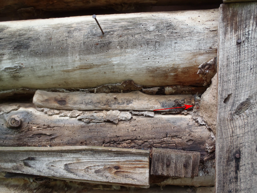
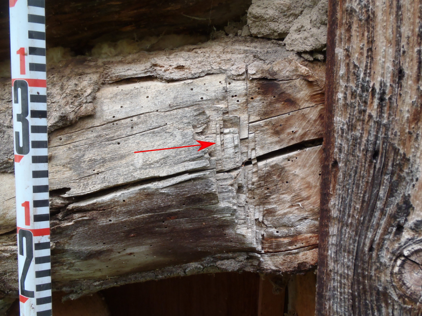
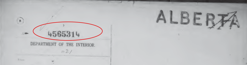
In order to gain land under the Dominion Lands Act, people who wished to homestead had to apply at the local land agency office. These offices were under the Dominion Lands Branch in Ottawa. For a $10 filing fee, an applicant could apply to homestead a quarter section (160 acres). Once a quarter section was homesteaded for the first time it was given a file number. All documents related to that section of land were then filed under that number. As we saw in the previous blog post about the cabin we found near Peace River, multiple people might apply to homestead on one section.
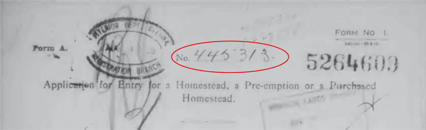
The first page of the file for a quarter section typically looks just like this (see below). The number circled in red is the file number.
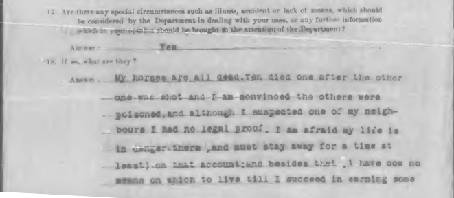
After filing, the homesteader then had three years to ‘prove up‘ their homestead claim. The requirements changed over the years as did the requirements for eligibility of the applicants. If you did not complete the process in three years, you would have to ask for an extension. One file contained a statement of a homesteader asking for an extension because his neighbor (allegedly) killed his horses.
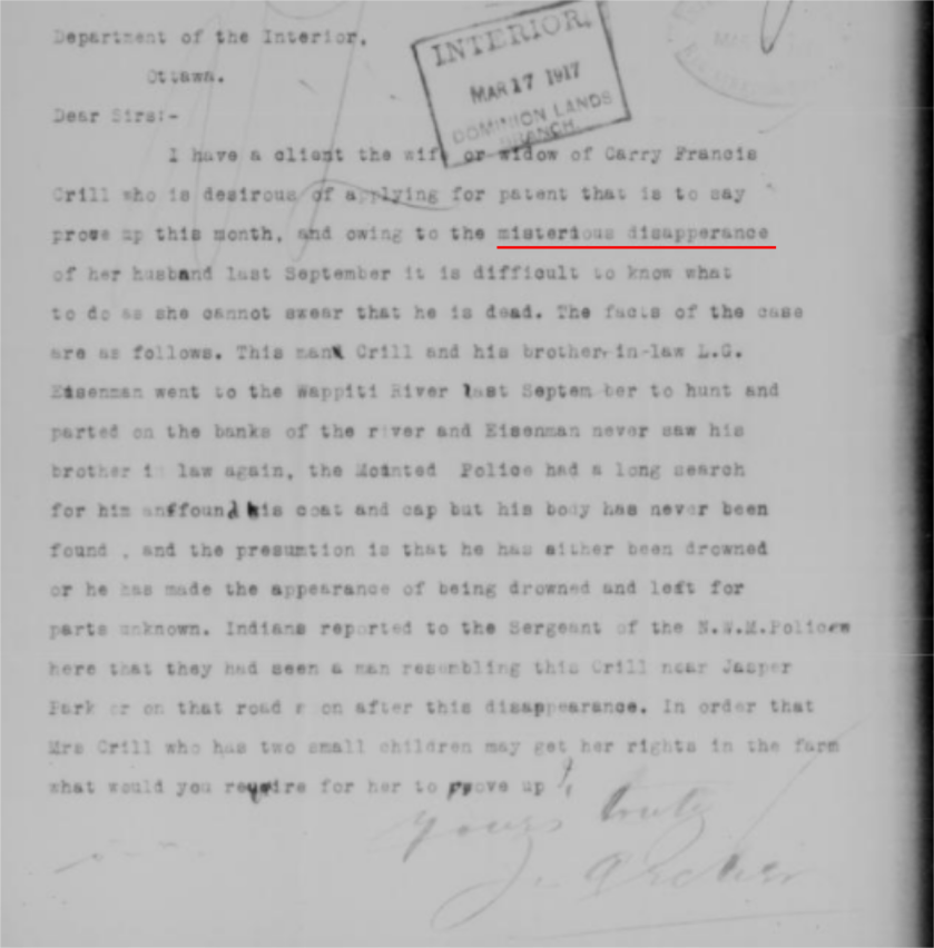
Applicants typically had to be male, meet the age requirement, and be a British subject (or declare an intention to be one). The required duties were that the person had to occupy the land for a set amount of time and had to undertake certain improvements upon the land within three years. The improvements usually included the construction a house and fences, and breaking and cropping a portion of the land. If you “proved up” your homestead you could apply for a patent which would give you legal ownership of the land. There were special exemptions to these rules. For example in some cases widows could apply for patents upon the death of their husbands, or as in the case below their “mysterious disappearance”.
For more information on the changes to the original Dominion Lands Act, check out this website:
The files normally include an application for homestead, an application for patent, and a notice that the patent has been issued.
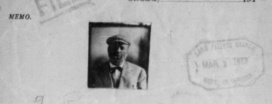
The application for entry is the first form that was filled out when someone wanted to homestead a quarter section. This form would capture information about the applicant’s age, birthplace, last residence, prior occupation, and the number of people in the household.
Below is a picture of what the top half of an application for entry looks like. You can see that the file number is recorded on the page.
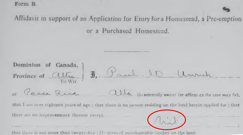
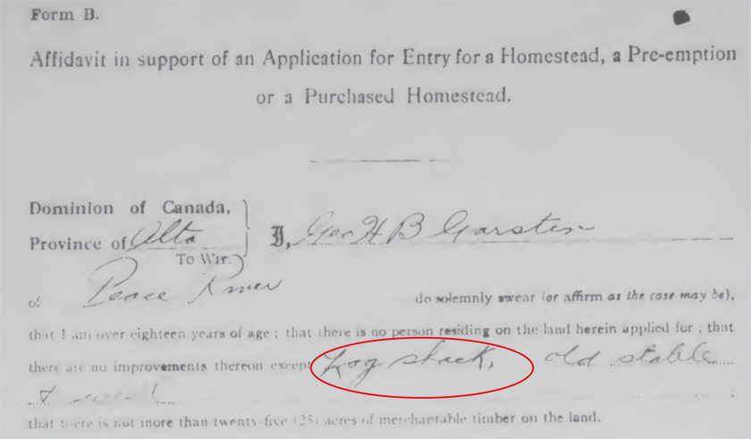
When we were researching the cabin near Peace River, the forms that we found were all application for entry. This usually indicates that the land was abandoned and wasn’t successfully homesteaded before 1930. After 1930 the homestead process changed as control of natural resources was transferred to the province.
The application for patent is the form that was filed to gain the patent (title) for the land. In order for the patent to be granted the applicant had to complete the required duties. These forms contained information about the applicant’s, age, occupation, nationality, number of people in the household, residency information, post office, as well as work they’d done like breaking, cropping, buildings, fencing, and livestock.
The notification of patent is the letter granting the patent (title to the land). It demonstrates that the applicant was successful and gained legal ownership of the land and it contains the date it was issued.
Sometimes the application was not for a homestead but for a pre-emption or a purchased homestead. A pre-emption allowed a homesteader to obtain a second quarter section of land next to their homestead entry. They had requirements that had to be fulfilled in addition to the requited duties of the homestead. Purchased homesteads were typically bought for $3 an acre. The accompanying files for both pre-emptions and purchased homestead are typically the same as those for the homestead applications.
The files can contain additional documents such as inspector’s reports, witness affidavits, records of abandonment, handwritten letters, court proceedings, wills, naturalization, and even poetry and pictures.

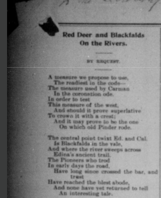
The above images are of the poet and poem found in the same file. Although this is by far not what the typical file looks like, until you look at the file you will never know what type of information you can find! If you want to learn how to use the Alberta Homestead Index for research keep an eye out for our next blog post.