The Glenbow Museum Archives are an exciting tool we can use as archaeologists to learn more about some historic sites that we encounter in our day to day field work, and to predict where we might find a certain type of historic site.
We recently worked on a historic site located between Mundare and Vegreville (southeast of Edmonton) consisting of three concrete foundations. Area locals informed us that this was a historic era school yard but didn’t know much about it beyond that. We were able to get information about the school by doing a search of the Glenbow Museum School Districts Archives. These archives have records of names, locations and dates of establishment of school districts in Alberta established between 1885 and 1982.
Using the Glenbow Museum Archives website (link below) we were able to search by legal land description (also known as the Alberta Township System or ATS) or by school name to find out which school district our site was located in.
Searching by ATS we entered the township, range and meridian and came up with two possible school districts for our location, Kolomea established June 8, 1906 and Thornton established January 10, 1910. We determined that the school at our location must be the Kolomea School as the ATS section it was listed in was consistent with the location of the site.
Thanks to the Glenbow Museum Archives we now had the name of the school which helped with further searches, and enabled us to find archival photographs and texts regarding the school and its history. Some archival photos were found by searches of the Virtual Museum and the Alberta Provincial Archives (links below).
The Glenbow Museum School District Archives is also a great tool that can be used for background research in a project area before the field work starts on an Historic Resources Impact Assessment. Using the School District Archives prior to commencement of field work will inform field workers if they should be looking for a school yard and might narrow down the search area to the quarter section the school yard should be located in. This tool could have enabled the identification of the Kolomea School Site before construction started, and prevented some construction delays.
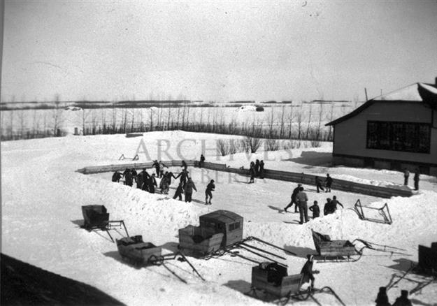
Photo credit: Provincial Archives of Alberta, HerMIS:
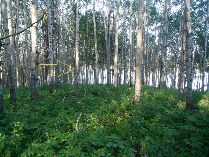
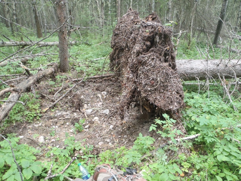
In 2013 Tree Time archaeologists got a chance to work on a relatively rare type of historic period site in Alberta: a historic schoolhouse. The Kolomea school site was brought to the attention of Tree Time Services by construction personnel for a transmission line project. The site consists of three concrete foundations surrounded by non-native bush. Local informants identified the foundations as a school, a teacher’s residence and a stable where students’ horses were housed during school hours. The school served the nearby Ukrainian community and was named Kolomea after a region in Ukraine.
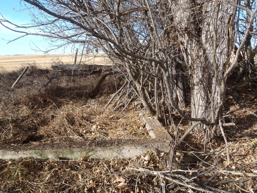
Concrete foundation identified as the teacher’s residence.
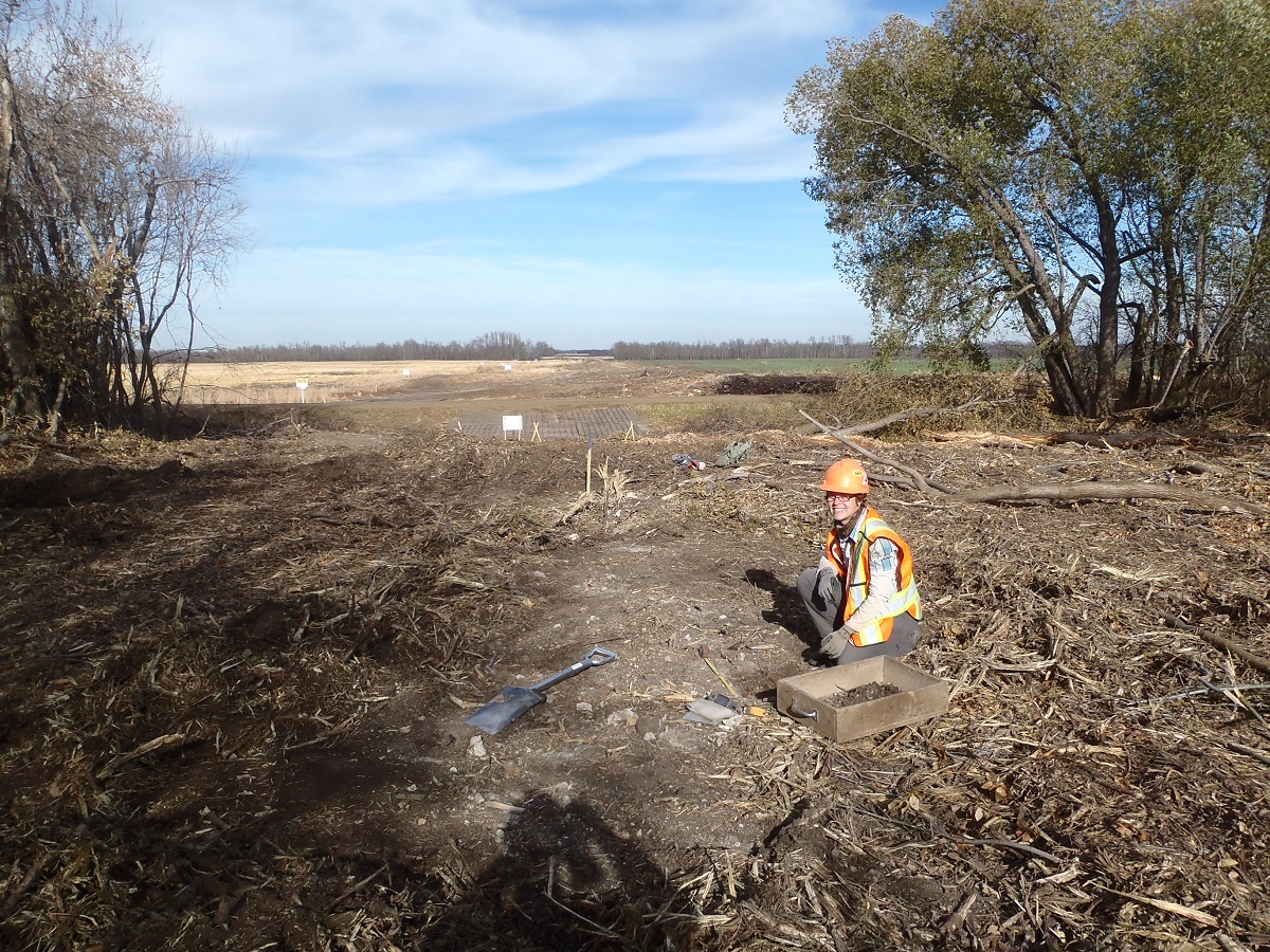
Tree Time undertook investigations at the school with the goals of assessing if the site was a historic resource; confirming the function and age of the foundations; determining the significance of the site to the surrounding community and to the province, and making recommendations regarding future management of the site. These normal objectives of Historic Resource Impact Assessment were complicated by the fact that construction had already started, and the site was partially inside the transmission line right of way.
To confirm the function and age of the foundations we referred to archival airphoto searches, historic land title searches, local history books, provincial archive searches, interviews with local informants and current landowners, and conducted small test excavations.
Using the Glenbow Museum Archives School Districts Database website we were were able to perform a search by legal land description to find out which school district our site was located within. This search indicated that the site was the Kolomea school. Having the name of the school helped us to pursue the next step – an historic land title search which further corroborated what we had learned through the Glenbow Museum Archives.
Local histories and archival searches through the Provincial Archives of Alberta confirmed that a one-room schoolhouse was built at this location in 1906. These records indicated that the one-room schoolhouse was replaced with a larger school in 1929. The construction date of 1929 for the large school confirmed that the site is a historic resource. We were able to find archival photos from the 1920s of the one-room school house and one from the 1930s showing the larger school. The photo of the larger school matches the location and general shape of the large foundation currently at the site.
To test and corroborate the archival and historical information, and to confirm the functions of the three buildings, four 50 x 50 cm test units were excavated at each of the foundations. These excavations resulted in the recovery of historic construction debris (concrete, brick, nails, window glass), buttons, fragments of glass vessels, porcelain, clinker (slag from coal heaters in the buildings), bone (probably burned in the stoves), tin and possibly bakelite (early plastic). Excavations in the house foundation uncovered a possible floor board. At the start of the project we had identified the northernmost foundation as the barn or stable, but owing to the discovery of a potential floor board during the excavation of this foundation we determined that it was more likely the house foundation and the southwestern foundation was the stable. We were hoping to find artifacts like jacks or marbles that would clearly represent the presence of children, but we had no luck in that department.
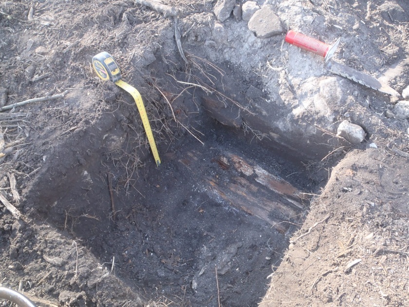
Excavation unit with possible floor board.
Historic documents indicate that the school was closed in 1952 and the building was moved to Lavoy, AB by the Catholic Church, where it still functions as a church today. The barn was also moved from its original location but is still located on the same quarter section. The teacher’s residence appears to have been moved or demolished, but we didn’t find any records of its history. Archival airphoto searches and interviews with local informants were not successful in identifying the location of the original one-room school house. We suspect that the foundation that has been identified as the house might have been the original one-room schoolhouse which was re-purposed as a teacher’s residence when the new school was built.
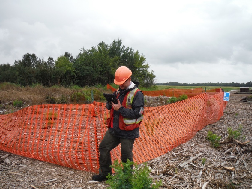
Kolomea school is a unique site that is strongly associated with the Ukrainian settlement of northeast central Alberta and can shed light on the poorly-documented lives of rural children in the mid-20th century. While we didn’t find any direct evidence of children at the site (except a few lost buttons) further explorations at the site would likely turn up some interesting and nostalgic material. The site was protected by temporary fences around the foundations while construction was completed to avoid any accidental impacts. The government of Alberta has granted the site an Historic Resource Value of 4h,a (historic and archaeological). This means that no more development can happen at this site without archaeologists doing a lot more work here.
The stable foundation protected by temporary fencing.
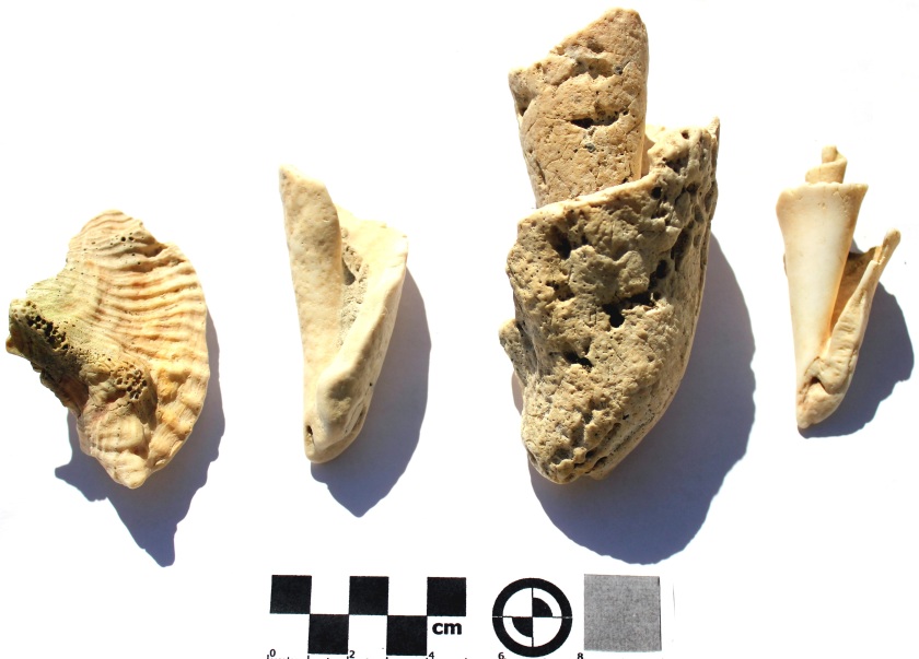
At our Archaeology Roadshow event in Lac La Biche, in fall 2015 Allan and Juanita Gaudreault brought in several conch shell fossils. These shell fossils were heavily worn and most were down to the central spiral. This made them difficult to identify at first. These are very unusual specimens because these type of marine shells are not found in Alberta. They are native to the Gulf of Mexico. Our initial interpretation (as archaeologists, not palaeontologists) was that this could possibly be a discarded souvenir or a fossil from the Cretaceous period when an ancient seaway stretched from the Arctic to the Gulf of Mexico.
Shell fossils from Gaudreault collection
Tree Time Services reached out to Alwynne Beaudoin, Curator of Earth Sciences and Quaternary Environments at the Royal Alberta Museum (RAM), for an answer. The RAM had a conch shell, also found in the Lac La Biche region, donated to the museum in 2011. She has been researching this conch shell and “has not been able to find another record of a conch in prehistoric context from Alberta, though there are records of other marine shells (and) they are unlikely to be Cretaceous.”
Furthermore, the specimen in the Royal Alberta collection was radiocarbon dated to “slightly more than 1000 years before present.” That specimen’s age debunks the discarded tourist souvenir theory. The most likely explanation for the RAM’s shell is prehistoric trade from the Caribbean to Alberta 1000 years ago. There are some artifacts found in Southwestern Manitoba, such as this shell gorget, made from a species of shellfish native to the Gulf of Mexico. However, evidence of prehistoric trade networks between the Canadian Plains and the Gulf of Mexico is extremely rare in Alberta and this would be an artifact of significant information potential.
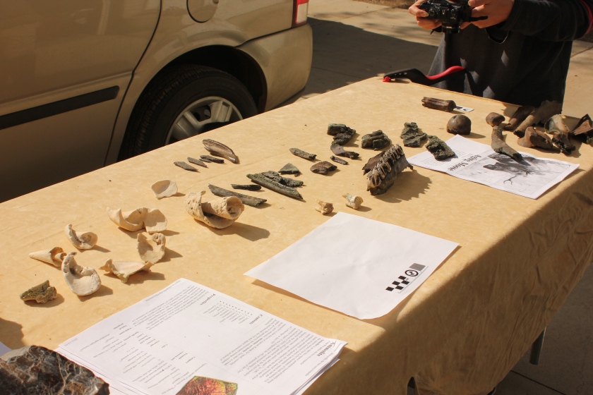
The Gaudreault collection of shell fossils and ancient bone fragments.
The potential that the 2015 shells represented trade or travel 1000 years ago, rather than palaeontology from millions of years ago, was pretty exciting. On September 7, 2016 Corey Cookson, Project Archaeologist at Tree Time Services, and Christina Barron-Ortiz, Assistant Curator at the Royal Alberta Museum, made the trip up to the Gaudreault’s home to view the rest of their collection. Upon another viewing of the conch fossils it was clear that our first interpretation was right, and these are remains from the Cretaceous period about 65 million years ago. With permission from the Gaudreaults, a representative sample of the shells were taken by Christina Barron-Ortiz for further study. We will post a future blog once we receive confirmation of the age of the shell fossils. Also stay tuned for another post about some other interesting fossils from the Gaudreault collection.
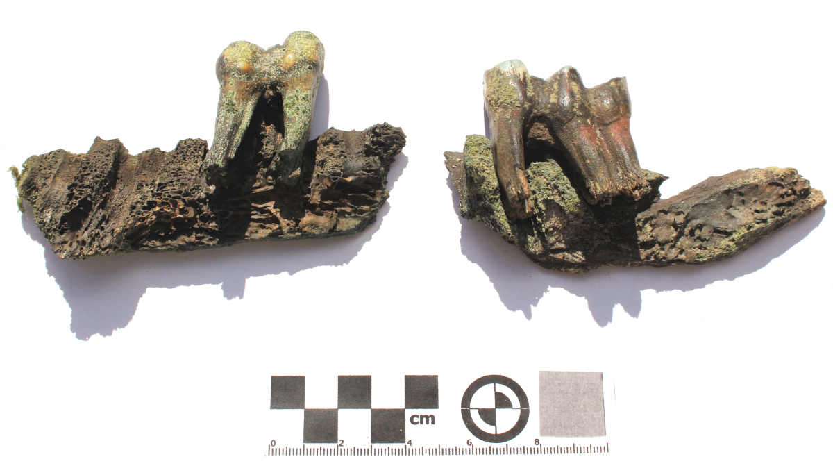
At our Archaeological Roadshow event in Lac La Biche, AB Allan and Juanita Gaudreault brought in a collection of fossils. The fossils were fragments of a darkly stained bison jaw and a set of blueish grey horse teeth. Mr. Gaudreault told us the specimens were found in a low area near a lake. We came up with two possible interpretations of these specimens: they may have been permineralized due to being in a place with very hard groundwater; or could be dated to the early Holocene.
It is quite rare to find animal remains in the boreal forest in central and northern Alberta. The acidic soils of the boreal forest make for very poor preservation conditions. Animal bone is therefore rare, and these finds could help teach us about past environments in the region.
Tree Time Services reached out to Chris Jass, Curator of Quaternary Palaeontology at the Royal Alberta Museum (RAM), for more information on determining a possible age for the specimens. Jass confirms that “you can get fairly dark staining and mineralization fairly quickly depending on the depositional environment. However, if there’s a horse there, (the Gaudreaults) may be finding some older material.” Horses were native to North America, but went extinct sometime between 13,000 and 11,000 years ago (North American horse teeth were also recently found at the Brazeau Archaeological Survey project ). The horses that are ubiquitous in North America today were introduced by the Spanish in the late 15th and early 16th centuries. Due to the fossilized nature of the specimen and the recovery of the teeth from a possible relic lake bed, these horse teeth may be from the extinct North American horse.
Chris Jass goes on to state that he has “been working with a diver who has been pulling bones out of Cold Lake, and we’ve got Pleistocene dates (>11,700 years ago) on a bison that he’s recovered from the lake. I think there is considerable potential for recovery of late Pleistocene/early Holocene (ca. 11,700 years ago) material in many of the lakes in Alberta.”
On September 7, 2016 Corey Cookson, Project Archaeologist at Tree Time Services, and Christina Barron-Ortiz, Assistant Curator at the Royal Alberta Museum, made the trip up to the Gaudreault’s home to view the rest of their collection. Christina Barron-Ortiz is a specialist in horse and bison teeth. She confirmed that the horse tooth has the characteristics of several specimens the Royal Alberta Museum recovered from the lake bed near Cold Lake, AB. She also suspected that the bison jaw bone represented ancient bison but could not be as sure as the horse. With permission from the Gaudreaults, the bison jaw and horse tooth were collected and results from carbon dating are expected in the Spring.
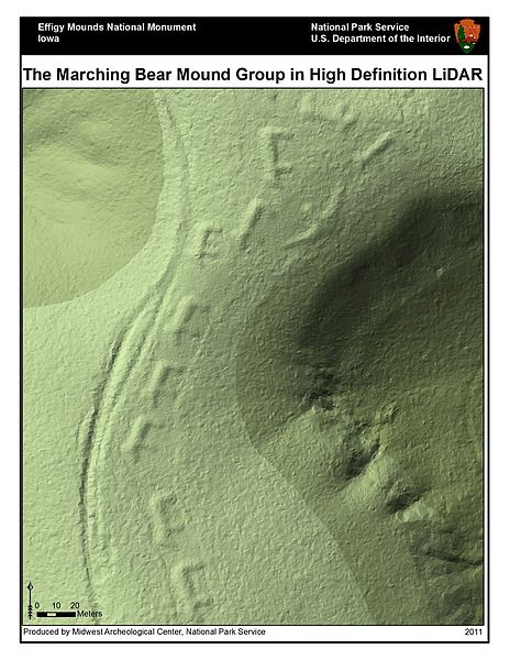
In recent months, news feeds have been erupting with stories of “Lost Maya Cities discovered using LiDAR”, “revealing the secrets of Stonehenge using LiDAR”, “LiDAR uncovers ancient city near Angkor Wat”, and the popularity of “space archaeologist” Sarah Parcak, but this technology is not limited to finding the remnants of “lost civilizations” in far reaching corners of the globe. LiDAR is used by archaeologists in Alberta to assist in the locating of potential archaeological sites that are threatened by development.
Light detection and ranging (LiDAR) is the process of mounting a laser on an aircraft and bouncing light pulses off the ground and measuring the time it takes for the laser to return. The process can take 2000-5000 measurements per second and makes the surface appear treeless, revealing surface features that cannot be seen using simple satellite imagery or aerial photos (Figure 1). However, using LiDAR to find archaeological sites in northern Alberta is not as easy as it can be in other parts of the world. LiDAR is great for identifying building structures, walls, and other features common of archaeological sites in other parts of the world. In northern Alberta these features are absent from Indigenous archaeological sites. To study the human history of northern Alberta prior to European contact we have to look at the landscape and identify landforms that would have been suitable for camping and hunting activities.
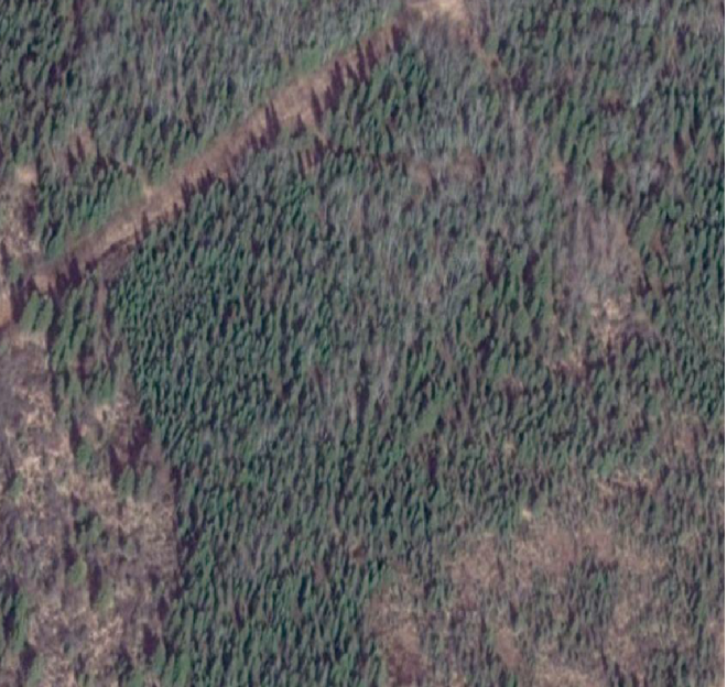
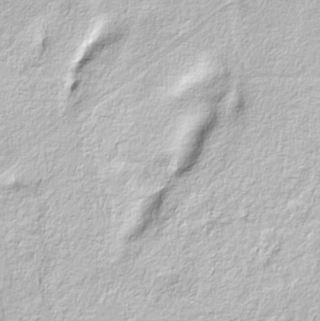
Figure 2. Satellite imagery of ridge overlooking marshFigure 3. LiDAR hillshade of the same ridge
In the above images, the first image is a satellite image of a ridge where we found an archaeological site (Figure 2). With just satellite imagery the area appears to be predominantly flat which is not a good area to camp or hunt. This is because the area would be thought to be poorly drained and with limited visibility of the surrounding terrain. When using LiDAR imagery (Figure 3) we notice there is a complex of distinct hills and ridges that would be ideal for making camp.
This technology has revolutionized the process of finding archaeological sites in Alberta and is revealing more about the history of people in the boreal forest. The ability to pinpoint the best landforms without having to do extensive on-the-ground survey has greatly increased the inventory of sites found in northern Alberta. This benefits our clients who will pay less money for the survey of their developments and we can make more accurate predictions about site locations which allow them to modify their developments to avoid potential sites.
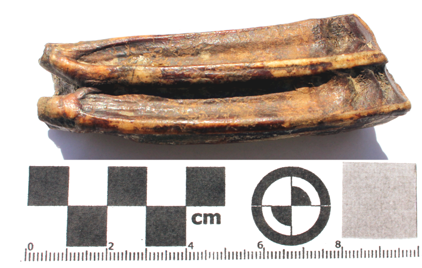
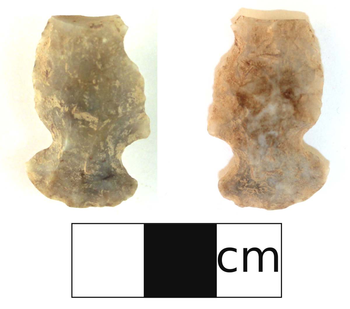
We often post images of beautifully crafted tools such as the besant point from FcPu-11 or the siltstone knife from Buffalo Beach but not every tool we find is a “work of art.” This week’s photograph is of an “ugly” artifact we found in 2016 when undertaking an HRIA for Sundre Forest Products. The site was found on a terrace overlooking the confluence of two tributaries to the North Saskatchewan River. The artifact is a side-notched chert projectile point similar to the Prairie or Plains side-notched typology. The point is asymmetrical with one edge being a rounded convex shape and the other an undulating edge with an angular shoulder. The tip of the point is broken off which is common of the projectile points we find and is likely the reason the point was discarded. While aesthetics can add to the function of a projectile point this artifact demonstrates it was not necessary. The idea that it doesn’t matter how it looks as long as it works was alive in the past as much as it is today.
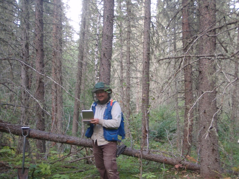
Once we have surveyed our targets and evaluated any sites we have found, it is time to return to the office. All of our notes are taken on an ipad in the field. Now all we have to do is export our notes into a database which eliminates the hours spent on data entry.
Note taking is extremely important for archaeologists (Figure 1). The notes supply researchers the context of the artifacts. In this case context means the precise location of the artifact and it’s association with other artifacts and landscape features. This helps researchers determine such things as the relationships between artifacts on a site, it’s position in time and space, and even how it is related to different archaeological sites (Figure 2). Without notes and proper excavation methods, the context in which the artifacts were found is lost forever, and the artifacts have little scientific or interpretive value.
Figure 1. Eric taking notes on an iPad that will later be used to interpret the site.Figure 2. An artifact in it’s original context found at an historic site.
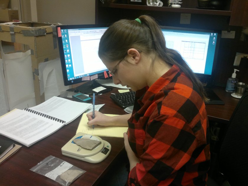
We also catalogue all of the artifacts that were collected in the field. We take measurements, weights, and note details such as material and artifact types, and enter them into a database (Figure 3). This along with the site notes gives us the information we need to write our reports.
Figure 3. Madeline is weighing an artifact.
In the final stage of the Historic Resources Impact assessment, we compile a report of all the work that we have done and submit it to our clients and the government. The report identifies which developments need to be modified to avoid impacting significant archaeological and historic resources. The site information is included in a government database of all the sites in Alberta as a reference for future industry development as well as researchers. This minimizes the impact that our clients have on Alberta’s history while preserving the past for future research and education.
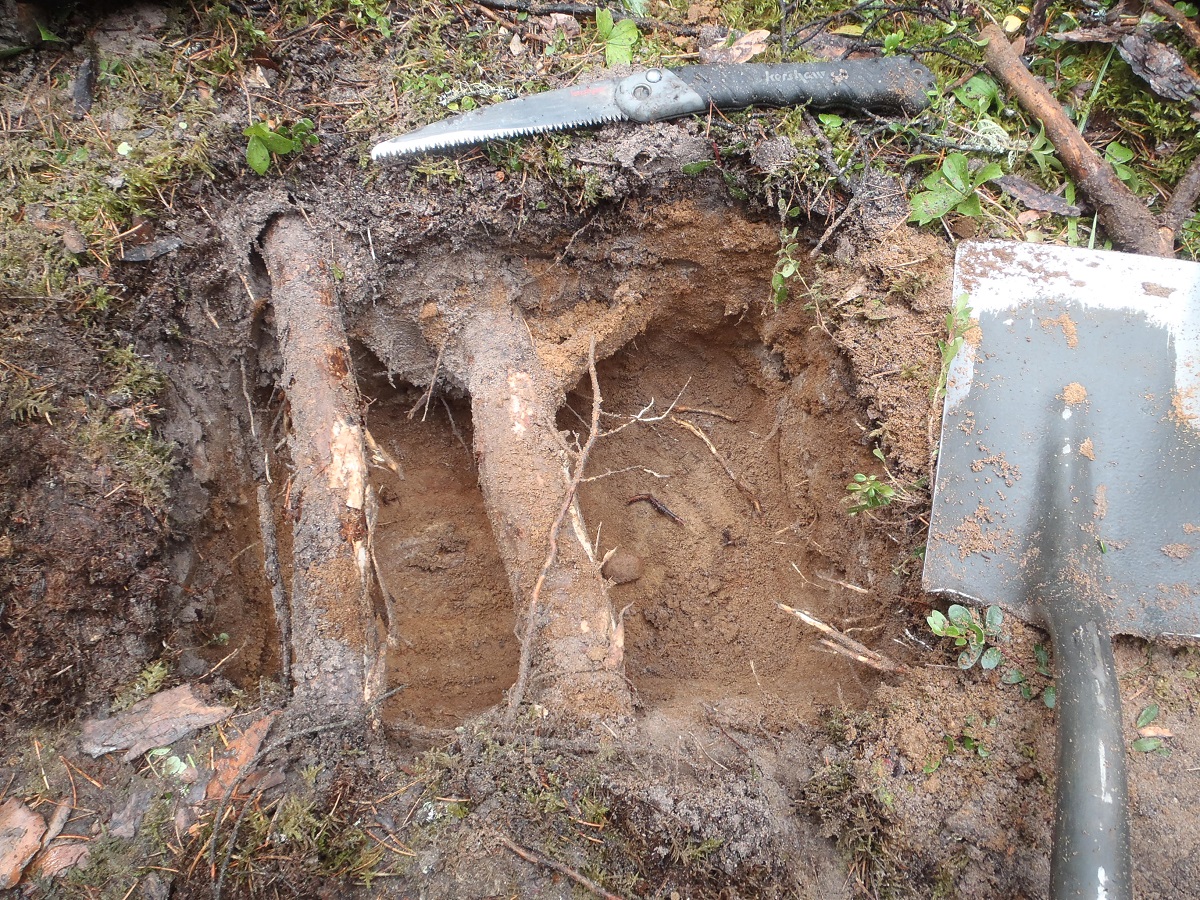
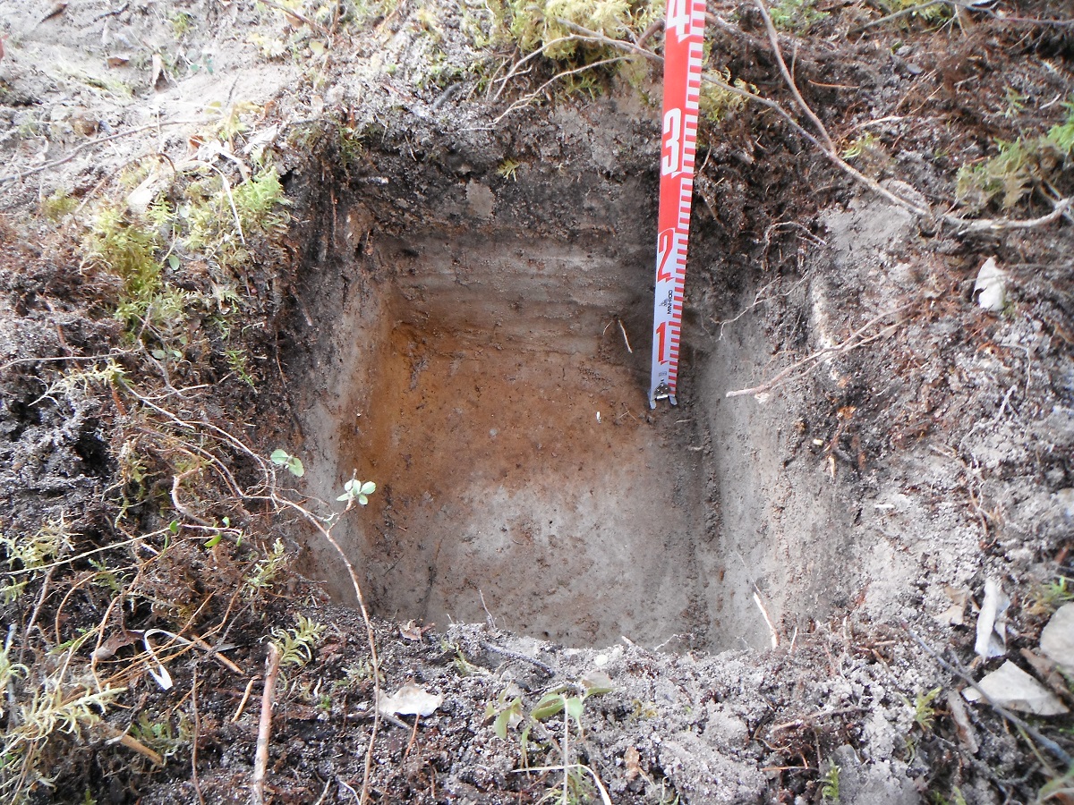
Digging in the forest we are always encountering tree roots. It’s a great test when you miss them all. Most days your shovel is sharp enough that you hardly notice the roots as the shovel blade slices through them. Sometimes you have layers of roots, which work as a group to form a wall. You can “smash” through them with a bit of effort, one root at a time. And then there are days like pictured here! Your shovel just won’t go through or you don’t have the energy to “smash” through them, so you have to break out the big guns! I like to carry a folding saw with me in my vest, so roots like these won’t get the better of me! Unfortunately these ones did. So I just dug around them.
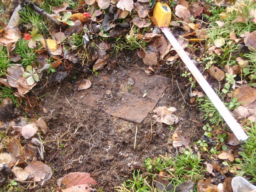
Figure 1. Positive shovel test that contained lithic debitage.
When we identify a site, we conduct further evaluative testing to determine the type, character, and extent of the site. This is done according to government guidelines, and depends on the type of site, and the type of landform. If the landform allows for it, testing occurs in each cardinal direction or in a grid. Some sites are found on ridges or point terraces, and so in these cases, it is not possible to test in all directions (Figure 1).
Tree Time’s standards are that there must be three negative tests spaced at most 10 m apart in each direction from any positive. Sometimes additional tests are required in order to determine the significance, the size, and type of the site. For example if none of the evaluative tests were positive, further testing might be done at closer intervals to better determine the significance of the site. In addition to rigorous note taking, we also map and photograph the site (Figure 2).
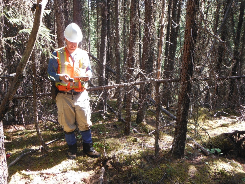
Figure 2. Vince taking notes at a site.
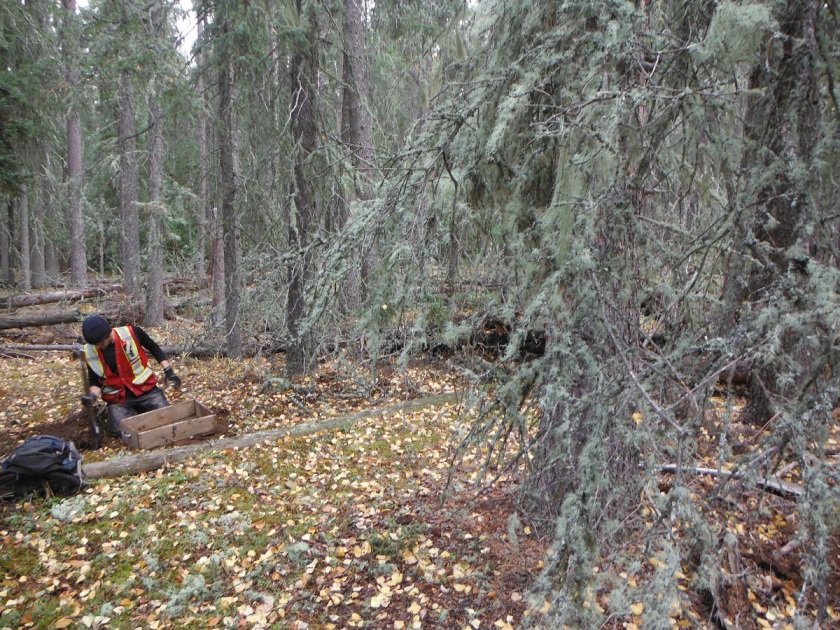
The evaluation of the site is an important step for two main reasons. The first is to enable the government to maintain an accurate site database and to better inform future researchers of the size and type of sites are in the area (Figure 3).
Figure 3. We are evaluating an historic site by flagging artifacts with red flagging tape.
Secondly, in this stage we determine the extent and significance of the site. If a client decides to avoid the site, delineation allows us to more precisely buffer the site. This is important because it allows the development to occur as close to the original plan as possible while still avoiding impacts to the site. In addition, if a client chooses to mitigate their impacts to the site through excavation, a more detailed evaluation of a site allows us to better predict the productivity of the site, and to render cost estimates of any mitigation work more accurately.
Figure 4. Buffer flagged around the site with orange flagging tape.
Once we have surveyed our targets, evaluated any sites we have found, and have finished our notes, it is time to return to the office (Figures 5 and 6).
Figure 5. Reid is finishing his notes before we move onto another target.Figure 6. After a long cold day, Brittany heads back to the office.
Using information compiled in the office, the next step of an HRIA is to leave the comforts of home behind and to venture into the field. Although there is a perception of archaeologists working at large excavations, often dressed in khakis and maybe wearing a fedora, archaeological survey is the most common type of field work in the CRM sector. So for now, we will focus on archaeological survey and discuss archaeological mitigation in an upcoming blog.
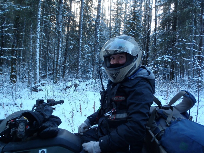
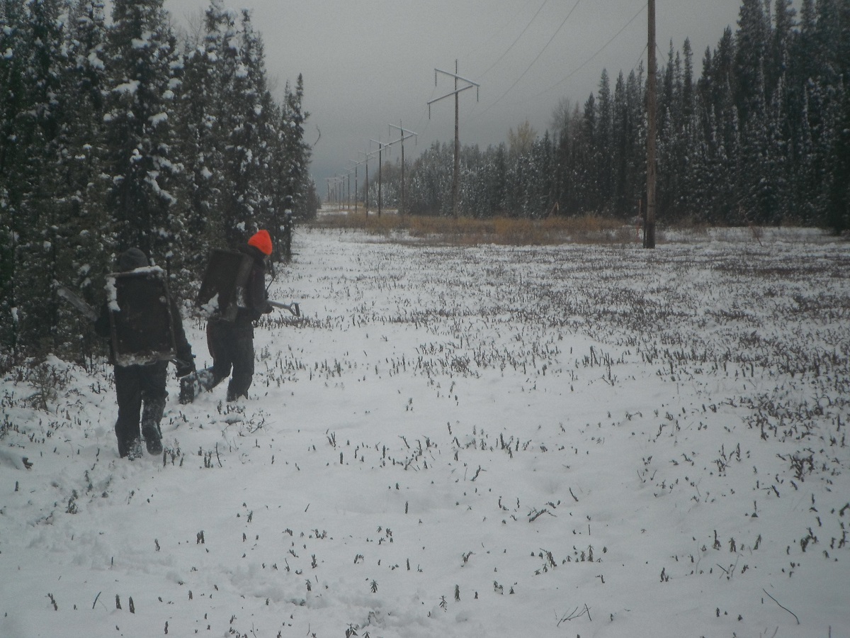
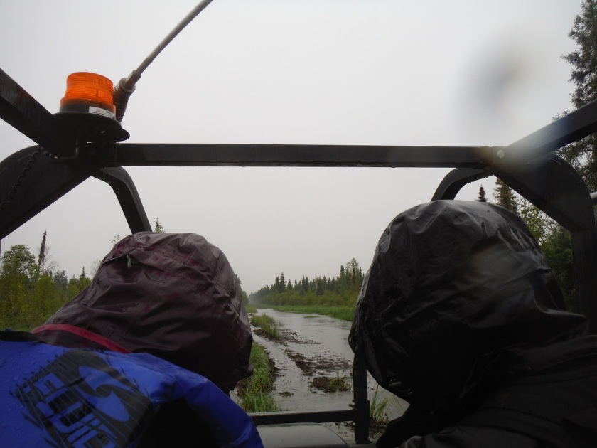
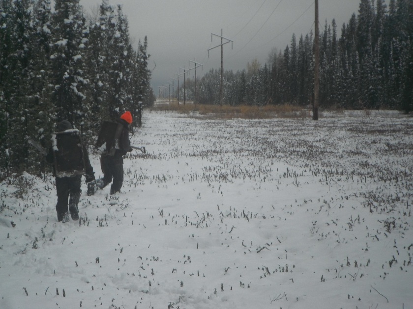
The purpose of an archaeological survey is to visit the high potential target areas we identified in our background research and GIS review in order to see if there are any historic or archaeological sites. We travel to these high potential locations using various means of transport including trucks, ATVs, Argos, the occasional helicopter for the most remote locations, and a lot of hiking (Figures 1 and 2).
Figure 1. Teresa and Vince in an Argo travelling to target areas.Figure 2. Archaeology happens in all weather as Teresa and Brittany hike in snow to our target areas.
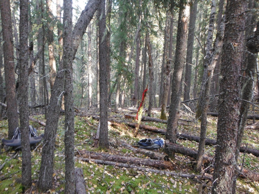
When we arrive at these locations, we use experience and expertise to determine if the landform has potential for archaeological and historic sites. For example, is this spot flat and dry? Would we like to camp or hunt from here? High, dry areas, and spots that have nice views are often tested. In fact sometimes we identify a site in the exact spot where we dropped our gear for lunch, as we naturally tend to stop on the best part of the landform (Figure 3).
Figure 3. Our gear placed at a positive shovel test, flagged with red flagging tape.
The most common method of subsurface sampling that we use is screened shovel tests (Figure 4). This means we dig holes about 40 cm square and 30 to 40 cm deep and screen all of the sediment in portable screens. If there are any tree throws or surface exposures, we also conduct opportunistic examinations of these for artifacts (Figure 5).
Figure 4. Matt is shovel testing.Figure 5. Picture of a tree throw that allows for opportunistic sampling.
There are several different sampling strategies that we use, these include systematic, semi-systematic, and judgmental testing. Systematic testing is the term we use when we place tests using a set interval, for example digging a test every 10 m along a landform. For judgmental testing we do not use a set interval instead we place shovel tests on the best part of a landform based on our past experience and conceptual models of how people lived on different types of landforms. Finally, semi-systematic testing is a combination of the previous two. For this method we place tests on the best locations of a land-form while trying to maintain a certain overall density of testing.
The shape of the landform helps determine what type of sampling strategy to use to test a target. A long uniform ridge might be better suited for hybrid or systematic testing, while a hillock might be more often tested in a judgmental manner (Figure 6).
Figure 6. Brittany testing a target using a semi-systematic strategy.
If the tests are negative, then we write our notes and move on to another location to survey. However, this does not mean that we can definitely say there is not a site at the location. Negative results only reduce the chance there’s a site at a location. To be 100% sure, we’d have to do a lot more excavation (Figure 7).
Figure 7. Although a nice area near water, we did not identify a site here.
On the other hand when we do identify a site, then we stay at the location to undertake further evaluative testing (Figure 8).
Figure 8. Vince is very happy after identifying a site when he found a point in a shovel test.